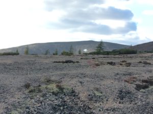
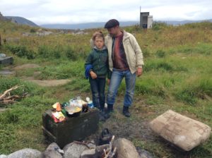
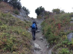
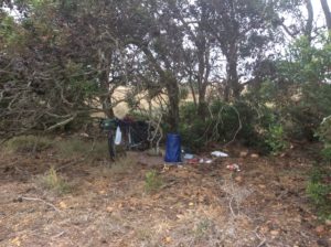
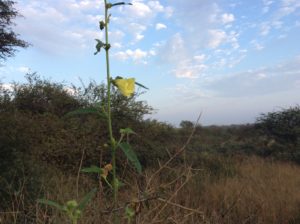
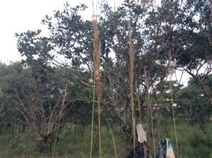
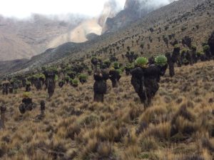
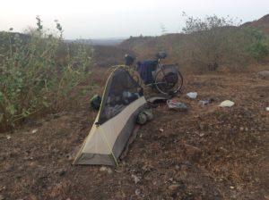
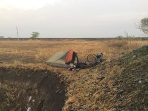
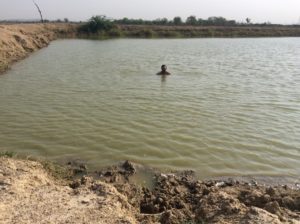
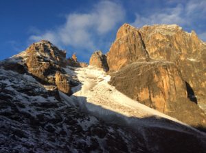
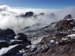
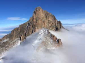
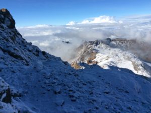
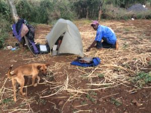
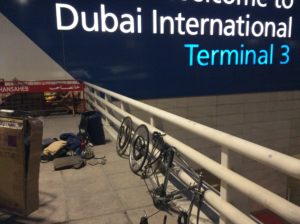
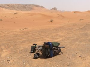
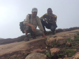
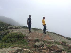
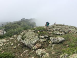
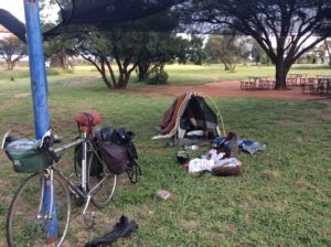
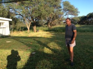
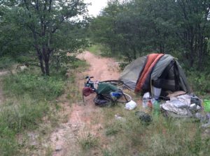
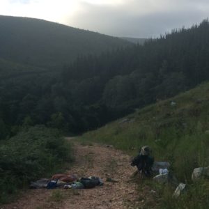
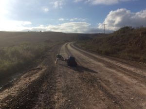
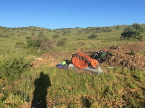
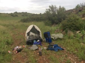
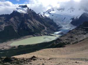
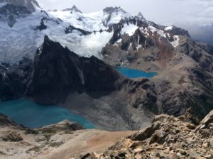
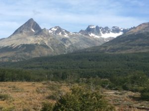
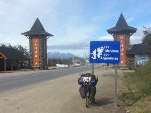
The month in Magadan was enlightening and gave a closer look at Russian culture, at least for that in the Far East. I left about the second week of October with winter weather coming on. There were snow flurries while making a cold ride 60 km to the airport in Sokol. Magadan’s at about the same latitude as Skagway, Alaska. Friends in Magadan hooked me up with people in Kabarovsk where I laid over for a night. They drove me around the city and treated me to dinner, more music, tea from a samovar. At Vladivostok I boarded a ferry that took me to South Korea where I had 5 days of recreational riding across the peninsula to Seoul. The wilderness expanses of the Kolyma became unhurried tea house hopping in Korea. South Korean infrastructure I would have to say is better than what you find in the US on average. Manicured, shouldered highways, often bike lanes and paths; many tunnels through mountainous sections, all equipped with exhaust fans and lighting; Wi-Fi available automatically througout larger cities. People were friendly, things felt safe. From Seoul I flew to San Francisco and stayed with the father of my friend Neil Larson in Oakland and then Neil’s brother Paul (& Deb) in Pleasant Hill. After that I had a sublime late fall ride across the Sierras and the Basin & Range to home. After three months of sedentary existence, and corresponding adjustments, I was ready for another adventure and went to the Wind Rivers for a 10 day trip in late February. Below are a few photos and a link to some video. I went into the Titcomb valley area hoping to bag a peak, with sights on Gannett if the stars aligned. Turned out I had about 5 days of snowy weather, 2 of them in a full on blizzard, and didn’t climb anything. Those days, however, were spent in the luxury of a roomy snow cave, excavated each day a little larger, till I had a bench seat, a kitchen counter and could stand up in it. The only downside was that the entrance would drift shut during wind, and I had to clear it out during the night several times. Otherwise, the blizzard could howl all it wanted while you were cozy inside. Made it to the mouth of Titcomb Valley, then a shoulder of Fremont Peak from the Indian basin side (where the wind was definitely up). On the trip out I thought I’d get a booby prize of Mt Lester, but got turned around 200 or 300 feet short of a surprisingly difficult summit.
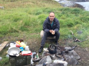
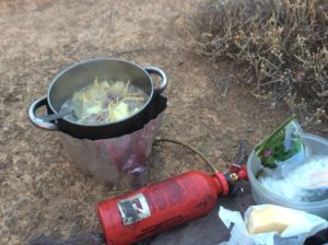
But it was still incredible as the Winds always are. I built the snow cave on the first day of the blizzard, knowing that the “1-season”, feather weight tent I had brought wouldn’t hold up at all in wind and snow. I had plenty of reading material, more fuel than I could ever burn, and days of hot drinks and soups; a Teton tea happy hour each afternoon. Had wine with dinner. Not bad being snowed in. One day I tried to write down all the Wind River trips I had taken over the years. I got to 55 with this one. Nine have been in the winter, 5 of those solo- tough finding partners for the winter stuff. Laurel and I made 19 trips that were mostly back packing but we climbed the N. Arete of Elingwood and Gannett together and made many long, trail-less tundra traverses. She was on 2 winter trips. Surprisingly, I only guided 5 trips there, but they were memorable enough to seem like there were more. The rest were climbing trips with many partners- Bert Stolp, Hal Gribble, Guy & Gleed Toombs, Pete Suci, Dave Lunt to name a few. We did hundreds of pitches and the climbs blur together. Those were some of the earliest trips and date back to the late 70s. I’m relying on images of a certain pitch or ledge or summit or camp or bear encounter or episode of gut splitting laughter and then try to tie it in with a given trip. I’m not sure I’ve gotten them all- or else I have too many. I climbed Gannett 6 times, once in the winter where an unplanned bivouac was necessary on the day we did the summit. We’re probably lucky to have lived through that. I hope to do 55 more Wind River trips before I die.
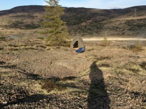
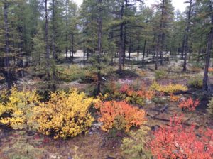
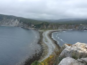
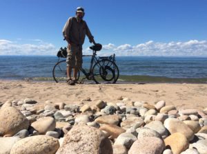
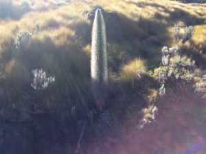
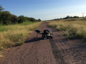
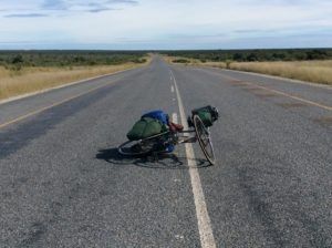
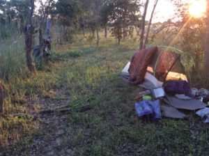
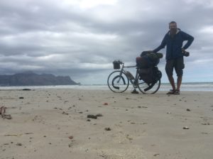
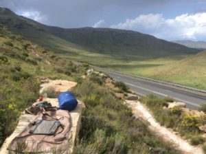
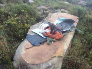
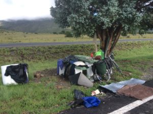
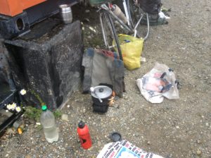
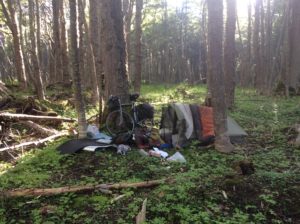
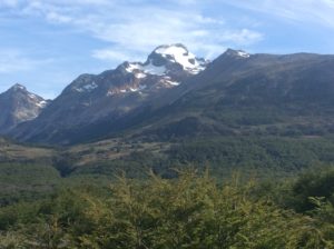
River Bags make very good sleds.Snow cave’s dug against the rock at the end of the track.Home sweet home. The ski bindings are “home made” and built in the 90s some time- I’ve been skiing on them for about 25 years now.Fremont & Jackson.Whiteout in Indian Basin.
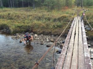
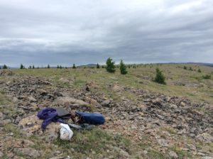
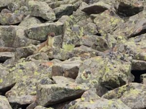
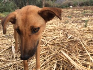
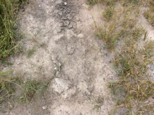
Keeping the entrance from blowing closed was a challenge. Had to shovel it twice during one night.Lester.Point turnaround.Wolverine track near camp. Didn’t miss seeing him by much and was disappointed till I thought of what may have ensued had he gotten wind of an outgassed molecule of frozen bratwurst from the snow cave.OLYMPUS DIGITAL CAMERA
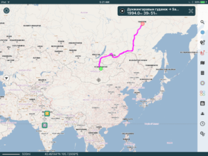
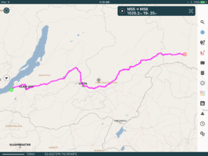
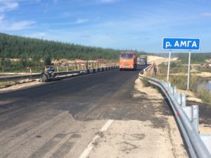
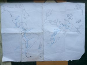
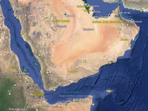
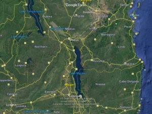
Kolyma HighwayAbove and below are the two halves of the top maps. The total distance is about 1200 miles. Ust-Nera is the half-way point and about 64.5 degrees north, comprable to Fairbanks, Alaska. Magadan is at 59 degrees north, about the same as Skagway.
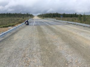
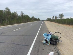
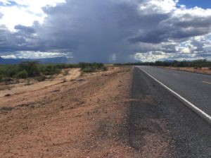
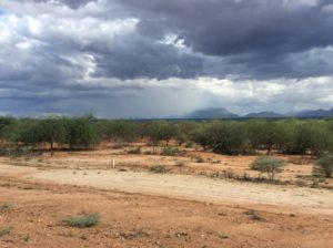
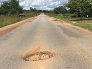
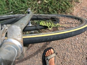
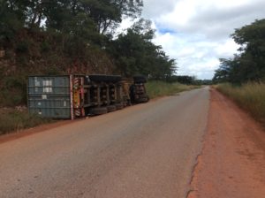
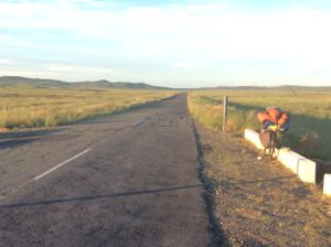
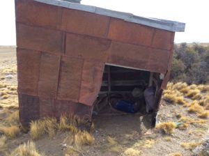
The Kolyma Highway is the world’s longest federally funded dirt road. It covers about 1200 miles, nearly the distance in going from Denver to San Francisco, with about 1100 of it being dirt/gravel. It’s by far the toughest piece road I’ve encountered in 23,000 miles of cycling since leaving Logan. It took 21 days and all else till now was just training. Mosquitos and flies could be horrendous. Some stretches I wouldn’t see a vehicle for hours and others would have a steady stream of trucks throwing up either choking dust or mud-spray as weather dictated. There were many steep grades and passes. Towns were few, with one stretch of nearly 400 miles having only a shack selling gas at the half-way point. Bears closely related to our grizzly are said to be plentiful but I saw only tracks.
The Kolyma (CALL-ah-mah) was built largely by Russian convicts and prisoners of war for the extraction of gold and other metals on the Kolyma River. Beginning in the 1930s, is was a Joseph Stalin project put in coordination NKVD’s Dalstroy, a USSR forced-labor program. NKVD was the predesessor to the KGB. The Dalstroy had a reputation for brutality and unknown thousands, perhaps over a million, perished in the GULAGs. Records are scant. The Kolyma today is called The Road of Bones as surrounding permafrost made the road itself the easiest way to dispose of bodies.Efforts for getting gold were stepped up during WWII to help fund the war. With millions dying in the fight against Hitler, prisoners, many of which were POWs, on the Kolyma were dispensable. GULAG commendants themselves were several times executed for not getting enough work out of the inmates. Stalin is known to have said that a prisoner was only good for about three months and after that they didn’t need him- he was just another mouth to feed. The inhumane GULAG conditions died with Stalin but intensive gold mining goes on today. Since Perestroika, investment and mining technology have come here from worldwide sources including the US and Canada.
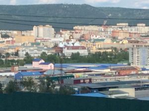
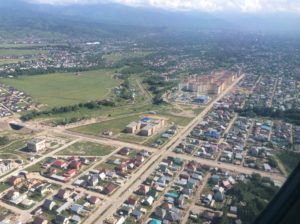
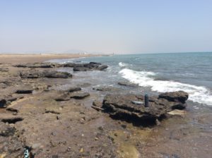
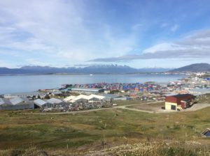
Magadan has grown to a city of over 100,000 people and is a major port and jumping off point for the gold fields. It was a “closed city” till 1987, the beginning of Perestroika, and even a Russian needed an invitation to go there. Tourists worldwide now come here as well as Russians looking for jobs and better pay. There has been boom-bust over the years with fluctuating metals markets and recovery from the dissolution of the Soviet Union was slow. Today, Magadan Oblast has much the same allure and culture that Alaska has for the US. It’s remarkably similar to Alaska in climate and topography, with the two being symmetrically situated about the northern Pacific Rim. Any Russian you talk to is well aware that Alaska once belonged to Russia, a fact that often gets squeezed into conversations.
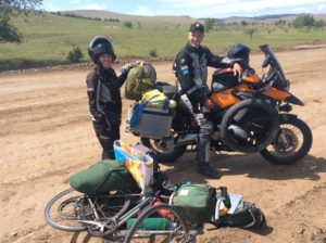
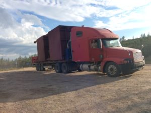
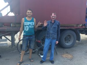
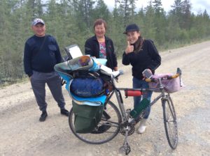
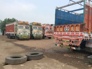
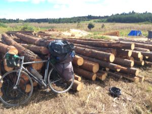
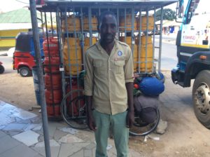
Andrei Onishyenko is from Kamchatka and was just finishing the R of B east-to-west and then heading home.One of many camps.This is a stockpile of cement powder that they evidently mix with the dirt/gravel road surface in some places. I don’t think it lasts more than a few years but when it’s new it could be really good…..…..but then it deteriorates to this and worse. Road conditions were probably 50% bouncy but tolerable gravel, 25% very smooth and 25% horrible.Nyurguyana Egorova and Petr Polusklin were from Yakutsk.Sergei and Alekse Mekyrdyanov were two brothers that stopped and gave me food and water. They saw my pants were pretty much in shreds (I wanted to buy new in Yakutsk but gave up finding what I wanted) and pulled out of the back of their car a pair of army fatigues- gorkas- that fit perfectly and were ideal pants for the Kolyma. Notice the O’Neil tee-shirt. I worked for O’Neil Wetsuits in 1979.Friendly RussiansFerry at Khandyga crossing the massive Alden River. Trucks had to be backed on which took hours, then this guy just about rolled his UAZ (AKA a bukhanka or “bread loaf”) backing down the narrow spit. UAZs are mass produced in Russia and serve as ambulances and sturdy 4WD vans on the extensive dirt roads of Yakutia and Magadan Oblast.Andrai and Victor were a two-truck convoy hauling diesel. Over the weeks it took me to pedal the Kolyma, they lapped me several times making trips back and forth from Magadan to drops along the Kolyma. They always stopped and made sure I was OK, gave me food and offered a ride when we were going the same direction. Good guys! The “Ognyeorno” truck trailer is bright orange when the mud’s washed off.
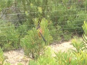
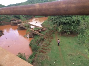
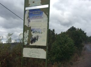
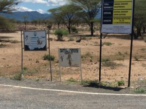
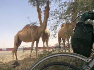
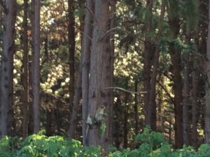
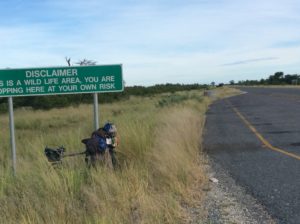
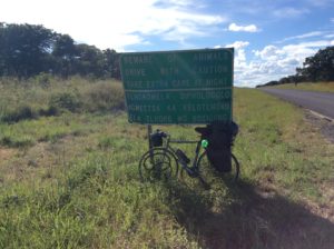
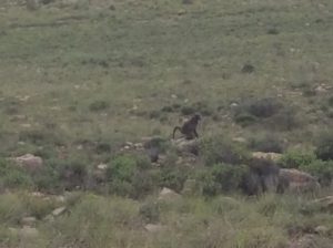
“Bear Aware” sign and entering mountains for the first time.Eugeny Radshenko and Alex Kimaev were from Magadan and heading to Yakutsk. Eugeny put me on the Magadan social network and people knew I was coming.Defunct Dalstroy era bridge.
The Kolyma begins in flat terrain and travels 200 miles through swampy taiga to the Alden River where a ferry transports vehicles across to Khandyga, the last city of any size (7000 people) for 400 miles. There’s one cafe at about 60 miles out, a shack selling gas at 200 miles and then the town of Ust-Nera at 400 miles. Ust-Nera marks the half-way point of the Kolyma.
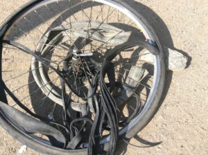
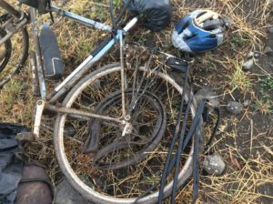
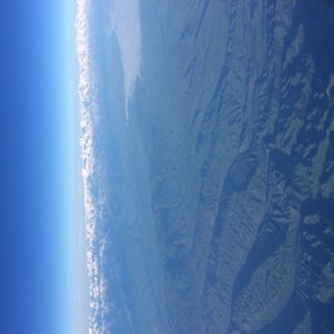
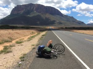
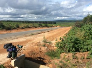
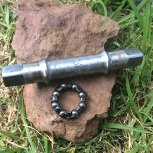
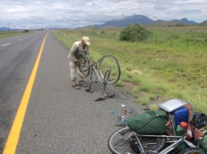
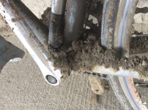
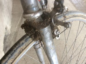
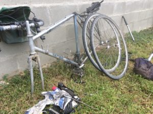
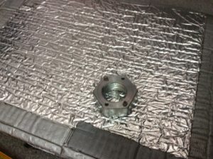
Soon after Khandyga the road left the flats and entered mountains. These were the first real mountains encountered since Mongolia and were a welcome change. Flowing water was everywhere and it was great to be able to dip your water bottle in to a stream to get a drink and then not need to carry more than a few swallows-worth of extra weight. The mountains meant steep grades and rougher roads that were made from sharper, crushed gravel causing many flats. Being on a thin-tired road bike, I was worried from the beginning about this much dirt road but was relieved when I had had no flats the first five days. Then the rougher road bed, sometimes with gravel a couple of inches across (‘2-inch minus’ in American lingo) would pinch the tire against the rim if you caught one just right and puncture the tube leaving a pair of “viper bites”. It’s tough to patch the two holes with one patch, and sometimes it takes two. After a few days of two-flats-a-day it was clear I wouldn’t have enough patches to get another 800 miles to Magadan.
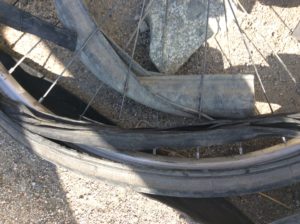
Vehicles and trucks have the same problems with these stretches and the shoulders are strewn with old tires and tubes. With few tire shops the entire length of the Kolyma, changing a tire often meant removing it from the rim right at the roadside and repairing it if you could. Semis are equipped with air compressors to refill the tire. Tires and tubes beyond repair line the road. But the old tubes came in handy for me. I was able to cut a strip out of one to make a liner for the inside of the rear tire. This gave a little added cushion. It helped things, but I was still getting a flat maybe every other day.
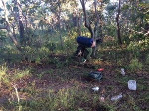
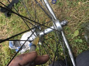
As I got close to Ust-Nera I decided to try another idea. I had had it in mind for a while to completely stuff the tire with thin strips of rubber from the old tubes and make it into a “non-pneumatic”. It being better to experiment when getting close to a town as opposed to when starting off on a long empty stretch, I tried it out maybe 80 miles from Ust-Nera. It worked tolerably well. On the dirt roads I could hardly tell it from a pneumatic, though later on when I hit pavement it made for a rough ride. I made some adjustments over the next couple of days to get it running as true as possible and ended up riding non-pneumatic on the rear 700 miles to Magadan. In that time I only had one flat on the front, but it was simply that the tire was shot and I had a new spare to put on.
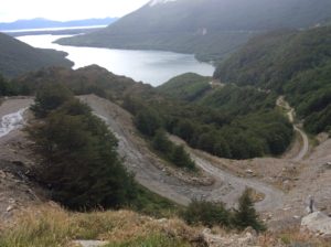
Short section of the original road to the left, new road switchbacking to the right. Not hard to imagine that the old road was hand dug.
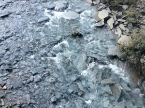
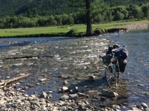
Another original-looking bridgeGreat camps.Most streams and rivers have bridges but a few had to be forded.
Above and below, cutting the rubber liner at a road-side shelter during rain.
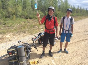
Trying out the strip method and making a solid tire.No tube, no flats!When I put the new tire on the front rim I discovered that the sidewall was begining to wear thru from years of breaking. Got me to Magadan but I haven’t yet found a replacement.Many markers for people in more modern times that have died on the Kolyma.Mark and Bronya stopped in their UAZ and had bread and raw fish to eat. The road to Tomtor is the original Road of Bones and shorter than the loop to Ust-Nera by about 120 miles. It’s unmaintained and I didn’t dare try it on the road bike but I got word that two Canadians, Kara and Brandon, came from Magadan across it while I looped up to Ust-Hera. The R of B is a small world and we were put in touch with each other later on and have exchanged a few emails. Tomtor and twin city Oymykon claim the world’s coldest recorded temperatures (-71 C) for cities outside of Antarctica.
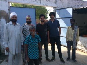
These guys were broken down and apparently waiting on help but had food and a fire going cooking mushrooms they had collected. They invited me to join in. If I got the names at all right, they are, L to R, Andrei, Ebadula, Akeem and Petrov.Old tire rims make good fire grates.
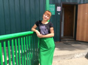
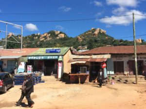
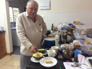
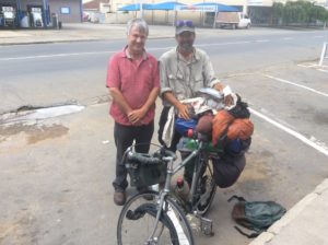
The mix of people in remote towns like Ust-Nera range wildly from almost hostile to over-the-top friendly and little in between. Alcoholism and associated domestic violence are ongoing problems. I was approached by drunks on several occasions that would at first be very friendly- especially when they found I was American- but you never knew where it was heading. I had a couple of times, 250 pound drunk men put their arm around me and start walking towards some untold destination and breaking away without an outright confrontation could be tricky. They were insisting on hospitality and to refuse was to offend. In Ust-Nera I wanted to buy more patch glue from a “shinomontaj” (tire repair) but was getting that sort of treatment from people working there. I managed to break free, sans patch glue, but decided after that to just get to a grocery store, stock up for the next week, buy gasoline for the cook stove and get out of town. I got the gas, found a magazine productivy (small grocery store) and was packing to go when a guy, Nicoli, I had said a few words to in the store was watching me pack and asked some questions. He spoke a few words of English, was sober and respectful- you never know whether you’re going to get sincere curiosity or heckling curiosity. After a few minutes he invited me to stay the night at his apartment which he shares with his mother. Well, they treated me like royalty and I ended up staying two nights and got a much needed rest. It was one of those times you could really use some kings-x safety and there it was.
I met Nicoli at the small Ust-Nera magazine and he spoke enough English that we could communicate. He shares some of the same culture a younger generation from the West is into.Natalya cooking one of several meals she made while I was there.Natalya has the job of checking the town’s water supply once a day where it’s taken from a creek. It involved measuring water height and temperature and keeping a chart recorder for the flow working properly. Tough job in the winter.Walking to the water source with Nicoli.
Nicoli is a tattoo artist and into Heavy Metal which I may have gained a slight appreciation for listening to him play it. He has drawing books filled with amazing artwork but little outlet for it in a place as remote as Ust-Nera.
J6
Natalya was a very sweet lady and did everything for me while I was there. I never got the story straight, but either her father or grandfather was a physicist/mathematician that ended up in “rehabilitation” here. They were from the Black Sea and she decided to move to Ust-Nera some years after he had passed away. That was over thirty years ago.
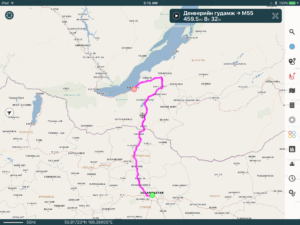
A few miles out of Ust-Nera I passed the half-way marker for the Kolyma. The first half took 10 days so I was making excellent time thus far. It was August 20th and it looked like I could make Magadan by the beginning of September. Before Yakutsk I was thinking I might average 40 to 50 miles a day on the dirt-road Kolyma. That would have put me in Magadan more like mid September. I was dreading what would happen if things went even slower, as they usually do. Ust-Nera is at 64.5º north- the Arctic Circle is at 66.5º – and the end of September is essentially late fall / early winter. But I was averaging over 60 miles a day and though the rear tire was slowing me up a bit, I knew I’d make it OK.
Halfway point in Kilometers. It’s about 600 miles to Magadan.
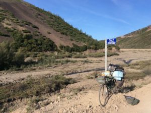
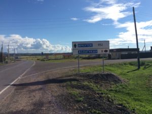
This is a side road that goes north essentially to the Arctic Ocean…….….and a sign with info. “Deroga Arctic” is in the quotes and is “Arctic Road”. I’m guessing it is a winter “ice road”. Be interesting to check out some day.
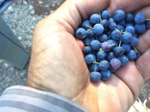
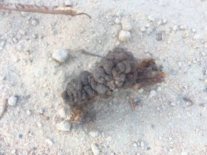
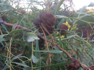
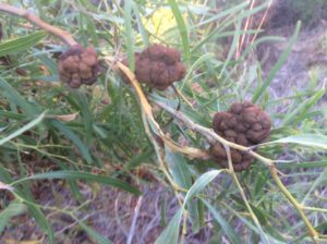
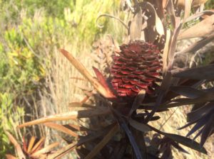
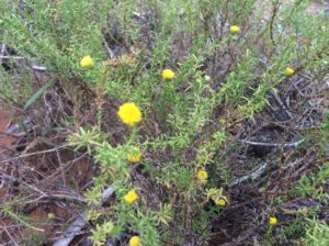
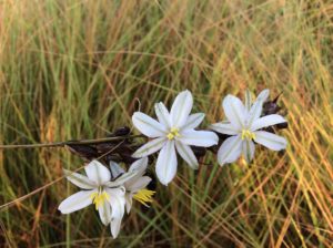
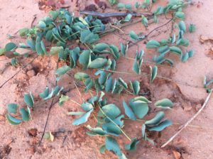
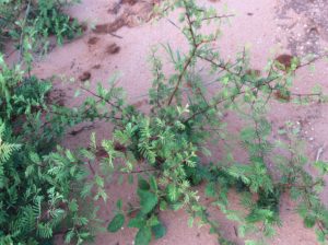
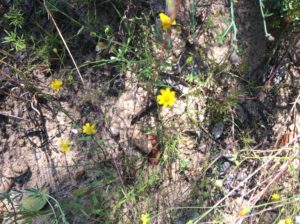
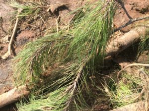
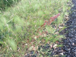
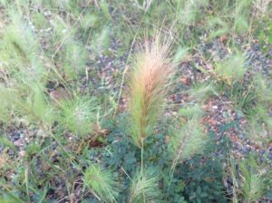
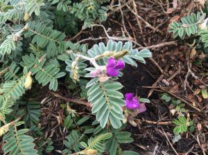
Snow fences.Katya and her dad, Sasha, stopped and wanted a photo. They’re from the small town of Yagandnoe where Sasha works in tax collection. Katya won my heart in all of two minutes. The pants are the gorkas from Sergei and Aleksi. Sasha and Katya.Five needle dwarf pine with a stone-seed cone that I’m sure the bears feed on.
Bolshevik, Susuman and MagadanBolshevik. Not much left of the town but there was some active mining going on.
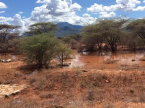
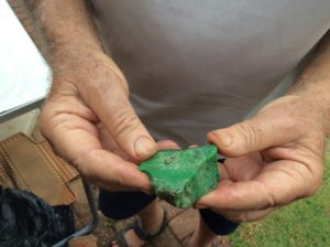
Gold mining on the Kolyma and Indigirka River systems has been long term and extensive. Rivers over thousands of years concentrate the gold and other heavy metals in a sort of natural sluicing process that is one of the universe’s great examples of negative entropy. Getting the gold means shoveling the river’s flood plain and bottom through a sluice, one dump truck at a time, and digging to what ever depth it’s profitable. Hundreds of miles of river have been made into a wasteland probably not much different than what things looked like when the glaciers first retreated. Recovery will be many years. What the rivers would be worth as 21st century eco-tourism destinations we’ll never know.
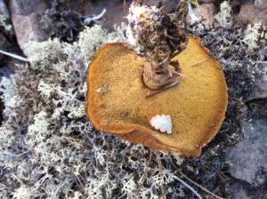
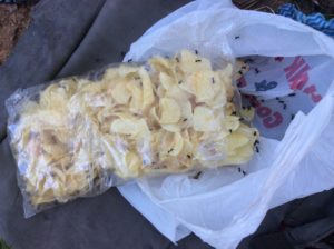
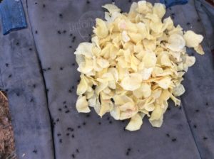
Huckleberries on breakfast cereal and bolete mushrooms with pasta were a daily thing.Closest I got to a grizzly bear, this guy stopped, couldn’t speak a word of English, wanted to know all about the trip, offered a ride, then gave me the best leftovers (below) I think I’ve ever had (I’m sure from his wife). Kbac is a lightly fermented wheat-derived drink- no narcotic effect- that tastes a little like prune juice. I’ve grown quite fond of it.
B
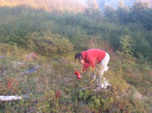
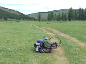
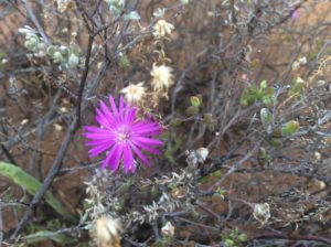
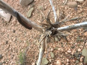
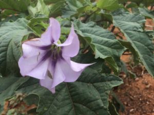
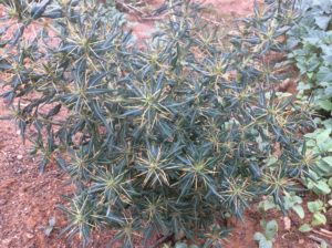
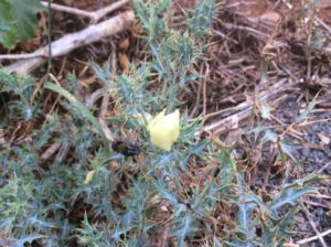
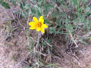
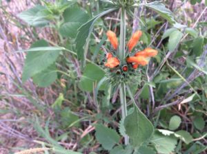
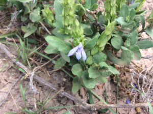
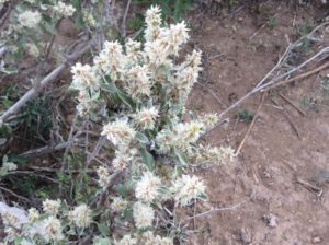
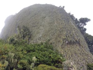
A camp at a pass in alpine where I quit early and went for a hike to a small Siberian summit and got a few plant photos.
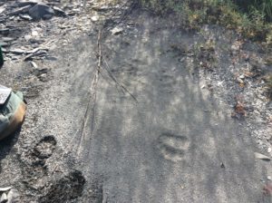
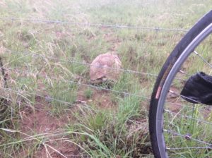
Grizzly track.Many beautiful, clear running streams.100 miles to go.
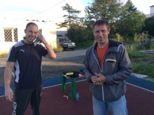
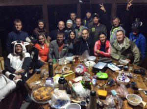
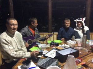
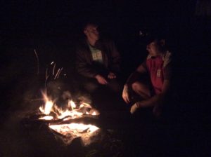
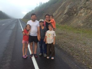
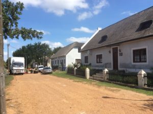
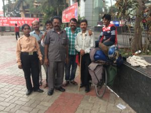
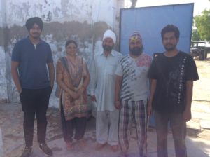
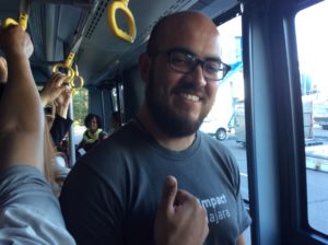
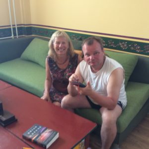
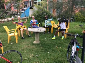
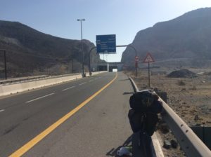
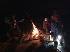
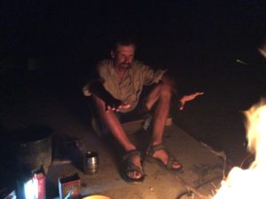
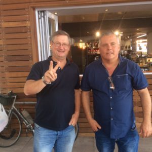
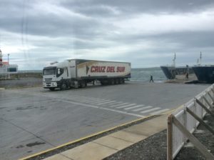
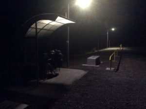
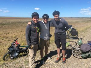
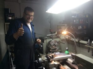
For the last couple of days getting to Magadan the weather turned rainy and cold. Magadan’s airport is at Sokol, about 40 miles before Magadan, and I got there in driving rain and found a hotel. Later that night I got a knock on the door from two guys, Dima and Sanya I (Sanya II to be met later and there was even a Sanya III) who knew I was coming and somehow learned I was in that hotel. Sanya spoke enough English that we could communicate and soon I was invited to a gathering in Magadan the following night. Dima picked me up the next afternoon and shuttled me to town. Dima took me all over, wanted to pay for repairs to the bike and payed for a room. Their gathering was a great time with food cooked over a fire, guitars and singing later on. There was no alcohol- they call themselves “the new Russians”- for which one can only have respect. These folks have got it figured out.
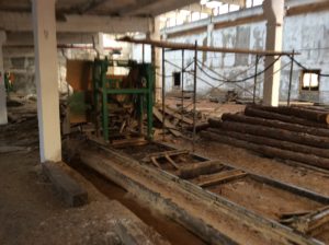
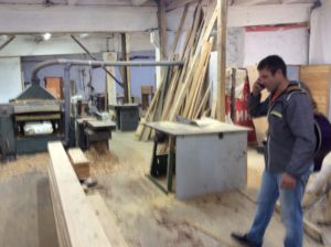
Sanya II and Dima.Jenya and Luba.Dima does about the same thing for living that I do but on a grander scale and he has many employees. This is a bandsaw-type sawmill a little bigger than the portable one I have.Dima was never too far from his cell phone- or his guitar.Great folks.Sanya I, Dima, Kolya and his girlfriend. If you can find my Facebook page, one out of hundreds of Steve Walkers, there are some video clips of playing songs and links to lyrics. These guys are all computer experts and one guy, Andrei, had live video on my page within a few minutes.
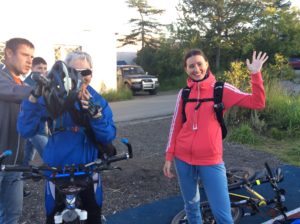
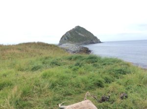
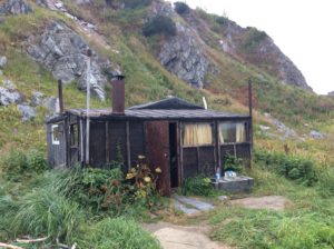
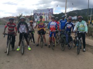
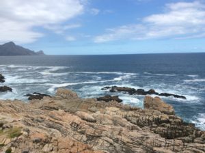
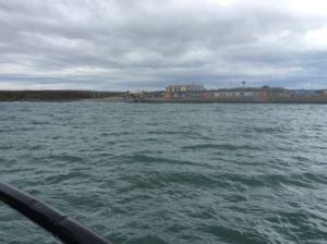
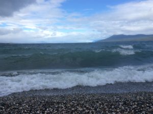
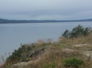
The next day they had a mountain bike ride planned and Dima lent me a bike as mine was pretty much non-functional with the front rim wear and a freewheel pawl that had begun to skip. We rode 12 miles of road/trail to an oceanside cabin at Cape Ostrovnoi and spent the night. Next day Sanya I and I hiked to Cape Ostrovnoi and got beautiful views of rugged coastline and saw many sea birds and chuleen, or seals.
Sanya I………..getting a drink.Cape Ostrovnoi.Sanya I & II at the oceanside cabin.
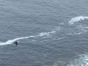
Dimitri and Yaroslof were fishermen that stopped by the cabin.Sanya IIPuffin.Sanya I near the top of Cape Ostrovnoi.Spit leading to Ostrovnoi. It was once an island but the bridge was created during WWII to prevent Japanese ships from going undetected towards Magadan.Fisherman who when he learned I’d cycled the Kolyma said it was the bones under the road that protected me.Descending a cable that led to the cabin.Sanya I and Ostrovnoi behind.Andrei works in real estate and lined me up with an apartment and took me around Magadan. He brought me to a “banya”, a sauna/massage place and though I’m glad I saw one, it was unbelievably hot and a bit painful for the uninitiated. They love it though.Picking brushnika with Dima and family. They’re essentially the same as our lingonberry or wild cranberry.Luba and Dima’s son.Dima’s wife Julia.
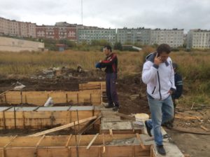
Tour of a house Dima’s building for himself and family. Just finishing up the foundation.
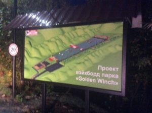
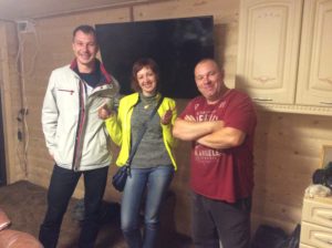
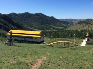
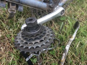
Stas, Victoria and Sergei. Sergei has built a water park, photo above this one, where you can “wake board”, a sort of waterskiing but with jumps and acrobatics. He’s wearing a “Los Angeles” tee-shirt and I tried to tell him that Logan, Utah has more in common with Magadan than LA.Pulling the rubber out of the tire and going back to pneumatic.
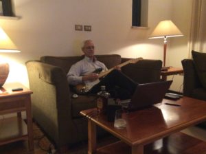
So, I’ve rented an apartment for a month and will stay and get to know Magadan a little and learn some Russian. I’ve bought a cheap guitar to play and Dima has lent me another guitar. I’ve been playing a lot and learning a few Russian folk songs but old tendonitis problems in my wrist and arm have been right there to haunt me. After this, there’s not much left but to make my way back to the US. I’m less than 800 miles from Alaska’s Aleutian Islands (Attu) but so far I haven’t found direct transportation there from Magadan at any kind of reasonable price. The alternative is an inexpensive flight to Vladivostok, ferry or fly to either Japan or South Korea, then probably fly to San Francisco. Then it’s either to Anchorage for the winter or cycle home for house repairs and earning money for the first time in a while. At the moment I’m favoring the latter and would do the logistically easy leg from Alaska’s Prudhoe Bay next spring/summer. Continue reading Yakutsk to Magadan
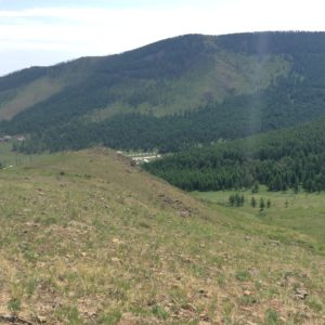
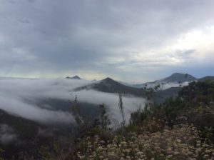
I had two weeks wait in Ulaanbaatar while the Russian visa was processed. I took advantage of the time and did a backpack trip into mountains north of UB which I accessed over dirt roads on the bike. The father of the girls running the hostel is a Buddhist monk and owns a monastery in the mountains on the way to where I was heading. They invited me to stay a night at the monastery which, nestled in a beautiful mountain valley, has facilities for retreats. I stayed one night and continued to the town of Terelj and then 20 dirt road miles up the Terelj River to Gorkhi-Terelj National Park. It’s an incredible place where few cars travel and there’s virtually no one going off road into the mountains. The exception is locals who collect pine nuts in the late summer and fall, but things were deserted at the time I was there.
I stashed the bike in some willows and packed the blue bike bag with 4 days of food and started up a ridge that led to alpine areas. Great camps, lots of bear and ungulate signs, saw counterparts to our squirrels, weasels and pikas. No encounters with people made for a much needed respite.
After returning to the bike I was able to continue in a loop back to UB. Then it was more languishing while waiting on the visa. UB has a yearly festival for which the city pretty much shuts down for a week while they have a sort of Marti Gras. I didn’t participate in it too much and missed out on things like horse races and archery tournaments but did get in on some of the food and drink street venders were selling. The visa was ready on the 14th of July and I was packed and ready to go that morning. Got the visa at about 10 am and began the 250 mile stretch north to the Russian border. Three nights got me there. I had heard nightmares of the border taking a full day to get through, but I managed it in about an hour-and-a-half. There were however an unusual number of lines to go through, I got checked for the first time at customs while exiting a country, and then for some reason they don’t allow non-motorized traffic between the border posts, a distance of about a 1/4 mile. I got a ride in a van and payed the guy almost $20 to take me through. He had to wait a bit while I convinced Russian immigration I was legitimate (they wanted to see the bike) and again while entrance customs had me dump out about 90% of the gear on the floor of the van. Much of the gear was wet from previous night’s rain and after seeing blackened cooking pots, assortments of greasy, worn tools and general wear and tear on it all, the customs guy lightened up a bit and mentioned he was from Magadan, the end of the Russian journey if I make it that far.
Russian travel began with debit card issues and I was lucky to get a few groceries on a credit card. No ATMs would work and I started to Ulan-Ude, a city of 300,000, one hundred fifty miles to the north. I got to UU about out of food but thankfully found out the debit card issues worked themselves out.
I wanted to see Lake Baikal, but it is about a hundred miles to the west from UU and my route was to the east. I decided to do it anyway, though the season was advancing. As it stood I would be reaching sub-arctic Magadan in mid to late September, possibly October. Shnyeg is the Russian word for snow and they seem to use it a lot when I ask about Magadan.
I rode the first 30 miles towards Baikal with the bike loaded, then camped and cached gear. Next morning I rode the unladen bike 70 miles to the lake, had lunch and then 70 back to the cache. Long day. Then it was back to UU and an 1100 mile trek east on the trans-Siberian highway to a turnoff that leads to Yakutsk. Much of the route is through taiga but would emerge into beautiful valleys and even a section of Saskatchewan-like prairie. Though it could be quite hilly, I made good time and stacked several 80+ mile days together and one 100 miler. Highway conditions began with rough road and lots of construction, but got better as I went. I stayed in a hotel in Chita, another modern city of 300,000. Thirteen days out of UU I reached the turn to Yakutsk.
This stretch begins on newly constructed highway but after 20 miles becomes intermittent dirt/paved. Since leaving Chita I had had three truckers offer me rides. On a rough dirt section about 50 miles into the leg to Yakutsk number three pulled up along side of me and I took him up on the offer. With the rate of travel on the dirt, it would be a full two weeks getting 700 miles to Yakutsk and would put me starting an 1100 mile all-dirt leg to Magadan the last week of August. I was having visions of Franklin, Alfred Packer and the Donner Party.
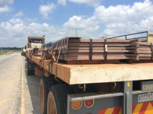
So, I threw in with the trucker, “Janey” (John) and over the several days he took me about 400 miles to within 200 miles of Yakutsk. Over the time spent I evolved into a sort of employee. Janey was hauling a gold sluice and a couple of hoppers on a flat-bed trailer. With limited chains and binders it made for an unwieldy, shifting load on the rough roads and we were constantly tightening and reconfiguring. In the US he would have been pulled off the highway at the first port of entry. He did get one ticket at a police check for, of all things, having a load that was too high. That much of it was held on with nylon straps that were the next size up from motorcycle tie-downs didn’t seem to matter. As far as I could understand (Janey spoke about as much English as I did Russian) he paid the ticket was with a bribe.
Janey saved me about a week of riding but took 3 days to do it so the gain was more like 4. There was no passenger seat in the cab and I sat on a tool box over the long days and rough roads. I got some rest from two weeks straight riding on the bike, but was otherwise working the whole time.
I’m staying one night in a hotel in Yakutsk (actually Nizhny Bestyakh, Yakutsk proper is an hour long ferry ride across the Lena River). There is a lot more to tell on this last leg and what’s here was written in a hurry. Next I start the 1100 mile dirt road to Magadan. Not sure how it’s going to go.
Monastery above and below.
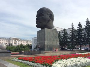
Mongolian alpineWeaselWorld’s largest bust of Lenin. Ulan-Ude.Lake Baikal above and below.
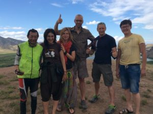
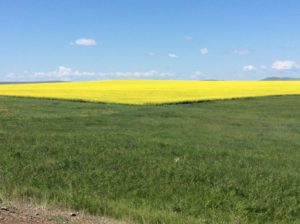
On the left is a cyclist from China. The others are Latvians Jana, Ieva, Didzis, Vents and Bato (from Ulan-Ude) who gave me an English fix at a rest stop.Lera Gorbova sent me away with an extra plate of food at a cafe.I think this is Tanga. The building, some kind of defunct factory, would have been built when Tsar Nicholas was in power.Mateo Marzari and Valentina Scarpellini are from near Milan, Italy and had been on the road for a year. Trans Siberian Railway. All electric!ChitaRape fieldsVaccinium is everwhere in Siberia.Aliakbar Yusupov and his father. They fled Tajikistan in the unrest that followed the Soviet breakup and settled in Chita. Ali is a very bright kid and speaks English well. They gave me lunch.Sergi, Natasha and family were driving from Vladivostok to Moscow, an unimaginable 7000+ miles. They were waiting for me at the top of a grade with drinks and sandwiches.Semi with Janey that took me 400 miles on the section to Yakutsk.Janey and Ygor Bechtomov. Ygor managed an auto parts store where we were working on bikes and semis. He kept us generally entertained. I am impressed at how similar US and Russian cultures are. We seem to laugh at the same jokes.Alexander and Anatolia are Yakutians and were doing a bike tour from Yakutsk to Blagoveshchensk, Siberia, a distance of about 1000 miles. There is a cycling culture in Yakutsk! They spoke some English as well as Russian and native Yakutian and we talked for about an hour.Pawel, Irina and Sargulana are Yakutians that stopped to say hello.The top town is Irkutsk which I’m riding away from. At Baikal I was about 250 km from it.Solovyevsk, Tinda and Yakutsk.Crossing into the Republic of Yakutia.Yakutian soil has a low but almost ubiquitous concentration of gold in it and is essentially strip-mined where it’s profitable. I doubt there is much in the way of EISs here but on the other hand the expanse of Siberian taiga is on a scale far beyond what’s in the US and Canada.The Amga, another one of those Russian rivers that turn up in Western crossword puzzles.The paved sections could be tantalizingly brief.Nearing Yakutsk.
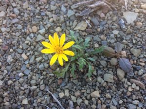
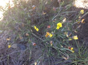
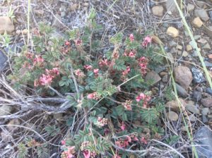
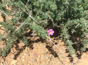
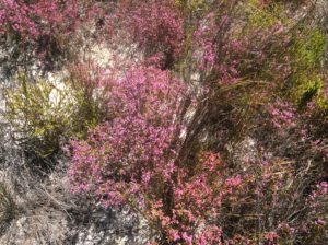
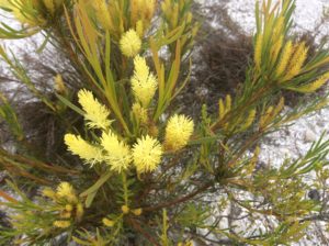
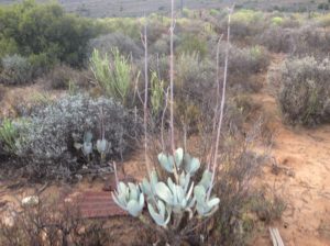
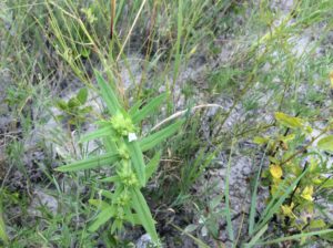
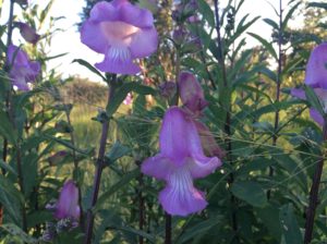
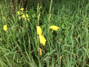
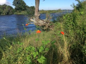
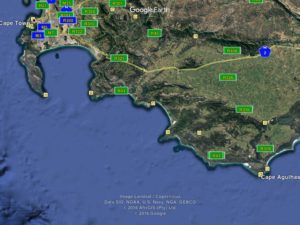
These first photos are coastal South Africa in an area called the Fynbos. The botanical world can be divided into six floral kingdoms. The largest is the northern hemisphere north of the Tropic of Cancer, which is more than half of the world’s land mass. I’m getting a feel for that kingdom presently seeing so many Mongolian plants similar to North America’s yet 180 degrees around the globe. Then South America and Australia are their own kingdoms. What little grows on Antarctica is its own. Tropical India, Southeast Asia and about all of non-Mediterranean Africa make up a kingdom, all except Africa’s southern coastal tip. Here lies the 6th region, the disproportionately small Fynbos.
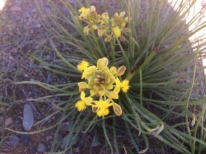
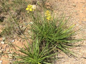
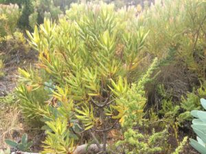
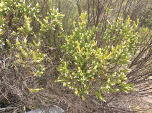
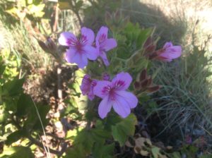
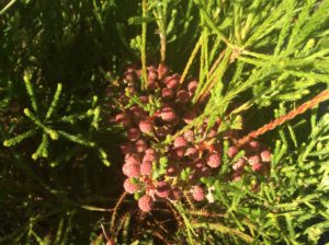
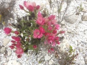
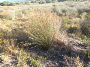
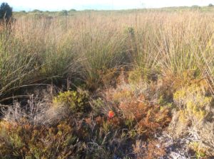
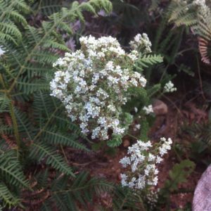
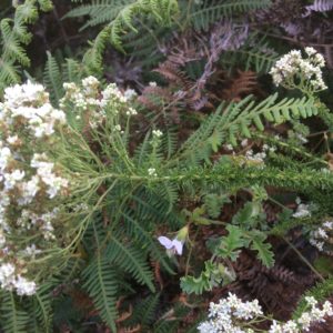
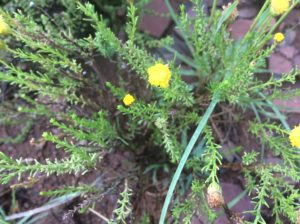
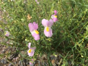
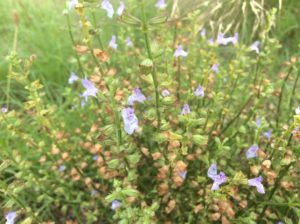
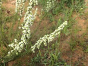
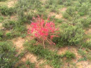
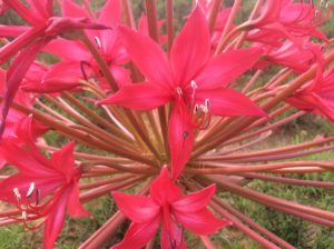
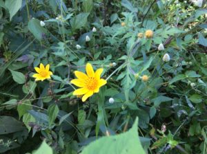
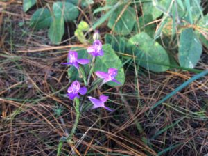
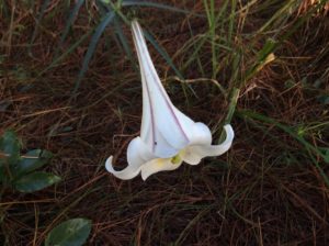
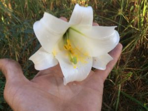
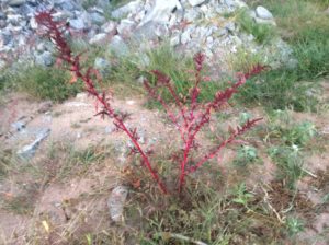
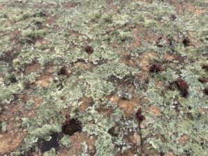
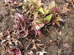
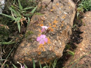
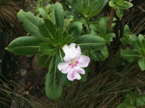
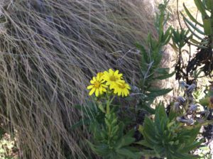
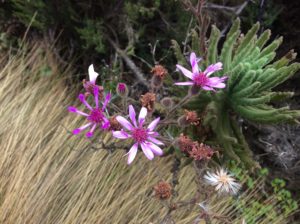
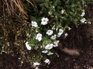
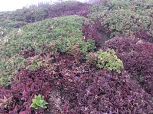
The Fynbos is a strip of land coming less than hundred and fifty miles inland from the coast and about 500 miles from west to east. In it there are about 9000 discovered species of plants and over 6000 of them are endemic. Below are a good 20 or 30, most of which I can’t even get to family.
Having said all that, here’s the same spurge I have growing in my lawn at home.This is one of several species of widow bird. The males cart these enormous tails around during mating season.Some kind of ungulate scat at the first camp after leaving Cape Town…….……not sure how they project it up into the trees.
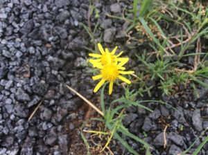
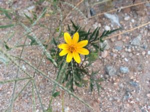
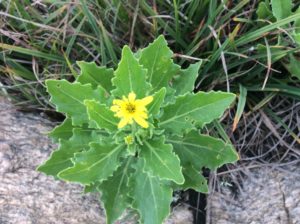
Not too many composites.
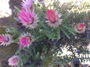
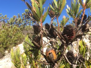
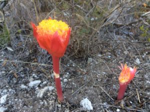
A protea after it has bloomed. The dark star shape was a huge flower. The family is Proteaceae and makes up over a thousand Fynbos species. South African pets, restaurants and hotel chains are named after it. Macadamia nuts come from that family.
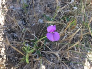
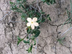
Viola?
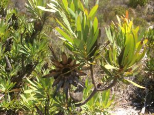
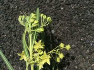
This might be conebush, a Leucadendron species in Proteaceae.
Haemanthus spp. Looks like it should be an orobanche or some kind of saprohyte. It’s in the Amaryllidaceae family.Restio spp. Restionaceaes are used to make thatch. Thamnochortus insignis is cultivated for it.
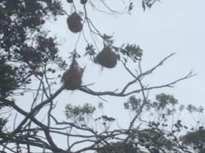
Thatch roofs made from Restio reeds have a precision look and can last 50 years.Camp with trippy trees…..…..having these fruits.Nests made by weavers of which there are many species throughout Africa.
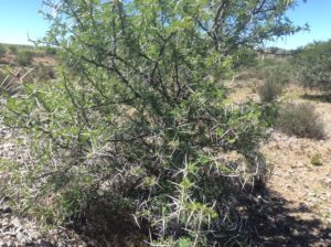
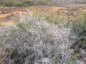
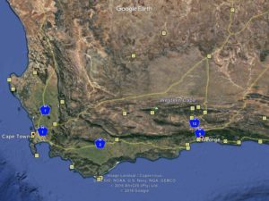
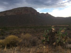
The Fynbos to the north extends into the Cape Fold Mountains and ends roughly where the Great Escarpment defines the edge of the interior plateau. The plateau regions can be divided into High Veld, Low Veld, Bush Veld and Karoo. The Karoo, below, was the first to be encountered and is arid and hot. Much of it resembles thorn scrub of North America’s Southwest.
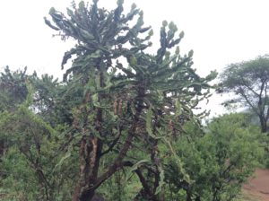
Pricklypear is an invasive here.
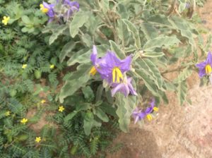
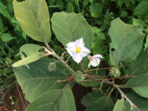
Solanaceae, an invasive as well.
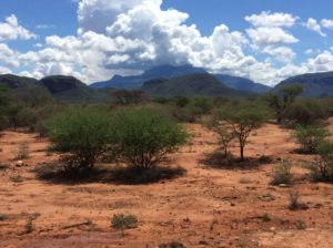
Mesquite-like acacias.
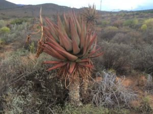
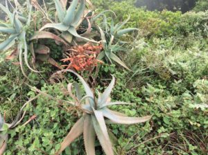
Aloe.Slipper plant. It grows in a comparable latitude and habitat in Mexico.
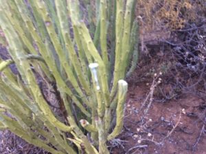
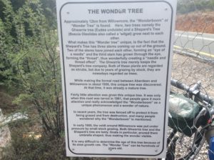
Wonder tree.Crawling on the stalk is a relative of the same ring worm you find curled up behind your washing machine. Some species grow to about a foot long. They’re harmless and kids will let one suitably sized curl around their wrists as a bracelet.
Few Composites
The Karoo’s ranges and valleys give way to higher elevation grasslands, or veld, as you go north. The grasslands are extensive and appear to be in a natural state that has somehow escaped agriculture and livestock grazing.
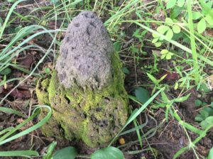
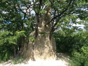
Veld and termite mounds.
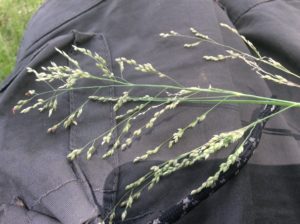
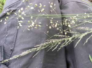
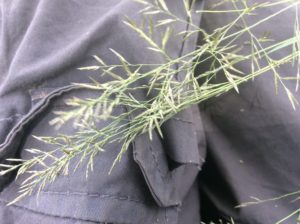
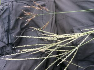
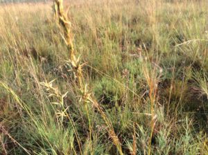
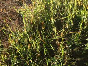
The grasses above and below were picked at arms length from a place I had lunch. Unbelievable diversity of grasses in South Africa.
Near Pretoria
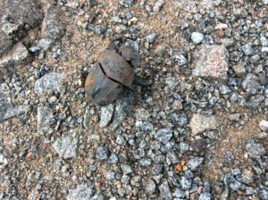
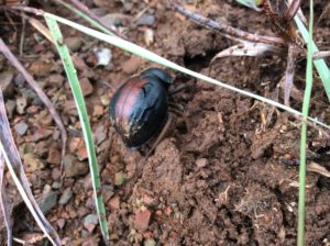
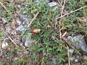
Lots of beetles
Tiny frogStill haven’t identified this but it grows in Mexico, Argentina and South Africa.
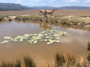
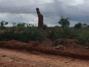
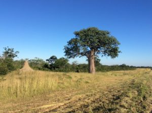
Termite mound in Botswana.
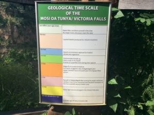
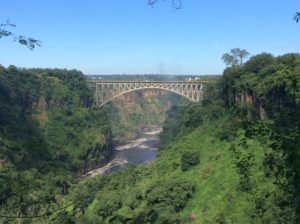
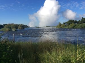
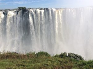
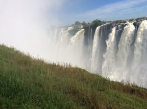
Above and below, Victoria Falls surroundings.Zambizi River before the falls.
After Victoria Falls, Zambia becomes wetter and jungle like, maybe dry tropics. It skirts the much wetter Congo to the west.
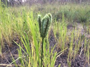
These things were hard not to run over on one stretch.Cool spider.Another wild grass in Zambia.Elephant grass was often over your head.
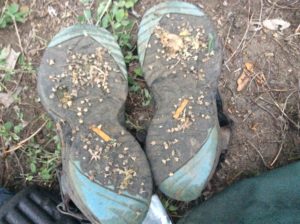
Mint of some kind.Tribulus terrestris, goat’s head or puncture vine. Nasty stuff.The thorn itself.Walking through them to get to a camp. The bike was carried.
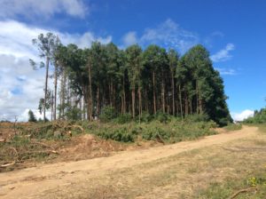
Old termite mound.Pines were farmed over many square miles in Tanzania. There were two species: Pinus radiata (Monterey pine) and P. patula from northern Mexico’s highlands. Older trees were well over 50 years and are now being harvested.Colobus monkeys in Monterrey pines.
Newt
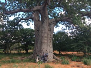
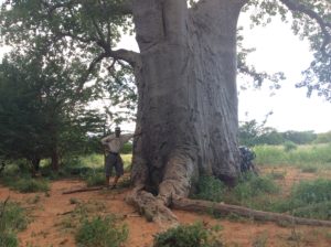
Babao tree.This is an escaped acete, the same grown in Latin America for vegetable oil.
These next were from Mt Longido in Northern Tanzania.
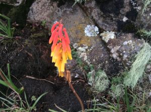
Euphorbia candelabraAloe
Plants on Mt Kenya.
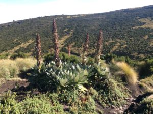
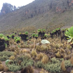
Dendrosenecio keniensis, or giant groundsel. Several volcanoes reach alpine altitudes in the area of Mts. Kilimanjaro and Kenya. Each has evolved its own species of the groundsel.
Lobelia telekii or giant lobelia
The deserts after Mt Kenya and on into Ethiopia were incredible but I didn’t take too many plant photos- too busy dealing with the natives. Below are the abundant acacia trees and the pealing bark of something that looks like Mexico’s Bursera species.
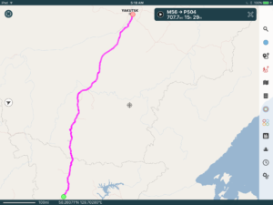
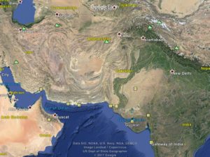
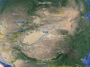
I flew from Muscat to Mumbai (Gateway of India) and cycled 1200 miles to Delhi.Then I flew to Ulaanbaatar, Mongolia by way of Bishkek, Kyrgyzstan.The trip so far. I’ve figured out how to put routes on the computer maps but not how to then upload them on to the web site. So, I drew this one by hand.
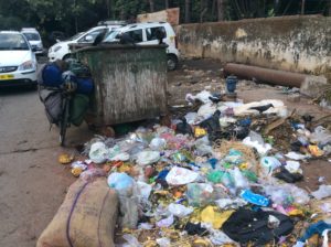
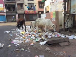
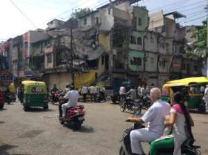
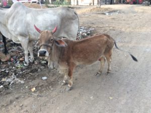
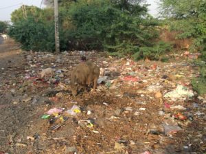
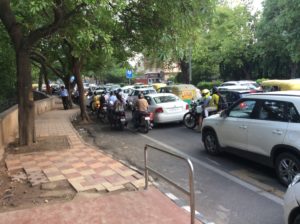
Flying from Muscat to Mumbai, India meant a few degrees drop in temperature but increased humidity. Hotter/dryer is probably more tolerable but neither place qualifies as an ideal climate. Indian culture has some differences from most of the rest of the world, the first clue being cows on busy inner city streets. If you’ve ever wondered what a cow eats in the middle of a big city the answer is garbage, wet garbage. I ate at a McDonalds (yes, they’re here too and serve masala flavored burgers) and when bussing my table had a choice between disposing in dry and wet garbage bins. The wet garbage is then put out on the street where, as you can imagine, there are mountains of it. Traffic is horrendous and at first glance utterly chaotic, but after a while patterns emerge and it becomes somewhat manageable. You’re at least as safe as a cow in it and if you stop dead in the middle of an intersection to look at the map, the cars, motorcycles, tuktuks, busses, carts, along with the cows themselves, will just go around you. I did however see a calf-motorcycle collision that both walked away from and one bicyclist hit by a motorcycle; no one hurt but the bike forks got mangled. The first days were hard and I was often in a sort of road rage state dealing with the crazy driving habits. One car bumped me on the arm as it passed and folded the breakaway mirror. While stopped at an intersection a tuktuk from behind nudged against a pannier and pushed me forward a few inches until he could slip passed. I was so blown away by that maneuver I couldn’t even get mad but made sure I took it out on the next person. In general, the sense of personal space is wholly different from the West. Standing in a line for anything you’ll be bumped, jostled and groped. If you leave a bit of space between you and the person in front of you it will be soon filled by the person behind you.
After a while it became clear that I was about the only one with a problem with the driving habits. Cutting people off is the norm. Traffic lights in Mumbai were pretty much advisory and any possibility for working your way through an intersection is fair game. The paradox is that it’s really more efficient and though you never go very fast, you keep moving. The same traffic jams in the West that are at a dead stop would tend to grind forward here. All the cutting off, weaving, running of red lights has the effect of maximizing movement and, at least qualitatively, appears no less safe than American cities. The rules are certainly laissez faire but the thing that makes it work is a higher level of tolerance. Getting cutoff to an American is to an Indian just slowing a bit to keep overall traffic flowing better. By the time I got to Delhi I was pretty much acclimated.
Adding new birds to the Life List in Mumbai.
If you’re a vegetarian you’ll find plenty to eat so long as you don’t mind deep fried everything. I’m sure they use vegetable oil, but it all becomes too much after a while. The food is invariably spicy hot as well. I never did see a full sized grocery store (they must exist), only the small shops with bins of basic grains, lots of dal combinations, lots of cheap candy and soft drinks. Many sell the groceries over the counter like you’re buying auto parts- awkward enough, but doubly so when you don’t speak the language. I tried cooking grocery foods a couple of times but soon gave up. For several long stretches it was coffee in the morning and deep fried anything (except meat!) after that. The fruit stands saved me and I would eat several bananas and mangos a day, oranges when I could find them. Alcohol cannot be sold within 500 meters of a main highway, so liquor stores were hard to find. Besides that it was ridiculously expensive. I stayed on the wagon through most of India.
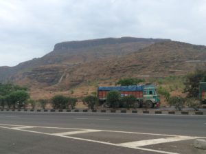
Western Ghats at the end of the dry season.“Riotously colored” Asian trucks.Good Camp.Fixing a flat in the only shade around.Indore, India.
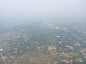
India’s population is around 1.3 billion people. One source has them now edging out China but most have China still in the lead. Regardless, India is expected to pass China in the near future. To put things in perspective, Africa has just over a billion people but ten times the area of India. North America, South America and Australia combined have about a billion people and a little less than double the area of Africa. India’s crowded but I did find stretches of road with wilder territory and places to camp. Inland from the west coast of India and stretching from the tip to well north of Mumbai are the Western Ghats mountains. They’re predominantly low hills with the highest point around 9000 feet- no competition for the Himalayas. The Ghats, though, are known for biodiversity and thought to have many unrecorded plant species. Crossing through them affords some relief from continuous humanity. Much of it is agricultural but stands of trees along fenceless highways offered good camping. I had some deer hanging around a camp one morning.
The Western Ghats are home to many of India’s tiger reserves. Tigers living truly in the wild are a thing of the past in India, but country wide there are over 50 reserves and around 2000 tigers, a number that has increased in the 21st century. Tourist dollars are the tigers’ best protection.
Buying a shirt in Mumbai and making a bunch of friends.Anybody that knew our dog Zeke will be glad to know he’s resurfaced in India and getting the respect he’s always deserved.
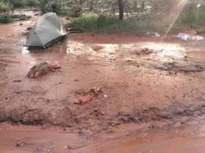
Muddy camp after a day of rain.
Closest I got to a tiger was in a museum in Gwalior.
It took about two weeks to ride the 1200 or so miles to Delhi from Mumbai. Winds were mild, terrain basically flat but many drenching rains were encountered as the monsoon was beginning. For the many motorcycles on the roads the rainstorms can be a problem but they can pull off and wait them out in what ever shelter can be found. A stoop or the eave of a house or one of the many outdoor, but covered restaurants are all available. Private property sort of gets suspended when it rains.
Waiting out rain.
Firoj Mansuri and Iliyas Sendhwa in the top photo and Dharmendra Dinkarwere below were gas station attendants that invited me in for chai tea. Many gas stations had refrigerated, filtered water on tap that made riding in the stifling heat bearable.One of countless towns.Rainy, muddy day and stuck trucks.Gwalior.
Advice from South African Willie Pienaar many months ago was to try an Internet based service called Warm Showers where people from all over the world offer a place to stay for passing cyclists. I finally got around to checking them out and found Ankit Agrawal in the city of Gwalior. I got to Gwalior after a 108 mile day and, in darkness, didn’t try to find Ankit’s place but instead got a hotel. Ankit came that night to the hotel and soon had a busy itinerary for me that included another ride with the local cycling club early the next morning. Fortunately he saw I was in no shape to get up at 5 am for the ride and instead let me sleep till 6 am and then go on a much shorter trip with just him touring downtown. That afternoon we rode from Gwalior to the town of Banmore and on to nearby Sran Farm House where I stayed a couple of nights with a family of Sikhs that were his friends. Ankit keeps a travel blog and wrote of our stay at Sran here.
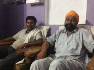
Singh family. Ranjeet (son), Mrs. Roopindar Kaur (mother), Talwinder (father), Kulwant (brother of Talwinder) and Amandeep (nephew). Kulwant experiments with combining compatible crops for better growing efficiency and was invited to a conference in the US to share ideas. Unfortunately he couldn’t get a passport in time and had to forfeit. He may get another opportunity.Talwinder, Kulwant, Bilas, Amandeep, Ranjeet, MistriKulwant, Ranjeet, Amandeep and Ankit at Sran Farm.
Sran is owned by the Singh family. Staying there, and even being put to work, was a window into how rural Indians live. As might be expected, farmers keep busy. I helped install an electrical transformer to get power to a house, loaded up and transported concrete power poles for use in getting electricity to a well pump, did some weeding. Got to drive a tractor for the first time in many years. After being amazed at the number of motorcycles on the roads loaded with four people, I got to be one of the four while riding to a nearby town. There are certainly differences in our cultures, but in the end I was amazed at how similar our lives are. They have the same group efforts to get work done and the same kind of chores and projects you would expect on any American farm. Core values are essentially the same.
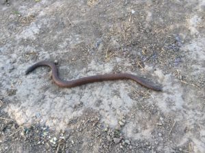
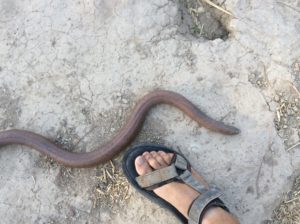
Many road signs had no English and it was hard to know which town was which.AnkitThis is one painting on an urban wall with many. All had environmental themes.Ankit lined me up with an interview for a local newspaper. These are my interviewers, Aditi and Harsha.No idea what they wrote, for all I know it’s a wanted poster.Taking a bath in a Taal.Kulwant leveling a field using a laser- pretty sophisticated stuff.Namandeep, a family friend, riding the bike.Eryx johnii, or red sand boa. It’s tail looks like a second head and it’s often called a two headed snake.
Ramkaran and Talwinder.
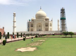
The route north of Gwalior went through Agra, home of the Taj Mahal, and I figured I owed it to myself to see it. It involved standing in several lines, some security related, others collecting money, and then a procession over the grounds to the white marble mausoleum recognizable from the post cards. I was glad I saw it but the pictures probably do it justice.
Taj Mahal
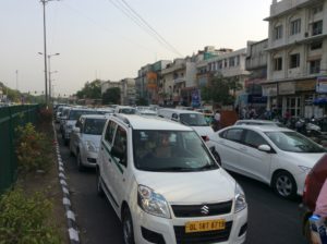
Two more days ride brought me to Delhi and a treasure hunt for embassies and bike shops. I found a hotel for $30 a night (with breakfast!) located in Nehru Place in the downtown. It was about a ten mile ride to the embassies through horrendous traffic. In the next two weeks I would make the ride about eight times. I was trying to get visas for both China and Pakistan with the intention of riding the Karakoram Highway from Islamabad to Kashgar, China. This route would have taken me close to K2 and I was hoping to spend some time in the area. It didn’t happen; after over a week of jumping through hoops for a Pakistan visa it was denied. I was both relieved and disappointed. Pakistan would have been a more dangerous place but the Himalayas and the route through China to Mongolia really looked worthwhile. So, with Tibet still off-the-scale expensive, not to mention the closed borders with Nepal, I decided to fly to Ulaanbaatar, Mongolia, a “walk in” country for Americans, and try to get a visa to Russia. I suspect there other alternatives for Tibet and I may one day get back here to fill in the gap.
New Delhi traffic. Cows have been removed from Delhi’s streets but I’m not sure it wasn’t safer having them there.
Roshan, right, ran the front desk at Clarks Inn in Delhi.The bike rack broke somewhere in Ethiopia, I got a poor weld job in Muscat, and finally replaced it in Delhi.
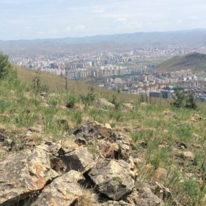
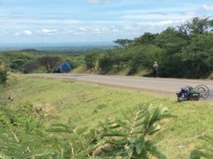
I’m in Ulaanbaatar now and the Russian visa will take another two weeks. I am, however, somewhat more confident that it’s going to happen. The Russians are a little more forthcoming and speak English well. The only downside is that the season is advancing and I’ll need about three months to get through Siberia if I take the Kolyma Highway (the Road of Bones) to Magadan on the east coast. I’ll be encountering snow flurries at some point. In the mean time I’m being treated very well at the Good Karma Hostel and at a reasonable price, breakfast included. There are mountains here and I may take a few days to do a backpack trip. The climate, latitude and situation among mountains is comparable to Boise, Idaho. Ulaanbaatar itself is unlike the typical Asian city, being much more Western, and it reminds me of Boise in many respects. The traffic is far more orderly and the continual horn honking of India (for which I wore earplugs) is greatly diminished. Mountain slopes with blue-black conifers on northern exposures and grassy south sides are a sight I haven’t seen since leaving Utah. I took a short hike yesterday in the foothills and found larch, spruce and pine trees as well as many familiar plants. At 47° North, I’m getting into circumpolar latitudes where ecosystems over the eons have migrated east and west round the globe until they meet. I’m half way around the world but it feels like home.
Flying out of Delhi…….with a stop at Almaty, Kazakhstan. The tall buildings are Soviet era blockhouses.From Almaty I flew a hundred miles to Bishkek, Kyrgyzstan and stayed overnight. I met Edgar Wynter, from Guadalajara, Mexico and we had dinner in Bishkek. He’s doing NGO work with the UN in Kazakhstan.The Himalayas were under cloud cover flying over but China’s Tien Shan were visible. The range is one of three in the world, all in Asia, with peaks over 7000 meters.Boldbaatar saw me loading up the bike at the Ulaanbaatar airport and bought me lunch. He lived for a while in Los Angeles.Sisters Erdenebileg (Abby), Erdenebadam (Erica), Erdentsetseg (Erika) ran the Good Karma. Erika went to college at SW Minnesota University in Marshall and Abby in several colleges in Chicago, New Mexico and California.Inga and Marek are from Poland and stayed at the Good Karma. Their son has been touring Africa on a bicycle off and on for four years.
Ulaanbaatar from foothills.
Below is a link to the television interview with Tefera Ghedamu in Addis Ababa. It’s long, the lip synching off by a few seconds, my on-the-spot arithmetic not very good, and I could have used a map in front of me.
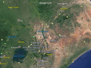
The route from Nairobi went through Marsabit and Moyale and on to Ethiopia’s capitol, Addis Ababa.Then I flew to the United Arab Emirates and cycled the north coast of Oman to Muscat.
I left off the last segment with next wanting to get a visa to Ethiopia in Nairobi, Kenya. I managed to do it but there were several hurdles. Ethiopia wanted a “letter” from the US Embassy stating intentions. This meant trips on the bike across town, two more nights in hotels and more long lines to simply be given a US letterheaded sheet of paper that I hand wrote my Ethiopian itinerary on. The US Embassy then stamped it with what amounted to a notary public. It cost $50 to do that. I must say that a bicycle is the only way to get around in the horrendous Nairobi traffic- or any other African capitol I’ve yet been to.
Ethiopian Embassy in Nairobi.
At the Ethiopian Embassy there were never any lines to speak of, but you waited just the same. They had comfortable couches and magazines to look at and it felt more like a doctor’s office. In the end they approved the visa, all for $140. In one sense it was almost too easy; I was expecting warnings about problems at the border with Kenya, and even hoping for some free consultation on what to expect. I inquired about border violence but this woman just said “no, everything is at peace now”.
Kenyan river with dugout canoes that they would shovel sand into from the river bottom. Probably for making bricks.
Kenya, southern Ethiopia and northwestern Somalia all meet near the town of Moyale. The border is not well defined in surrounding areas and there has been fighting in recent years. It is unclear how much is “government sponsored” and how much is intertribal. Much of the land of northern Kenya is the Chalbi Desert. It is occupied by semi-nomadic herders from many language groups and for which international boundaries are not necessarily respected. They fight among themselves and have done so for millennia. Livestock rustling is a way of life and, even today, a young man coming home with a haul of goats is just a rite to adulthood. From the perspective of a Western cyclist passing through they might be described as wild and not playing by the same rules. It made for some interesting episodes, stay tuned.
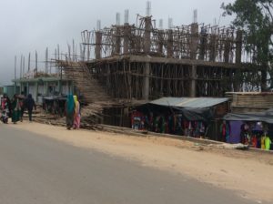
Scafolding for buildings in Nanyuki. I would see this method often in the coming weeks. It’s just 2 and 3 inch diameter wooden poles joined with a 20 penny nail. A few would have an additional wire tie.
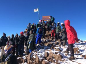
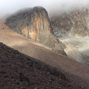
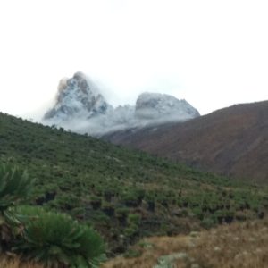
Mt Kenya lay on the route north of Nairobi. It’s highest point is a little over 17,000 feet and is the second highest mountain in Africa, next to Kilimanjaro. Unlike Kilimanjaro, a guide is not required to climb it which I was hoping would bring things into my price range. It’s also a much more interesting mountain than the Kilimanjaro volcano, with jagged spires and exposed faces reminiscent of the Tetons. The two highest summits, Bation and Nelion, are “technical” meaning the average person would want to be roped up to climb it. I was hoping to either find partners or climb sans rope if either peak looked reasonable. The third highest point is Lenana, a walk up, and the most popular summit.
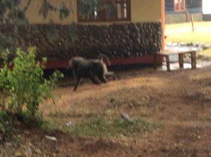
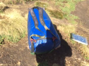
Baboon at the Mt Kenya trailhead.Bike bag made into a backpack. I salvaged the shoulder straps clear back in Ecuador (off a pack thrown away at the side of the road) with the intention of attaching them to the blue bag. They’ve been in the bottom of a pannier since, but I finally got around to it. They weren’t very comfortable but did the job.
So, I found a campground in the nearby tourist town of Nanyuki where I could stay and then leave the bike. A taxi took me to the trailhead. Once there I was dismayed to find a park fee of $50 a day and, though guides aren’t required in general, you must have a guide if you’re solo. A guide costs $30 a day and then there is a onetime camping fee of $20. My taxi driver was, of course, right there to line me up with a guide service and took me to the office of one back in town. Being all packed up for four days of hiking and just that close to actually doing it, I let them talk me into a hikeup of Lenana for grand total of $380. A technical climb of Bation would be $700 but they said if I felt like “3rd classing it” when I got up there I could, and the “hiking guide” would just wait for me. It’s all pretty subjective and I think the most important thing is that they get your money, although $30 a day for a guide is ridiculously cheap. The $50 and $30 fees should probably be swapped.
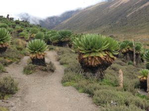
Giant grounsels endemic to Mt. Kenya’s alpine.Nelion and Bation are the massif to the right and Lenana is to the left off the picture.
I still can’t decide if it was worth it or not. To make a long story short, I hiked through rainy weather to a base camp (Camp Shipton), ditched my somewhat obnoxious guide on the day of the climb, and hiked to the top of a snow dusted Lenana. The next day I hiked out. Saw lots of new birds, Zebras and Cape Buffalo lower down as well as incredible flora in the alpine. The pictures say it all.
High on Mt Kenya.Nelion from Lenana. Bation is directly behind.Nearing Lenana’s summit.Crowded summit. Not sure “soloing” is really possible.Mt Kenya has many faces and buttresses with solid looking rock that I would assume have routes on them.Nice camp high up. The official camp was essentially squalid and I camped well away, somewhat to the chagrin of my guide.Summit from the approach.
Mt Kenya was a fair amount of work, but it was a nice break from cycling. It felt good to get back on the bike. The next miles went through small towns populated with Meru speakers. These folks are friendly, have more of a Westernized economy (for better or worse) and English speakers are common. I stopped to buy tomatoes that were being sold from the trunk of a car and ended up camping at the house of the seller, Josephat. He and his family were hospitable and brought out chai tea to drink in the evening. We talked well into the night about anything and everything. Many Africans, these folks included, are aware of advances in the world of genetics and have at least a glimmer of understanding (as much as me, anyway) regarding recent discoveries in the world of mitochondrial DNA, i.e., we all come from Africa and, more specifically, all trans African humanity has a common African “grand mother” that dates to a short 80,000-100,000 years ago. White skin is a recent developement that amounts to infinitesimally small differences in the human genome. It was gratifying to talk about this stuff with native Africans.
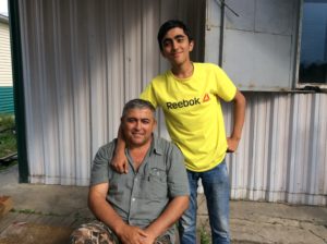
Carolina, Doreen and Lucy are Meru. They had a small store and cafe that served great food. They loaded me up with desserts and bottles of juice, all free gratis, as I was leaving. Lucy wants me to come back and climb Kenya with her.Josephat (and Check) helping me pitch the tent.Check.This is Josephat’s neighbor, Pauline, making gravel fill for house foundations that she sells to local builders. She collects liftable rocks in the surrounding hills and breaks them into grapefruit sizes (behind her to the right) with a sledge hammer. Then she shatters them again into course gravel with a hammer. The rocks she’s pounding in the picture are contained in a hoop of steel bound by a strip of rubber tire and tie wire. It’s held over a suitable flat rock used as an anvil. I spent an hour breaking rocks just to try and imagine what it must be like. The hammer head is loosely attached to a homemade handle. She said it took about three weeks to make the two stacks visible in the picture. After the hour or so of hammering I could notice no disernabe increase.Pauline, Linety (Josephat’s wife), and J near their house. They have no electricity and cook with charcoal. His kids, boys and girls, go to school.First encounter with camel herders. I would see thousands of camels in the next few hundred miles.Saw several of these signs starting in Tanzania and through Ethiopia. A fair amount of aid comes from China as well.There is a great deal of African culture, found particularly with nomadic herders, that treat women and girls in ways Western culture regards as criminal. Fathers “sell” daughters for a bride’s price as early as 10 years of age and female circumcision, better described as female genital mutilation (FGM), in all its hideous forms, is commonly practiced in some areas. NGOs from many places around the world are trying to effect change.After leaving Meru speaking areas near Mt Kenya, the topography tilts downward into desert climate. During the rainy season, which is when I was there, it’s really a beautiful place.
The rainy season replenishes water holes like these. They have a variety of ways to enhance water retention including rubber liners in depressions and concrete barriers dug into stream beds to create water saturated sand. This year rainfall was above average. Droughts can really be tough.
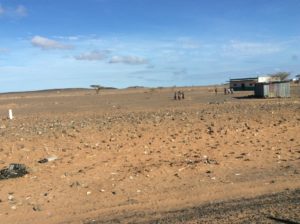
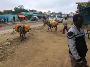
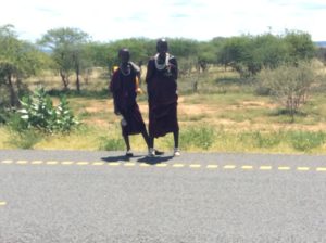
At the town of Isiola you leave Meru speakers and enter the domain of semi-nomadic pastoralists. The culture is similar to the Maasai and many come from the same basic language group, Nilotic, but are comprised of many different tribes including Samburu, Turkanas, Rendille, Gabbra, Somali, Bomba, Kikuyu, Luo to name a few. As I got close to some of the camps a guy in a Land Rover was coming towards me and stopped to talk. I was already leary of such behavior out on these deserted roads, but this guy seemed OK. He was from the pastoral culture and had the characteristic stretched ears but the fact he was driving an automobile means he also had a connection to Western culture- he wasn’t going to mess with me. Sure enough, he told me when I saw these camps and herders along the road side to just keep moving. Sound advice. The first few encounters were just the usual begging but then a few became more aggressive. These weren’t children anymore, more like twenty year olds. On one uphill a guy ran behind me and pulled the bike to a stop and demanded money. I told him no and started to ride off and he pulled the bike to a stop again. I told him NO again and waved him to get back and he let me go. I had a can of bear spray in the front pack but it wasn’t readily available. I would have used it otherwise, but I’m glad I didn’t. With time to think about it, I decided it would just make things worse unless I really feared for my life. As primitive as these guys are, the one 21st century commodity I sometimes see is a cell phone; he would have just called ahead to relatives. (As a foot note, I have this image of these two Maasai herders back in Tanzania decked out in their crimson finery, walking in tandem with a bunch of cows ahead of them. Each had the stick they use as a cattle prod tucked under an arm, then each had one hand holding a cell phone, the other shading the screen so they could see to text. Would have made a great adverisement for iPhone). Anyway, that was the first guy. Then it happened again. This time the bear spray was right there, but this “kid”, dressed in a bright blue shúkà and a good 3 or 4 inches taller than me, let me go the first time. Others waved me to stop, but I was on flatter ground and could go around and then outrun them. That happened several times over the next couple of days.
A long ways from any towns, there was no choice but to camp as evening came on. This actually wasn’t too bad. I’d hit a section where there were no people in sight and get the bike off the road and into the bush unnoticed. Then I’d just hang for a few minutes. If anybody did see me, they’d be right over and I’d march back to the highway. Next, I’d take a short hike around and look for tracks, livestock or human, and any well used paths. You listen for the bells that hang on the cows. Jackasses make a loud bray. If you get a green light on all that, camp. It’s really no different than a camp anywhere, just here, if somebody did find you with all your stuff unloaded and scattered around, you’d be robbed for sure.
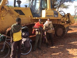
The next day was more of the same. Flat-to-downhill, terrain made outrunning easier, but when there was a chase it always left you unnerved. I came to a small village called Log-Logo, got water at a grocery store and began a long grade to the town of Marsabit. I knew I was going to get harassed on the uphill and after a mile or two came to a military looking installation and pulled in. Two guys in a small pickup truck, David Ndundo and Mathew Geacho, were pulling out and pretty much new what was going on. They loaded the bike into the back of the truck and took me 10 miles to a hotel in Marsabit.
David and Mathew, my rescuers, are technicians testing for asphalt thicknesss on the newly laid highway of northern Kenya.
I spent the night there and the next morning found a van that was going to Moyale, the border town with Ethiopia. It was about a 150 mile ride that passed through many herder communities. I was glad I didn’t try to cycle it.
By comparison of cultures, over the endless expanses of Patagonia, the perspective of an Argentine driving along and seeing a lone bicycle is “how’s this guy surviving out here in the middle of nowhere? I’ll see if he needs help”. For a Chalbi Desert herder in the middle of nowhere it’s more like “how come this guy gets the luxury of a bicycle loaded with more stuff than we’re going to see in a lifetime? Lets check him out a little closer”. From there it becomes a game taking intimidation begging to the limit of outright robbery, a line that I’m sure gets crossed. It gives you some idea what it must have been like for a white man to roam the American west in the 1800s.
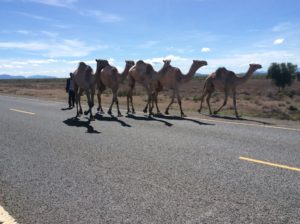
Loading the bike on the van, or matatu, that took me to Moyale, the border with Ethiopia.Encouraging advertisement inside. The driver couldn’t speak a word of English, but he was friendly and safe.Never got a good photo of the portable houses the herders use, but here is a row of them. They’re framed with saplings and branches with roof and wall coverings essentially made from garbage (recycling at its best!), the more plastic the better.Chalbi Desert.Ethiopian immigration.New Ethiopian immigration offices soon to be opened. The 500 miles of road from a Isiola to Moyale was dirt up until the early 2000s when they began paving it. It was completed in 2016. A paved road and consequent traffic increase is all new to much of the pastoral culture.Moyale.
At Moyale I was immediately swarmed with people as I unloaded the bike from the van’s roof. Everybody wanted to do something for me that would get them a tip. I was becoming more and more annoyed as I repacked the bike and one guy finally cleared everybody away. I was thankful till I realized he just wanted me for himself. Once the bike was loaded I could ride away, hopefully with all my gear still intact. Then it was the same drill of getting checked out of one country and into another. The money changers were waiting and I had about a hundred dollars worth to change out. This time I was ready for them. I had ample time in the van to calculate how much Ethiopian birr I should get, and got them in a bidding war, exploiting rivalries. I got a good deal.
Ethiopia began as a shock when driving went back to the right side. It should have been a relief, but it just confused me all the more for a day or so. I had talked to a few people about what to expect cycling highways in rural Ethiopia and all said I’d see lots of excited children, but would be pretty much out of the pastoral culture of northern Kenya. So, I decided to ride the bike again. Camping was about impossible as you go from a comparatively empty desert to crowded foothills and highlands. Hotels, however, were cheap. I lasted three days but was back on a bus at Hagere Mariyam. In part I was skipping a 200 mile stretch of rough dirt road that would be hilly and slow, but I knew as well the kids would be unrelenting. From the border to Hagere, about 200 miles as well, I had rocks thrown at me, one kid hit me with a stick, one karate kicked at the pannier as I went by, many chased and grabbed at anything loose- usually a bag of garbage or a half empty bottle of coke under a bungi. Probably the most disturbing was a little girl no more than three or four years old shaking her fist at me.
Termite mound.These child generals were among the few eager to be photographed. They’re guarding this machine that’s out in the middle of nowhere. For me, it was a good place to lean the bike and take a break. I hope the guns weren’t loaded.Bus ride from Hagere Mariyam. It could have been a lot hotter, but I was borderline uncomfortable in a teeshirt and shorts. This guy’s dressed for an early spring day in Wyoming.
Two busses and one van ride, over two days, got me to Modjo, Ethiopia and a far easier culture to be in. Kids were in school again, adults had work to do. I stayed in one of the nicer hotels of the trip in Modjo for about $20. From there I cycled the remaining 45 miles to Addis Ababa, Ethiopia’s capitol, where I met with Haile-Kiros Gessesse. Haile is an old friend of one of my friends in the US, Gail Blattenberger, and she hooked me up. Haile took me to dinner that night with a few friends that I soon realized were some of Ethiopia’s more important people. Haile, retired now, was Ethiopia’s Ambassodor to China and held several government positions over his career. He was part of the Ethiopian revolution that, in 1991, overthrew a government, led by Mengistu Haile Mariam, responsible for a genocide over the previous fifteen years that claimed over a half-million lives. The Red Terror, or Qey Shibir was the height of it in the late 1970s. War crippled the country’s agriculture and food shortages, exacerbated by drought, led to famine. The famine made Western news, the famine’s cause, war, not so much. LiveAid, two concurrent rock concerts held in the US and Britain in 1985, raised relief money for the famine. Though over $100 million was made directly and indirectly, it’s debated to this day how much of it went to fuel the civil war. After the overthrow, Mengistu escaped the country and is today living in asylum in Zimbabwe, following a similar path with Chili’s Pinochet.
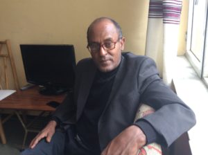
Present at the dinner was Tefera Ghedamu, a journalist and documentary film maker, who also hosts a weekly television show interviewing people from all walks of life with interesting stories to tell. A few days later I was on his show, Meet EBC, which he’s done for over 20 years.
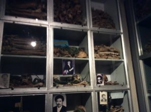
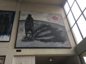
Qey Shibir, or Red Terror, museum. These are bones and belongings of victims disinterred from mass graves after killings in the 1970s. Over a half-million people lost their lives in a genocide that created famine and had power struggles from a brutal military dictatorship, the Derg, as an underlying cause.Museum painting of a mother casting a shadow of her four children that were killed.Tefera Ghedamu.
There were a few errands to do over the days spent in Addis and many miles on the bike running around the city. I was lost about half the time and at one place asked a guy, Tekalng (Tek) Assefa, in a parking lot for instructions. He told me what I needed to know as he looked the bike over and then mentioned he was in a cycling club. He said they were doing a ride the following Sunday and invited me to come. Haile mentioned that I should get in touch with the cycling club, there’s only one that I know of, so this was all serendipity. I took him up on it and came to the coffee shop where everyone met early Sunday. These guys are serious riders and go at a much faster pace than I’m used to, but with the bags off the bike I could at least keep up with most (not all!). It was about a 50 mile day that left me as tired as having ridden a 100 mile day at the regular pace. I had a great time though and Tek paid for breakfast and a lunch he wasn’t even able to stay around for.
Ethiopian Cycling Club. I didn’t get everybody’s name but Gene and Jose are in the center, Feshaye in the green shoes and Tek on the right.Gene, Jose, Tek and Feshaye.
I met Gene Lin on the ride and he invited me to stay at his place the last night in Addis. Gene is from Vail, Colorado and is a consultant to the Ethiopian government working on upgrading electric infrastructure. Gene was a great host, fantastic guitarist and wouldn’t let me pay for anything. He took me to a wedding reception at the home of Norway’s Ambassodor to Ethiopia, providing me with appropriate attire. During the reception the Ambassador gave a speech that ended with the fact that we all come from Africa and have a very recent common ancestry. I was impressed.
Mekdes was a very sweet lady working the front desk at the Yeka Hotel.Oleg Malkov is a Russian astronomer and was staying at the hotel in Addis. Over several morning’s breakfast we talked about everything from Trump & Putin to astrophysics which he lives, eats and sleeps.Gene’s an accomplished blues/rock guitarist and has a band in Addis. It was great to listen to and play a guitar after a year’s hiatus.From hobo to yuppie.
From Addis Ababa I had intended to carry on to Eritrea, cross the Red Sea to Yemen and on to Oman. On the grand map of the Eastern Hemispere, Yemen and Oman are the “Pythagorean cutoff” from Africa to Asia. The objective from northern Africa is to get to Asia without going through Iran, where I wouldn’t be admitted anyway. If I got to Oman I could take a boat or fly from Muscat across to India. Nobody I talked to had much to recommend in Eritrea, a heavily industrialized place known as a refueling stop for a steady stream of ships going to and from the Suez Canal. Yemen is in the midst of a civil war and would be hard to get into. Oman, by contrast, is safe and has a thriving economy. Oman was first recommended to me by my friend Daniel Steuri back in Patagonia. Addis has regular flights to Dubai in The United Arab Emirates (UAE), which borders Oman, so I booked a flight to there, with the intention of cycling Oman’s northern coast to Muscat, the capitol. The only downside is the season- HOT.
Reassembling the bike in the Dubai airport and jumping back into the life of a hobo.Mariam Alfalasi is a lab tech doing medical research. She got me through a somewhat complicated grocery store in Dubai.After a sleepless night in the Dubai airport, I took an afternoon nap in the shade of about the only tree for miles. I woke up to these camels around me when one nudged my leg.United Arab Emirates, not far from Dubai. It’s over 100°F.Oman gets virtually all it’s water by mining “fossil water”, a non renewable resource. I was surprised to see an abundance of green lawns and watering on 110°F afternoons.Muscat, Oman and a very different culture. Modern, fundamentalist, very safe.The Gulf of Oman.
The ride through Oman has been good overall. People are friendly and I can leave the bike unattended about anywhere. For the first time since leaving the US, I’m encountering large grocery stores without armed guards covering the entrances. Some places in Argentina had things dwindled to a guy in a uniform and no visible firearm, but about anywhere else you were greeted with sawed off shotguns and AK-47s. Of course, these same guys were also watching the bike so I couldn’t complain. (Ethiopia is the one place where a security guard and an accomplice at a restaurant tried to steal the bike’s front pack- another story).
The heat is intense here and walking out of an airconditioned restaurant into it will part your hair. It’s dry heat though and soon you’ll begin to sweat. That’s the key. So long as you’ve got water, and I drink gallons of it a day, it’s down the hatch and out your pores in a coninuous flow to keep clothing soaked; cotton works best. On the bike, you try not to be in a hurry and if movements are kept slow the light breeze you create riding makes it surprisingly tolerable. Days have been over 110°F and nights get down to about 95°F.
It took five days to get to Muscat and I was able to camp throughout on some incredible but desolate desert. A terrible beauty. At the moment I’m jumping through hoops trying to get a visa to India and I’ve been nearly a week waiting on it. Hotels are expensive here so I’ll be glad to get going again. There are no alcohol sales in Oman (except at the airport) so I’ve involuntarily saved money in that regard. It’s too hot for wine but a cold beer would sure be nice.
Once in India, I’m not sure what’s going to happen. Not too much interest for folks making the ride over Tibet, and the price just keeps going up. The Nepali-Sino border has been closed from a 2015 earthquake but was supposed to reopen this year. Now land slides will keep it closed till at least next year, meaning one would have to fly to Lhasa and then begin the overland trip. I’m looking at the moment at Pakistan again and possibly taking the Karakoram Highway which would lead to circumventing Tibet’s west side and then on to Mongolia by a different route. On the upside, I’ve got the whole season to get to Ulaanbaatar, which from India is far less distance than that covered last summer in South America. The unknowns, however, are far greater. Visas are getting harder, borders uncertain. I was hoping to winter in Ulaanbaatar and then start on Siberia as soon as melting snows would allow travel in the spring of 2018. Latin America, from Mexico on, is for the most part friendly but I know now that the rest of the world doesn’t necessarily follow suit. Till next time.
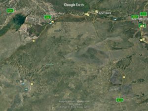
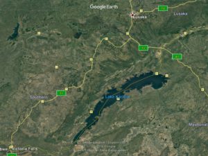
From Lusaka I traveled NE to the border w/ Tanzania between Lakes Tanganyika and Malawi and then on to Dodoma via Iringa.From Dodoma, north to Arusha and Nairobi.uyg
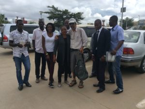
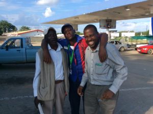
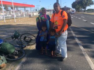
Getting away from Lusaka was a challenge. The morning I was to leave, Luis set me up with his video camera that he mounted on the handlebars to get footage riding from his place to a café near downtown where he bought me breakfast. A bike cam is something I should have probably had all along to catalogue some of the riding, and I may buy one yet if I’m ever in one pace long enough to shop for one. At the café the loaded bike soon attracted a crowd in the parking lot with every one wanting to know details. One lady, Brenda, gave me a 50 kwacha donation (about $5) and soon she and her daughter and a couple of other folks were all being treated to breakfast by Luis at the café.
Luis and his taxi driver, Victor.Didn’t get everybody’s name but Brenda and her daughter Niza are on my right.
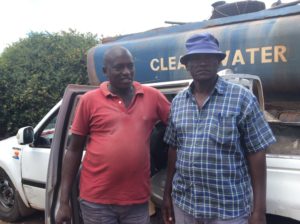
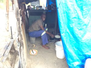
As we talked in the café- in an English I would struggle to understand even if my hearing were 100 percent- we learned that Brenda was running a school for underprivileged children at her house in Chilanga, a town 10 miles south of Lusaka. She mentioned also some horrible murders going on in her neighborhood where two children were killed and then internal organs removed in a sort of witchcraft sorcery. Things aren’t what they seem in otherwise happy and peaceful Lusaka. After we had talked I decided to go and take a look at what she was doing with the intent I could pass the info on to people that might be able to help her financially.
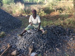
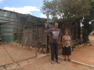
She and her family are farely well to do as far as Zambians go, her husband being an electrical engineer spending most of his time in South Africa. They own about three acres of land where they’re building three more rental houses on their property. Short on funds, the building came to a stop, but she now wants to use at least one of the houses for the school. She said that since the murders, children from more or less good family situations are now staying home because it’s safer; children from not so good family situations are coming to her place for the same reason- safety. Lack of education and illiteracy are high in Zambia. There is a pubic school system but it is not necessarily well attended. I don’t have demographic details but it would be interesting to know.
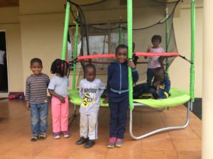
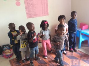
Kids at Brenda’s school.
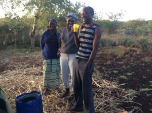
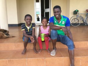
Brenda’s children Jeremiah, Monda and brother-in-law Evans.
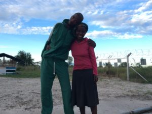
I ended up staying the night with Brenda, Niza and their family and was again treated like royalty. They walked with me the next morning a kilometer to the main highway and we had a long goodby in company with several neighbors.
North of Lusaka the main highway continues to copper belt areas and on to Democratic Republic of Congo (DRC). Due to revenues from extractive industries things are fairly modern along this route and most ammenities can be found. I turned off of it however a hundred miles to the north of Lusaka and travelled into Zambia’s more remote northestern district which is much poorer. The modern grocery stores of Lusaka became shops selling grains and a few can goods. Coke and Pepsi although are found throughout. Fruits and veggies could still be found at roadside stands and through it all I was able to eat OK, just no Reggianno cheese or red wine with pasta. On the positive side, things were very cheap and I was getting by on a couple of dollars a day. Camping was relatively easy.
One rainy day I had the bike bags well bundled up, but jettisoned the raincoat, stored the wallet, and in shorts and Tevas just got wet. But it wasn’t that warm and I spent an afternoon borderline shivering. A couple of days later I had the flu. I rode for two more days to Mpika and actually found a good hotel and after a day resting felt like I was improving enough to start on a two hundred mile stretch to Isoka. Then it really hit me. I was in about the seventh day of riding sick when I found a clinic in the small villiage of Matumbo. I was wondering if I had Malaria but the nurse there, Peter, tested for it and it came up negative. The symptoms seemed more bacterial than viral and I decided to chance antibiotics which Peter gave me along with more Malaria test kits, pain relievers and antihistamines. I gave him about half the cash I had on hand which amounted to about $10. The antibiotic did the trick and I was feeling better after a couple of days. Having to keep riding through it all was tough.
Peter, the nurse at Matumbo.
At the clinic “office” they had charts on a wall that kept track of individual patients and it was telling to see the amount of Malaria and HIV patients. Both are a major problem in Central Africa.
Billboards in Zambia that would be politically incorrect in the Western world. The US probably uses more chemicals than anyone on the planet but the less said the better.
I met Toto in Mpika. He lives in Nairobi but was cycling to Lusaka to see family.
More friends in Zambia.De-anting potato chips.
Northern Zambia is very poor and there are children everywhere. They line the roads, some going to and from school, others just hanging out. Teenaged mothers are routinely seen carrying infants. The kids can be a problem and constantly beg. They will start out with how are you or good morning (at any time of the day) and then say money or give me money or give me my money and I even heard give me back my money a couple of times. I could go for weeks without seeing a white person, so for them to see a white apparition on a bicycle ride by is cause for great excitement. If I was on flat terrain and had good speed I could say hi back or just ingnore them and keep going, all the while hearing how are you, I’m fine and money till I was out of earshot. If I was going up hill, though, they would run along side and be grabbing at the bike along with the heckling. It gave one visions of Gulliver’s Travels.
Children along a stretch of road in Zambia.Extensive conifer tree planting near Mafinga, TZ. Judging from tree rings, they were planted shortly after WWII. I saw two species that I later learned are Pinus radiata from the California coast near Monterrey and P. patula from highlands of Mexico. The stands are visible on Google Earth and appear to be over 30 square miles in size. This stand is being logged.Chameleon.
Could be Yellowstone. Elevation is about 6,000 feet. Nice to camp in pines for a night.
Colobus monkeys in pine trees.
I got to the border with Tanzania and crossed fairly easily but got my first dose of Tanzanian begging and money extortion. It leaves Zambia in the dust. Any border will be replete with money changers that are all over you to exchange currency. I try to spend as much of one country’s cash as I can before getting to a border because your not going to get a good exchange rate in the first place and they’re going to short change you in the second place. If it’s just a few dollars I don’t worry about it and accept the forfeiture. At the Tanzanian border I had maybe $40 in Kwacha but knew there would be visa fees to spend it on. Immigration first said it was $50 but it had to be in greenbacks. There was a place a few doors down that would dispence dollars, but in going there I was being hounded by a smartly dressed guy in white shoes that wanted me to do the exchange with him. I told him any left over kwats would go to him. Since I didn’t have $50 in Zambian Kwacha I had to get an ATM and then swap for a crisp new US $50 at the exchange office. When I got back to immigration, the officer said he hadn’t noticed I was American and said it would be another $50. Then, in the same breath added that I could still do it for the original $50 but it would only be good for 14 days and said it would be tough to make Kenya that quickly on the bicycle. He added it was good for one year and multiple entries and mentioned other added bonuses I was by that time not paying attention to. It was like buying a phone plan. I figured better safe than sorry and headed back to the exchange office. Of course, my white-shoed friend was waiting with a $50 in his hand. What ever. I still had Kwachas to get rid of so we did the deal. I got the magic STAMP and was on my way. But then Mr White Shoes says as I’m walking out the door that he had miscalculated and needed another 10,000 Shillings (a few dollars) and I gave it to him. But I made the mistake of letting him see the juicy stack of shillings still in my wallet and with hardly a studder he said he needed still more. At this point we went back in the immigration office and I got out a pen and on the back of a blank visa form started to hand calculate what the exchange should be. He distracted me the whole time, saying things like he could do all this easily on his calculator, but I made him wait and said the more he talked the longer this was going to take. Once satisfied he’d already gotten a good deal, I told him I wasn’t paying anything more. Then he said he would go to the police. At that I said, yes, lets go to the police. It wasn’t hard to find a policeman, and though the officer said he didn’t know exchange rates, he took the original stack of bills I gave to White Shoes, put it in my hand and said to go to the exchange office and have it valued. When I got to the exchange I told the guy to just give me another $50 back, which he did along with about $10 in shillings! I walked back out to White Shoes and gave him back his $50, pocketed the $10, and left him still insisting I ripped him off as I rode away. Welcome to Tanzania.
The border of Tanzania also marked the one year point for having been on the road. The odometer was a little over 16,000 miles and I figured I was on the bike for about 300 of the days. So, I’ve averaged about 55 miles a day when riding.
Baobab tree.Newt.Great camp in a secluded spot but I got hit with a drenching rain.
I had a chance encounter in Botswana with a guy, Andrew Marx, who saw me fixing a flat on a deserted stretch while he was enroute to Pretoria. He stopped and offered to fill the tire with an electric pump which I took him up on. I mentioned some of my tire and tube woes and inquired as to what I’d find in that regard in Zambia and Tanzania. The answer was “not much”. He’s an Africaaner and working with a British mining company in Mbeya, Tanzania, a town not too far from the border with Zambia. He said he’d be returning to Mbeya (with his wife and a new baby) in a few weeks and could get tires and tubes in Pretoria which I could pick up on the way through. He didn’t ask for money but we exchanged email addresses and he drove off. I had been having trouble with tubes on the rear tire that were splitting on the inside seam and was increasingly convinced it was a combination of cheap tubes and using thinner 23c tubes on the fatter 28c tires. But the problem had been getting progressively worse and now a tube was bursting every couple of days. The rim strip, which in this case was just duck tape, looked OK, so I couldn’t imagine that being the cause. I finally made a new rim strip out of an old tube (I have many of them) and that fixed the problem. Still not sure what the actual cause was. It began happening clear back in Peru with the flats steadily increasing in frequency ever since.
I must have seen a dozen truck rollovers in Zambia. I noticed after a while that the drivers tended to be quite young, even kids. They were also the most aggressive towards bicycles. Kenya’s been much better in that regard.
In Lusaka, I bought a less than desirable tire and a couple of tubes with thicker “schrader” valves for which I had to file out the hole in the rim (meant for a “presta” tube) to fit the valve. I had pretty much forgotten about Andrew and then I got an email as I neared Mbeya that he had the tires complete with 28c tubes. He recommended a hotel there and we met up a few days later. I had a great evening at the hotel’s plein aire restaurant with six or eight of his English speaking friends also working jobs in Tanzania. I spent a couple of hours talking to a guy from Chicago who is collecting epidemiology data for the US Gov’t. First person from home I’ve seen in a while (although Chicago’s is of course a bit of a foreign country).
Added to the splitting tube fiascos have been patch kits that work poorly at best and require a sort of alchemy to get to work at all. I might bore you with all the techniques, combinations, frustrations and failures at some point when I have more time. I long for Rema Tiptop kits which I should have filled a pannier with before leaving the US. I’ll be looking for patch kits here in Nairobi before I leave.
Iringa. The photo is of shops and people of course, but what I’m really interested in are the granite outcrops in the background that go for miles. If the bolters ever got to this place, Tanzania could have sport clmbing as one more source of tourism.
Tanzania has been a tough country to ride through. There were some good miles after Mbeya getting to Iringa and then to Dodoma, the twin capitol with Dar es Salaam, but after that you get into Maasai territory where the children are even more aggressive beggars and often throw rocks when they don’t get their way. I haven’t been hit directly yet, but they hit the pannier once with a plum-sized rock that was thrown from atop a road cut where it gathered enough speed to have done some damage had it hit me. The Maasai are traditionally cattle herders and dress in colorful frocks called shúkàs. They set the world standard for ear piercing and stretching. They’re fiercely traditional, paternalistic and resistant to changes the modern world is bringing to their culture. They’re maintaining traditions of nomadic herding, but their populations are also increasing, helped in part by the same modern world benefits they’re fighting to reject. With the greater numbers comes more cows and with that an over-grazed range that it’s a wonder a cow can even surive on. The cows are all skin and bone.
Alpher took me around Dodoma to bike shops and grocery stores for an hour. It would have been a half-day’s work done on my own. I bought tubes at a bike shop for about $1.50, very cheap, but the valves leaked from the beginning and I ended up throwing them away.First encounters with Maasai. They don’t like to be photographed, but I took these from a distance with telephoto.
Tanzania was a colony of sorts for the Germans beginning in the late 1800s but was lost to the British after WWI. It was governed as Tanganyika on the mainland and Zanzibar on the island archipelago. Independence was gained from the British in 1961 and thence renamed Tanzania, a combination of the two disricts. You hear two pronunciations depending on who your talking to, Tan-zan-‘ia or Tan-‘zan-ia.
After independence it was voted to make a unifying language of the 104 recognized languages the country embraces (Zambia has 72). Swahili was already lingua franca for the African Great Lakes region and had become a coagulation several languages in itself, having Bantu origins but through trade had picked up other African languages as well as Arabic and Latin (meza is Swahili for table). It’s taught in the primary schools so children that go to school will be bilingual in their native tongue and Swahili. Swahili is spoken in courts of law and gov’t. The bottom line for me in all this is that few people speak English in Tanzania.
I fought my way to Arusha, which is the gateway to both the Serengeti and Mt Kilimanjaro. Things became more touristy, I began seeing white people again, and amenities like grocery stores and Wi-Fi became available. I spent a night in a hotel in Arusha and then made my way north to the border with Kenya, two days ride away.
Camping was difficult enough among the Maasai here that I went to a hotel in Longido where they had a place to pitch the tent for $10 a night, breakfast included. I met there Penny and Melanie who are doing NGO work with rural Tanzanians and focused on women’s health issues. Penny is an MD from the UK and Melanie, her daughter-in-law, was born in Kenya but lives in Vermont with her husband (a wild life photographer and film maker) and two children. It was wonderful to communicate with English speakers. The hotel itself (Hotel Tembo) has NGO funding and is set up with solar electric panels, solar hot water heaters and rooftop rainwater collection. The property is a sort of pilot project that engineering students are participating in. There was a paper in a loose leaf binder in the hotel commons that was set in an academic tone, and described work being done there. It was fascinating to see measures to conserve water in this region with its long dry seasons. The project, Buckets to Rain Barrels is funded by Canadians. More info can be found here.
Penny and Melanie are traveling to remote villiages to provide information on prenatal care and women’s health issues. They’ve been doing this for eight years but just this year they’re walking on the eggshell terrain of subjects like planned parenthood. The culture they’re working with is steeped in a tradition where fathers receive money (cattle) from suitors when the daughter marries. The father is always eager to attain such wealth and daughters are often betrothed at 9 or 10 years old and married by their early teens. This, of course, interferes with education not to mention subjecting a girl to a life of virtual slavery. Suitors often already have wives, and a younger girl entering into such a family is often abused by wives jealous of the attentions the new wife might be getting. Education often opens the eyes of young girls subjected to this culture, and though polygamy is legal, keeping a girl from going to school that wants to do so is illegal. It’s likely these rights are not much talked about in the paternalistic society. It’s easy to imagine such misogynous fathers and husbands a few short years ago throwing rocks at passing bicyclists.
I decided to spend an extra day there and learn more. Melanie suggested a hike up the adjacent mountain the town of Longido lies next to called, not surprisingly, Mt Longido. Caroline, the hotel manager, said I couldn’t go there alone and had to have a guide. She was instantly on the phone that morning during breakfast. The guide, Juma, came by a few minutes later and said the fee was $50. I offered $20 and we agreed on $25. I had a great day. Like my friend Walter from all the way back in Costa Rica, Juma had some training in natural sciences, binomial taxonomy, and was very good with bird ID. I got my money’s worth. The hike was wonderful. Juma was something of a climber, having guided Kilimanjaro, and we did some easy 5th class scrambling to get to the summit. (I should mention as well that he said just this year they completed a mountain bike trail to the top of Kilimanjaro’s 19,300 foot summit!). Cape buffalo and elephants graze easier slopes on the far side of Mt Longido and we saw buffalo scat in rocky terrain near the summit. When we got down I gave him a tip and took him to lunch.
Euphorbia candelabra on the hike with Juma
Astragalus?
Juma near summit. “L” for Longido.SummitLena……..….and Ian are a german couple that made the hike as well.Penny (right) and Melanie at Hotel Tembo. Tembo means “peace”.
The work being done at the hotel had some maintenance problems, the worst of which was the roof gutters that caught the rain water. I agreed to stay an extra day and work on them. The building is an octagon shape and the gutter joints are at an odd angle. The game is to use only local materials that can be readily available to the inhabitants, so 4″ PVC pipe was spit in two for the gutters and attached with a manufactured hanger evidently sold in their small hardware shops. I found a pair of tin snips at the hotel and tried to fashion angled joints out of some metal roofing that was laying around. I bought a tube of silicone and a caulking gun at the towns hardware store. I improved things, but the system really needs a re-think. I was able to observe it in a hard rain and saw that about 70 percent of the water was shooting over the top of gutter and onto the ground. The system works well enough in the wet season but they haven’t the cistern capacity to take them very far into the dry season even if the catchment were improved. I wouldn’t call the project ill concieved, but it needs budget to work out the kinks that go with R & D.
Gutters at Tembo.Solar hot water heaters to the left, water storage to the right.
I left Tembo the following morning and crossed into Kenya by about noon. Lots of hoops to jump through with visas and money. A $50 greenback with a defect in it sent me to the back of the line. I got some comic relief when the customs folks wanted documentation on the bicycle make and model. I pointed out first the name on my passport, then the decal on the bike’s downtube. Then the SW on on the head tube, then the SW under the bottom bracket. The coup de grace was the Steve & Walker cut into the opposing tangs on the inside of the forks. I convinced them! They wanted then to know more about the trip and the one official, Emmanuel, has even left a comment in the blog. These are all firsts.
A later encounter with a Maasai youth and his little brother at a petrol convenience store was a little tense. He came up to me demanding money with the little brother standing there grabbing at the bike. I told them both to back off. He was almost as tall as me and I would have had my hands full if it came to a fight. He wouldn’t stand down and soon we’re faced off nose-to-nose and, almost shouting, I told him to get the hell away from the bike. He finally backed down and they both disappeared.
Then there was one more money encounter that ended unfavoraby this time. I had had lunch at place with a really nice guy that served good food at a fair price. I paid using the new Kenyan shillings. It’s always a challenge adjusting to new currency, but I did it OK and felt good about the conversion from Tanzanian shillings. Later I bought a litre of water but when told the price my brain reverted to Tanzanian shillings and I was thinking 600 T. shillings when it was only 60 K. shillings. When I payed with a 1000 K. shilling note this kid saw it right off. He nonchalantly gave me 400 change and, bingo, I just payed about $6 for a litre of water. I realized the mistake as I walked out the door but didn’t do anything about it. Win some, loose some.
Easy miles then took me to a camp in the bush. I was more careful selecting a camp site than I’ve been in a while. I “egressed” the highway with no cars or people in sight and quickly got a secluded spot. Goat’s heads have been ubiquitous since entering Tanzania so the bike has to be carried any time you leave the highway. Not an easy task.
Goat’s heads collected carrying the bike to a camp.
So, now I’m in Nairobi and will go to the Ethiopian Embassy tomorrow for visa stuff and continue the never ending quest for bike shops. It appears the road north to Ethiopia is now mostly paved, but it wasn’t just a few years ago. It was slated to be completed in 2016 but time will tell if it’s true. I may spend some time on Mt. Kenya if weather cooperates. Addis Ababa in Ethiopia is maybe two weeks away if I rode straight through.
The route went from Pretoria to Gabarone, Botswana and north to Palapye.Then to Francistown and WNW to Nata near the top of the map.From Nata, remote Highway 33 travels north…..…..to Kazungula and Livingstone.Then north again to Lusaka.
My stay at Pretoria was at a hostel / hotel dedicated to providing economic quarters for out of town people attending to family being treated in a nearby hospital, the same where I got the Malaria prescription. The pharmacy folks actually clued me in on the place. After I sunk $500+ for the meds I guess they figured I deserved a break. Mostly older folks stay there, a few permanent residents, and the facility, Four Flowers Foundation, was a great place to rest for a couple of days- quiet and clean. I was there for three nights and the manager and his wife, Vivian and Nora Morris, made my stay pleasant. Vivian spent part of his career collecting gemstones and crystals that he took around to rock shows in southern Africa. He was what we’d call a rockhound and had a few samples of tiger eye and other gems kicking around the grounds. People there were friendly and talkative and it was entertaining to hear what the Afrikaaner retirees had done for a living.
Vivian Morris from Four Flowers Foundation.Nora Morris cooking us breakfast.A gemstone having to do with garnets- he had more info than I could absorb.
Visits to embassies were mostly unencouraging as in general an embassy will only issue a visa to a person from the country where the embsssy is located, in this case, South Africa. Makes sense, but it’s all new to me. One piece of good news, Kenya said, contrary to the country’s website, that I could get a visa at point of entry. Who knows. Ethiopia said to apply at Nairobi, Kenya. Russia said my plans for Siberia were possible but there was nothing they could do then and there. Didn’t make it to China’s embassy. I went to the U.S. Embassy for possible advice but, without an appointment, didn’t get far; two security guys came out in the parking lot and like robots that were neither friendly nor unfriendly told me to contact an American Civil Services office either in Johannesburg or Gaborone, Botswana. Their advice then culminated in suggesting I always lock my bike when not attending it and not to ride through downtown Pretoria.
On the way to the border with Botswana, I took a short detour to an archeological site called the Maropeng Crucible of Humankind. A UNESCO World Heritage Site, there are Hominid fossils dating back 3 million years in a network of limestone caves covering about 500 square kilometers. See https://en.m.wikipedia.org/wiki/Cradle_of_Humankind. Work there is ongoing with significant discoveries in just the last few years.
Somewhere near there I discovered in my pants pocket keys to my room and entrance gates at the Four Flowers Foundation- I had forgotten to turn them over to Vivian. I sent him an email requesting an address to which I could send them and then found a PostNet (the South African equivelant to FedEx) in Rustenburg, the next sizable town. After I gave the PostNet folks the sad story, they gave me a very good deal on overnight delivery and were in general fun to be around.
Leigh Ann, Chris (manager), Chere and Charissa from PostNet.Camp at a church yard near the border with Botswana.Fires Van Vuuren, the caretaker at the church………and his 25 year old dog accompanied by tormenting chihuahuas.
I took a less traveled route to the border with Botswana where things were pretty well deserted. There were no lines at immigration and the lady who stamps the passports was behind the counter sitting and waiting. It should have been simple from there but somehow she didn’t like the idea of me riding a bike through Botswana alone and had to keep going to her boss with questions. Unlike any border I’ve ever been through, she invited me to come through a door to her side of the counter and sit while negotiations were made. They even took a look at my website. I finally convinced them it would be OK and the boss gave a nod. Back around to the other side I watched as she held the stamp over passport but then asked me just one more question. I wanted to reach through and slam the hovering hand to the page. I’m not even sure what she asked but I nodded and, finally, STAMP.
I rode tailwind into Gabarone, found a hotel, then went to the American Civil Services office which, in Gabarone, is at the Embassy. The ACS was only open Monday and Thursday mornings and it was then noon, Monday- they were closed. So, I gave up on talking with the consulate, slept the night at the hotel (& casino!) and started north the next morning.
Cape cobra that had been killed by villagers at Debete, Botswana. Poisonous snakes are pretty much killed onsite in Africa.Jimson Chengeta stopped to talk in Palapye, Botswana. Retired now, he was educated in wildlife management in the UK.Nthophi Ramotsoko, right, studied ground water engineering in Edmonton, Alberta and now works for the gov’t in Palapye. He’s also involved with Amway and, as you might guess, was trying to interest me.Blue highway short cut that actually worked.Chameleon crossing the highway.
Botswana is a country about three times the area of the state of Utah but only 2/3 the people. Most of the population is located on the east side, between Gabarone and Francistown. Elsewhere are vast expanses of wild Africa, a sample of which I got when leaving Francistown but especially after turning north from Nata, Botswana. Getting to Francistown was flat, fast and uneventful. A left turn and good tail wind then took me to Nata. Had one 112 mile day on that stretch. From Nata the route went north over a little traveled highway to the Zambian border at Kazungula. No fences for this stretch and much wildlife. There are many elephants which made for some exciting travel and you had to keep a constant lookout for them. The terrain is “bushveld” where trees and shrubs are just high enough to hide the giant beasts, and they had a habit of appearing out of nowhere. I figured a hundred or so feet seemed ample distance from the highway to pass by one and did so for a couple of bulls. Then I had one turn towards me when I was adjacent with him. He lowered his head, stuck his ears straight out and took a couple of bluff charge steps towards me- it put my heart in my throat. There after, the hundred feet became more like a hundred yards. When I would see one that was too close I’d wait for a car, sometimes 15 or 20 minutes, and wave him down to escort me through, riding the bike along side the vehicle. The elephants are habituated to the cars and trucks but the bikes, being a bit more animate, get their attention. They are sensitive to eye contact and if you are going to pass close, it’s best to just look straight ahead and ride; easier said than done. I watched one bull from maybe two hundred yards out while waiting for a car. He was facing me and glancing my way as if to say “what are you lookin’ at?”
Hard to see, but there’s an elephant crossing the road in the distance.Elephant dung was a common sight for about a hundred miles.
Along with elephants there were much less threatening giraffes, zebras, impalas, tiny deer that I think were reeboks. One warthog! They say there are lions and cape buffalo as well but I never saw them. Camping could be nerve wracking, and I always pitched the tent near a climbable tree. I have a can of bear spray that has survived now multiple airline flights and about 16 border crossings. Might dissuade a lion, but little else. I keep stove gasoline and a lighter close by as a last resort.
Enormous termite mound.
I was able to camp a couple of nights at microwave towers. They have fenced enclosures and two security people that man them day and night. The two I stayed at had people more than glad for company and a break in a routine that must be pretty boring. They would offer food and heat water for nightly showers, all done on wood fires. Virtually everyone in Botswana speaks some English, so we could communicate pretty well.
View from the first microwave tower which my hosts were surprisingly game to have me climb.Wanani and Cuatro at the first tower.
Elephant track.Garden spider at the tower. It’s abdomin is a good 3 inches.Moagi at the second tower.Joseph and Moagi.
Botswana was a British protectorate until the mid 60s and English influence is still prevalent. Zambia and Zimbabwe were Crown Colonies then as well, but as North and South Rhodesia. Together with Swaziland and country-locked Lesotho, they all gained independence in the 60s. Zambia declared its independence at the closing ceremony for the 1964 Summer Olympics in Japan making them the only country to enter the games as one country and leave as another.
After getting to the border with Zambia, you cross the Zambezi River fifty or so miles upstream from Victoria Falls. Transportation is by ferry, but it will only carry two semi trucks at a time. Trucks were lined up for miles on each side, the wait being as much as two weeks. They’re currently building a bridge and I’m sure there will be great relief to get it finished. No wait for peds and bikes.
ZebrasNear the border with Zambia you emerge from wild bush into an ocean of corn fields that went for miles.
Baobab tree.Marcu Bogdan from Romania at the Botswana-Zambia border. He’s crossing Africa north-south having started in Egypt.
At the ferry a guy, Levy, came to me, struck up a conversation and invited me to stay at his house. It being late in the day, I took him up on the offer. He made me dinner over a charcoal fire and cooked Nshima (ground corn not very different from polenta) tomatoes, onions and hard boiled eggs that he then fried in oil. Very good. The next day he rode 50 miles with me to Livingstone, the tourist town near Victoria Falls. We managed to kill most of the day doing that but he had a place for us to stay there. He is involved with the Baptist Church and we stayed at his pastor’s compound. The pastor, a Filipino, invited us for dinner, over the course of which he waisted no time in trying to convert me. A younger man than me, he insisted it was never too late for salvation, even for a guy my age. I endured the evening but was glad to get going early the next morning.
Bridge over Zambezi River near Victoria Falls.Mist rising just upstream from the falls.
Victoria Falls.
Billboard in Livingston. Very touristy, very commercialized.
Victoria Falls were indeed spectacular and worth seeing. I spent the morning walking mist trails and getting soaked with spray. Once back in Livingstone I got groceries and rode a 30 mile afternoon to a good camp in secluded bush. Several days of mild headwind followed taking me to Lusaka, Zambia’s capitol. Roads for the most part were good, even very good. In South Africa, chip sealing is part of new construction for highways, and they use very course aggregate. I’m guessing that the rough surface offers better traction and less tendency for hydroplaning on roads that can see heavy rains. They were tough to ride a bike on, though, and generated a screaming hiss when a car flew past at 80 mph- it was like spraying a high pressure air nozzle across your ear. Botswana saw a decline in chip sealing and the practice is non-existent in Zambia. The “good” highways in Zambia are smoother, shoulders fair, but when roads are deteriorated they can be a nightmare. The traffic has been much heavier in Zambia, particularly truck traffic, and bad roads could be a free-for-all of traffic weaving in and out of chuckholes, competing for the best lines. There is considerable bicycle traffic in Zambia as well and a palpable disdain for them by the trucks- I get no better treatment than anybody and they’ll honk to get you out of the way and then pass with as tight a clearance as they can get away with, sometimes pushing me onto a dirt shoulder.
A few of the many camps in the bush.
Alanna Dent was in Chomo and is a volunteer for the Peace Core. Over about a half-hour conversation she tripled my knowledge of Zambia.Green Mamba that had been hit on the highway. I’ve now seen the “big 3” of poisonous snakes- mamba, adder & cobra- but have yet to see one live……and hope I don’t.Ants, biting ones this time, devouring a bag of garbage.Truckload of copper ingots coming from Zambia’s copperbelt. Out of curiousity I counted trucks one day and was up to 29 in about 7 hours of riding. Together with how much a truck can carry and the price of copper scrap in the U.S., simple arithmetic suggests a multi-billion dollar a year export. The fluctuating price of copper though has made it a boom-bust industry over the years.
The final leg to Lusaka was through headwind and I was fairly beat when I pulled up to a KFC (they appear to have edged out McDonalds in world wide popularity) to try and get Wi-Fi and locate a hotel. Luis Lopes was watching me park the bike through the window and waved me to come in and share some chicken. The next thing I knew I was staying at his place and being treated like royalty. He’s a builder constructing high-end houses for rentals on a property his brother owns. He fed me many meals over three days while I worked on the blog and did repairs. He wouldn’t let me ride the bike to town and arranged a taxi to take me around to bike shops one day. The houses are beautiful. He builds doors and trim out of African rosewood but then plant trees for replacement. He has one mahogany that’s becoming sizable. He has several avocado, passion fruit and kiwi fruit trees on the property as well.
Luis Lopes.Russian military vehicle that Luis and his brother somehow got a hold of. It was converted into an all-terrain camper and is where he put me up.Beautiful construction on the houses they’re building.
He does a lot of building with African rosewood….….but then is planting replacement trees. The seedling front and second from left is teak.Entrance to the camper where I slept. There are two dents barely visible on the facing cabinet where an elephant had poked a tusk inside on an earlier camping trip.
The stay with Luis has been a good rest and I haven’t been able to spend a dime in three days. I was considering another attempt at contacting the U.S. Embassy in Lusaka but have been so discouraged at previous embassy tries that I was then leaning towards riding on and taking my chances. Luis suggested getting an appointment and got them on the phone. Over the telephone it took some convincing with the front desk person, but he finally gave me an email address to set up an appointment. In the email I gave them some background on what I was doing and got a response right away to come the next afternoon. This time I was given a security pass, invited in and spent a good hour with a somebody fairly high in the food chain. He printed out all kinds of info on upcoming countries and had lots of sound advice but knew well bounderies where he just couldn’t say. Very good, professional treatment this time. Appointments make the difference- Thanks Luis.
Tomorrow I’ll be on the road again headed to Tanzania- maybe 8 days away.
From Cape Town the route followed coastline to Cape Agulhas, the tip of the continent…….….then to George….….then mostly on “blue highways” that roughly parallel the shown main road to Johannesburg and Pretoria.
I finally flew out Ushuaia and landed in Buenos Aires in the middle of the night and found a place to hang in the airport till morning. International airports typically have good “camping” facilities for all the folks waiting on connecting flights. There’s plenty of electrical outlets and Wi-Fi’s readily available. I had a couple of days to spend in B.A. and saw a few sights in the city, then it was off to airport camping again to catch a midnight flight to Cape Town, South Africa that was via Qatar in the Middle East. Twenty-seven hours of flights and airports later I was in C.T.
Carolina from Ushuaia Extreme lined me up with a bike box for the flights as well as a shop in Buenos Aires that had tires I could never seem to find elsewhere.Flying out of Ushuaia.Posh hotel in B.A. I could have lived without; nice to do once in a while.B.A.Making friends in Buenos Aires.Eva Perón is well remembered in Argentina.What happens when you don’t lock your car in B.A.This is a bar. I didn’t go in but I’m sure Hunter S. Thompson wouldn’t have missed the opportunity.Anita “camped out” next to me at the airport in B.A. waiting on flights. She’s from Moscow, Russia but now surfs for a living, lives in Panama, and hasn’t been home in years. She speaks Spanish, Russian and English (well!) that I know of.Hilton picked me up at the airport in Cape Town and helped me find a hotel.Cape Town and Table Mountain.
Once in cape Town I went to a sporting goods store and was able to finally replace the Whisperlite stove I lost in Mazatlán, Mexico. I did see them for sale in S. America but at more than double the price that I paid here. I left the dinosaur I bought in Quito in the crotch of a tree near Ushuaia where in twenty years I’m sure I’ll be able to find it again. It was tempormental, inefficient, sooty and needed constant fixing. I couldn’t even see giving it away to someone.
Then I found a bike shop and got bearings for the headset and bottom bracket. From there I was off. At the suggestion of Hilton, my taxi driver, I went a little out of the way to get to the southernmost point of the continent, Cape Agulhas, that was maybe a 150 mile detour. Headwinds made for slow travel, nothing like Patagonia, but it was the morning of the fifth day that I got there. Beautiful coast line along the way through geography called Fynbos, a green and biologically diverse scrubland. In reading about it, it was not the first time I’ve heard “world’s greatest biodiversity” about a given area.
Another zipper replacement. I could never find zippers in S. America; they’re all in Cape Town.Near Cape Town
Elim, S.A. The roofs of the buildings are thatch and made from reeds in the genus Restio. I’ll have photos in the next plant segment.One of only 3 African penguin rookeries on the continent.
Lighthouse at Cape Agulhas. “Agulhas” is derived from Latin and means needle. The Portuguese named it not for pointy rocks, but for the compass needle showing no declination at that time. Today, magnetic north here is about 25º west of true north.Lighthouse’s fresnel lens.Ostriches are common both as farm animals and in a wild state.Camp along route climbing into mountains. The foreground ridge is pine covered but planted long enough ago that they look like they’d always been there. Felt like home.First mountains after leaving the coast and part of a belt of ranges that roughly follow southern Africa’s east and west coasts. Collectively, they’re called The Great Escarpment.
After Cape Agulhas, the route trends east and north to George and put me about as close as I’ll get to the antipodal diameter with Logan, Utah. It’s located to the southeast of George about two thousand miles in the Indian Ocean. Now every mile I ride will be getting me closer to home- psychologically comforting. After George I turned inland and began climbing into mountains that lead to the interior and a more deserty rain shadow. Geographically, the coast is referred to as the Fynbos, inland the Karoo and the separating mountains The Great Escarpment.
I finally changed the bearings in the bottom bracket but found the old ones were in perfect shape.Short section of dirt road near Heidelberg, S.A.A bit of Utah landscape once again after descending the coastal mountains into the interior’s rain shadow. Prickly pair is an invasive here.New MSR stove- great relief. A lot easier to use and far better fuel efficiency.Nice campBlue highways.Got needed water here.Baboons. Those that I’ve seen have been wild and I was lucky to get this close for a photo. Near Cape Town, however, they’ve habituated well to humans and can open unlocked cars and doors to houses. There are warning signs saying things like “what to do if you’re surrounded by a troop” and “act calm and show confidence”. This is either a female or a juvenile. The males look formidable.Good spot to sleep….……but I was completely drenched by morning. From the perch on the rock there was no way to anchor the fly out and away from the tent. The night started clear, so I wasn’t too worried, but I hastily pitched the tent about midnight in rain and intense thunder & lightning.Drying out.Sleeping bag lable I had hoped I would never have to test. Took a good 3 days to dry the bag.Road side repairs with Simon whom I lent some tools.Another great camp in Karoo scrub.The goat’s head, above and below, is alive and well in S. Africa. Unfortunately it found the bike tires before I found it.
Ticks! None have bitten me yet but I’ve found them crawling on me.Noupoort, S.A.The grasslands, or Veld, are extensive and amazing. In the U.S. these habitats are too often converted to agriculture. The thousands of bumps are termite mounds- most building here is masonry.Border with the Orange Free State and entering a mostly Dutch speaking area.Crossing the Orange River.A puff adder that had been hit on the highway. A viper counterpart to our rattlesnakes, they’re responsible for the vast majority of snake bites in Africa. They hold their ground when approached but don’t warn like a rattlesnake and often get stepped on. They say cobras slither off before you see them. They all make for carefull travel when wheeling the bike through tall grass to a campsite.Spent two nights here waiting out rain. Kept relatively dry this time.Tortoise!
Below are a just a handful of the many people I’ve talked to since getting to S.A. There are many English speakers here though accents are often hard to understand. Blacks typically speak their tribe’s language as their first language and many are then taught English by bilingual Dutch (Afrikaaner) speakers. You can imagine the accent. They can understand me (most of the time) but at first I didn’t realize people were speaking English back.
Lionel & Philba Visagie.Rachael ran a very nice restaurant in Struisbaai, near Cape Agulhas.Nose Makeleni had lots of questions.These guys had an art gallery in Hartenbos- lost their info.Lionel and Philba Visagie gave me water when I needed it.Robert and Joy Balcon are safari guides and world travelers that had a load of info on Africa for me.Matthew Luyanda worked on the road crew and came over to eat lunch with me. He’s from the Xhosa (Cosa) Tribe, the same as Nelson Mandela.Willie Pienaar has been all over Africa on both a motorcycle and a bicycle. It was a short conversation, but he had valuable info as well and has kept in contact answering more questions. Check out MyCrazyDad.com for his travels.These guys were in the town of Noupoort.
There are far fewer long distance cyclists here (I’ve seen one guy from Spain’s Canary Islands since being in South Africa) and many people are curious. I’ve described where I’ve gone countless times but most people don’t really comprehend the distances. One guy nodded patiently while I told of Central and South America and then asked where I was going next. I said on to Pretoria and Zimbabwe but not sure after that. He said “Zimbabwe? You’re riding your bicycle to Zimbabwe?”. I’m getting to where I say a lot less until specifically asked.
Soweto, or South West Town, a district of Johannesburg that was in world news quite a bit in the 1970s and 80s. Near Johannesburg’s gold mines, there was much unrest here in the years leading to Nelson Mandela’s release from prison.The hill is gold mine tailings between Soweto and downtown Johannesburg.
I’ve been looking ahead to the route through Asia and would like to cross the Tibetan Plateau from Nepal to Mongolia. This would be one of the grails of the trip. Travel is restricted there but the prospect of riding a bike over it that began as impossible has advanced now to just expensive. Tourists need to be accompanied by a guide. To do it with just myself would be beyond what I could afford. I have, however, been in touch with a company in Lhasa and worked out a group rate for 6 people that would be around $3200/person to go from the Nepali-Sino border to the Chinese city of Xining, which is out of the travel restriction zone. It would take about a month and the price includes hotels and meals. The accompanying guide amounts to what we would call a sag wagon- no panniers required- good news. Furthermore, camping is limited, so distances between towns and hotels beyond that which can be covered in a day by bicycle will require riding for part of the time. The bad news is that it sounds like your riding in the back of a truck. They gave me a cursory itinerary that was about 2/3 biking / 1/3 riding for a total of about 2000 miles. That would amount to ~1400 miles biking over a month’s time but with no loads. This is close to what I’ve been doing over the last year loaded. So, for all the folks that wanted to ride a leg of the trip, now’s your chance. For my timeline, it could happen this fall, but it could also be the spring of 2018. I’ll have to see how Africa and the Middle East go, but I should be able to commit in the next couple of months. Anybody interested can email me at steven.g.walker@gmail.com for more info.
I’m now in Pretoria checking into embassies for visa info, replacing the drive train on the bike (cluster rings completely shot), and stocking up on Malaria prophylaxis. In S. Africa, Malaria meds are by prescription, so I had to go to a doctor. It was very cheap and the doctor, Elizna Britten had a lot of good information. The meds, however, are not cheap: 4 month’s worth of pills were about $500!
Aggy Modise, Dr Elizna Britten and Sinah Monageng. Aggy and Sinah speak Tshwane.
From here I go to west to Botswana and then north to Victoria Falls. I’ll hopefully be putting out the next blog somewhere in Zambia.
From El Chaltén, a highway parallels pea-green Lago Viedma back to the main highway. El Calafate is on the south shore of blue colored Lago Argentino. The city of Rio Gallegos is under the “Santa Cruz” which is Rio Gallegos’ province.From Rio Gallegos the highway cuts through a portion of Chile, and ferries onto the island of Tierra del Fuego at the “gap” in the road, and continues south, then west to Ushuaia.
I spent over three weeks in El Chaltén. Climbing of any kind never materialized. To tackle a bigger peak I would have wanted to get to know partners pretty well, and it just wasn’t happening. The sport climbs near town didn’t seem worth the gear rental. Folks are pretty well teamed up before they get here and once again language barriers were an added obstacle. I did encounter climbers from the U.S. but was discouraged by generational differences and I’m sure they thought the same about climbing with some over-the-hill-never-was-been. Climbing was something I hoped to do more of on the trip.
Of the three weeks in Chaltén, I spent one week sick with the flu, three days of which I hardly got out of the tent. I had a good place to convalesce though, with a camp at the outskirts of town in some old-growth beech forest. Quiet and secluded. Once I felt better I took a few hikes into alpine zones and near the big peaks. Two were off the main trails, and as always, one often sees more interesting things away from crowds. The Calceolaria uniflora being one, it was first described by Darwin himself, it’s common English name being Darwin’s slipper. (See last “Plants” segment).
A hike to the summit of Cerro Pollo gave a grand view of the Fitzroy skyline.Fitzroy group from ridge leading to Cerro Negro.Cerro Negro and a faint outline of Cerro Torre to the right of the summit. Cerro Torre rarely came out of the clouds while I was there.Laguna Torre. Very muddy with glacial sill.Lago de Los Tres, where I had hiked the previous week, is above and Laguna Sucia below.
After almost a month I was ready to move on and packed to go. Wind for the first 50 miles woud be a tailwind that blew constantly through Chaltén for the time I was there. It could be calmer at night and in the mornings but invariably gathered strength in the afternoons and evenings. No need for an early start this time.
I rode the wind back to the junction with Ruta 40, but then turned 120° into almost direct headwind for which it was impossible to make any progress whatsoever. I spotted a metal shack off the highway a little ways, hopped the fence to check it out and began shuttling gear. Good enough under the circumstances.
Hotel Patagonia.
Somewhere in Peru or Bolivia I had come across a website that mapped current world wide surface wind. It’s function is ostensibly a service for wind power industries. The site, https://earth.nullschool.net/#current/wind/surface/level/orthographic=-72.27,-56.93,3000/loc=-79.769,-48.371,is invaluable for a cyclist navigating Patagonian wind. Since discovering the site, I would look briefly at it each time I had Wi-Fi and gained familiarity with what wind “usually” did on stretches I’d be covering later on. With that, I could know the likelihood that bad conditions might change favorably if I waited a day or two, or whether I’d have to grim it out. From my location at the shack I knew it wasn’t probable that wind direction would change for a some distance, but that it often calmed at night. Sure enough, around midnight, it became a tolerable head/side wind and by 1:30 am I was riding in the light of a nearly full moon, making maybe 7 or 8 miles an hour. I was at the foot of elongated Lago Viedma, the focus of katabatic winds coming off of Patagonia’s southern ice cap, Campo Hielo Sur. After 20 miles the route ascends into foothills where I then found windless conditions in moonlight surrounded by incredible Patagonian expanses. One car passed during the night.
I reached El Calafate by 10 am, ate at a restaurant, found a camp outside of town and went to sleep by early in the afternoon. Next morning I went to town and looked at the wind map and found conditions for the next 230 miles to be a direct tailwind for 90% of the route. No choice but to stock up on groceries and get going. I made a 140 mile day and found another shack that appeared to be a half-finished bus stop in the middle of nowhere. A bit drafty, but out of direct wind. Made Rio Gallegos early the next day, but, once again, needed to wait for a change in the wind before continuing. I checked into a spendy, but nice hotel (camping is far preferable to some of the cheaper hotels) and spent two nights.
Sheridan Patagonia. Wind kept up all night and into the morning but was fortunately at my back for the ride.
At 3:00 am of the second night I began riding in light crosswind that developed into a component of tailwind after 20 miles. I made the Chilean border by 10 am and was confronted with more border surprises. For these vast and desolate stretches that comprise Patagonia and Tierra del Fuego I always leave a good sized town well stocked with supplies. Chile, in general, lets no fresh food across its border and meats, vegetables, fruits, even mushrooms, are all contraband. I had heard rumors to this effect but the tiny stretch of dead end road one travels to the sub-Antarctic climates of Ushuaia and Punta Arenas wouldn’t seem to be an area of concern. I told them what I had. Their response was that I would have to throw more than half of what I had away. I explained it would be stupid to ride a bicycle out into Tierra del Fuego’s no-man’s land without a good stock of food. They allowed that if the food was cooked it would be OK. They set me up in a place more-or-less out of the wind and I boiled potatoes, hamburger, bell pepper, mushrooms, onions, garlic, broccoli (I actually eat pretty well out there) and put it all in plastic bags. I had good treatment through it all and one guy even brought me hot coffee and cookies while I cooked. They took me at my word when I said I was done (I’m sure they weren’t blind to the virtual impossibility of something like a fruit fly destroying vineyards over a thousand miles away to the north). I had the benefit as well of being recipient to fruit others were giving up as they crossed- they saw me there cooking and figured they’d rather give it to me than see the Chileans get it. I left on a full stomach.
Chilean border beauracracy.
Mostly favorable wind took me to the ferry that crosses the Strait of Magellan to the island of Tierra del Fuego proper. T. del F. is about the size of Vermont and New Hampshire combined and contains many habitats from active volcanoes to peaks encased by glaciers to miles of flat pampa. In diminishing evening wind I rode another 20 miles and had a beautiful camp on green grass in open steppe. Had the wind picked up it woud have been a disaster, but as it was things stayed calm. I took no chances, however; and was riding again by 3:00 am.
Ferry terminal.Strait of Magellan and a strong tidal current making the ocean look like a choppy river.Landing on Tierra del Fuego.Night ride and solar/battery lighting at a rest area.
I saw a few other cyclists that day coming towards me. A guy from Guadalajara, Mexico, a couple from Denmark, a guy from Rio de Janeiro. These were the first I’d seen in a while. An expected 30 mile stretch of construction and dirt road came that afternoon and slowed things a bit, particularly since it was accompanied with rain and mud. One stretch was freshly paved but not yet allowing traffic and I helped myself to it. The construction ended at the Argentine border and I crossed without hassle. Another 20 miles of tailwind gave me a 120 mile day.
Muddy roads.
Argentine border.
More tailwind took me 30 miles to Rio Grande, Argentina, followed by 10 miles of headwind that wrapped around again to tailwind. Somewhere in this stretch I encountered the first cyclists from the U.S. I had seen for the entire 12,500 miles I’d traveled from Logan, Utah. I had seen enough passing cyclists the last couple of days that I was considering just giving a wave and continuing on, but as it was I was glad I stopped.
They were a group of three and from the Northeast, but one guy, Noah, was working in Cedar City, Utah guiding outdoor trips for people with drug addictions. As we talked the conversation naturally came to the topic of our new president and it was found we had about the same take on it all. I was quick to mention that I had been a volunteer for the Bernie Sanders campaign, but then Cameron pulled out a photo on his cell phone of he and Bernie at Bernie’s house on New Years Day. Cameron was the Coordinated Campaign Director for the Vermont Democratic Party and his partner, Krista, was Sanders’ Operations Director. You can follow the cycling travels of Eli, Noah and Cameron on http://Www.mundopequeno.org. Mundo pequeno indeed.
Noah, Eli & Cameron.Cameron and Bernie.
Over the two days spent in Rio Gallegos I had booked flights to Cape Town, South Africa. The first would be from Ushuaia to Buenos Aires. With wind being the unknown it is here, I left myself plenty of time to complete the last leg to Ushuaia. As it was I had about a week to spare and spent a couple of days in Tolhuin at the foot of Lago Fagnano before finishing the last 60 miles. I found a Panaderia with Wi-Fi and worked on the blog, as well as spending time at camp finishing Nelson Mandela’s autobiography as a start to knowing something about South Africa. I was lucky to find an English version at a bookstore in El Chaltén. I spent one morning cleaning & lubing of the bike.
Major scrub down of the bike- the cleaner the better for overseas customs.New oil in the hubs and bottom bracket.I have the tool for removing and cleaning the freewheel but finding somebody with a vise to hold the tool while the wheel is spun off is always a challenge. A tire shop in Tolhuin was willing to let me use theirs.Lake Fagnano. Huge waves for a lake.Beaver near camp at Tolhuin. They were introduced here for their fur but with no natural predators they’re now considered a problem.Lots of foxes. Often they’re habituated to humans.A much calmer Lago Fagnano. The lake also goes by the indigenous name of Khami.Lago Escondido (Hidden Lake) and Khami in the distance from Passo Girabaldi. P.G. is the last summit before descending to Ushuaia.Last camp before Ushuaia.High peaks near Ushuaia.
The last 60 miles to Ushuaia from Tolhuin are westerly for which there would usually be a headwind. With time to spare I waited a couple of days and had the extrodinary luck of almost no wind at all covering the last leg. Since El Chaltén the wind gods have treated me well.
The Beagle Channel, Ushuaia and a couple of acres of shipping containers at about center photo. Navarino Island, in the distance, is in Chile.Mileage from Logan to Ushuaia.Ushuaia has increased dramatically in size from what I saw in 2007, and it continues to grow. Currently, the population is about 70,000 full time residents. It’s considered the world’s most austral city.
A very different Ushuaia from 2007.Joel & Natalia at the En Freddo Wi-Fi Cafe let me take up space for an afternoon while I wrote the blog.
One of the tasks I wanted to complete in Ushuaia was to find a machine shop that could make a tool that would allow me to adjust a stubborn bottom bracket bearing. The last adjustment was in Bogotá, Colombia and I cringed while this well meaning kid drove the bearing cup around with a hammer and a punch. The crank arms were a bit loose again (bearings have worn evenly, but need replacing which I’ll do in Cape Town where hopefully I can find non-metric bearing balls). I asked around and found Diego Otamendi’s shop and he built the perfect tool for me at a very reasonable price. His daughter, Andrea, interpreted and it was fun to spend time there.
Andrea and her dad Diego. Andrea is a psychology student in Cordoba, AR but helps her dad out running machines on vacations.DiegoPart Diego made for me.
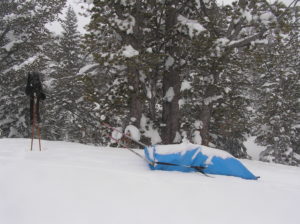
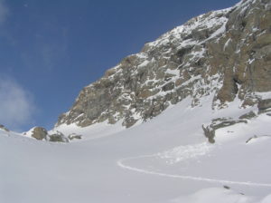
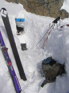
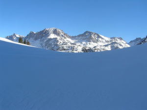
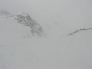
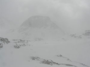
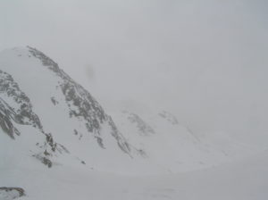
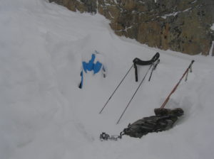
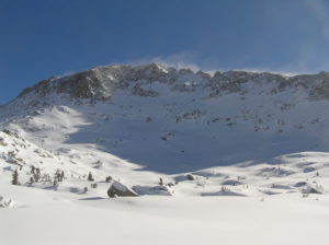
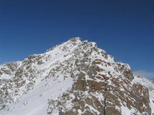
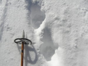
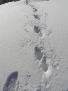
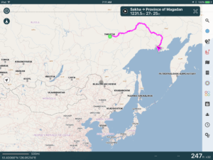
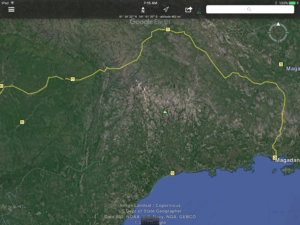
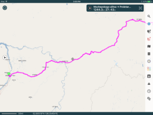
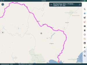
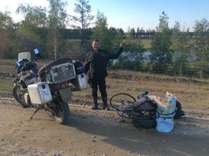
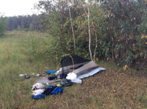
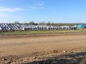
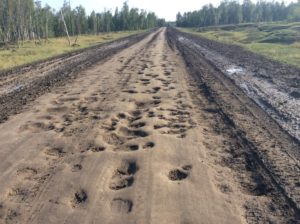
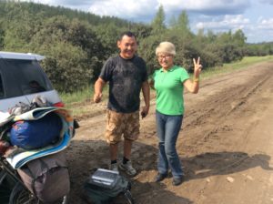
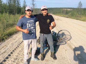
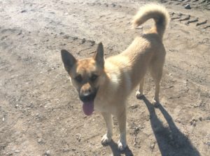
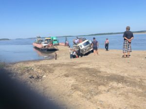
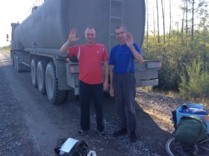
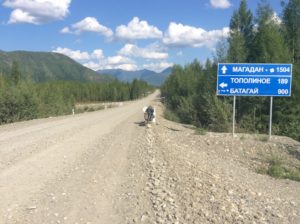
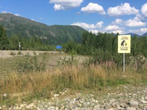
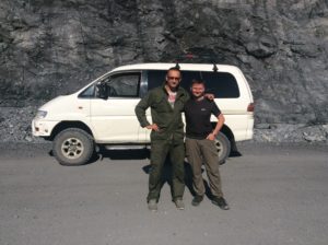
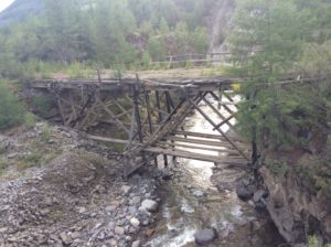
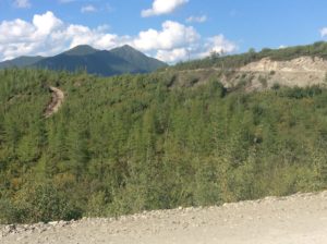
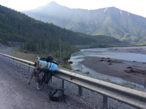
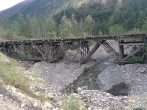
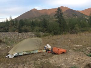
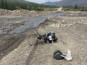
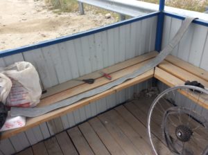
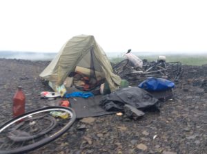
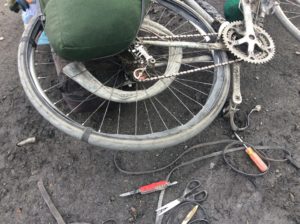
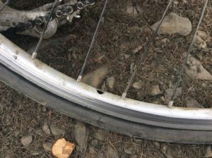
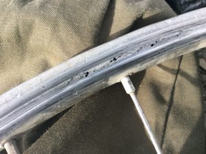
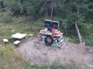
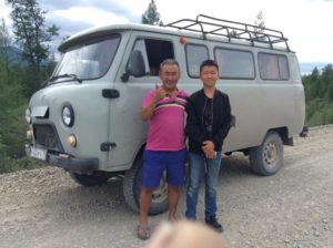
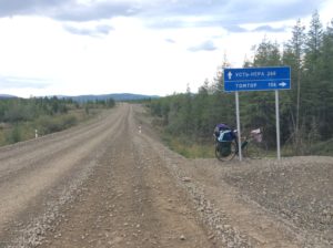
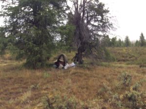
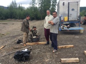
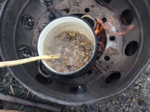
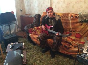
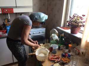
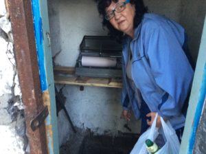
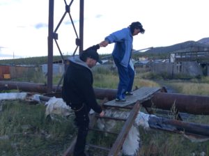
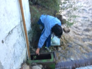
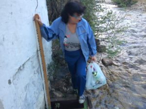
 J6
J6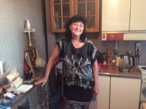
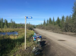
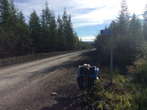
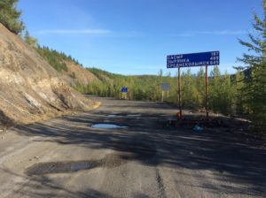
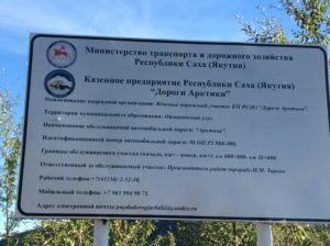
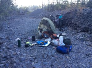
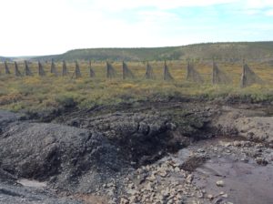
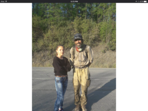
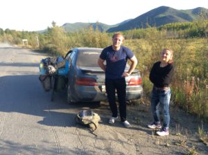
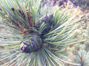
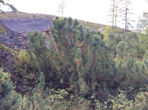
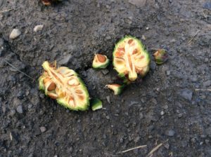
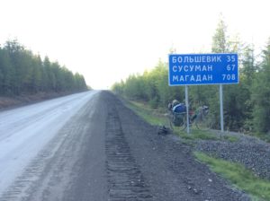
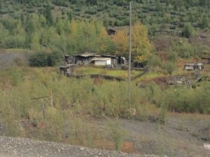
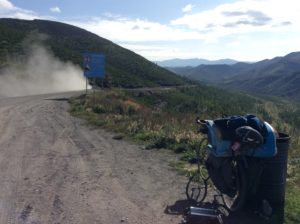
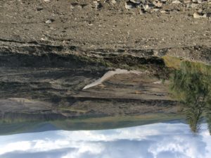
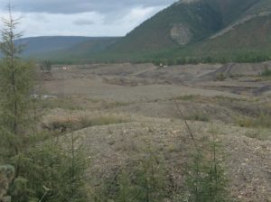
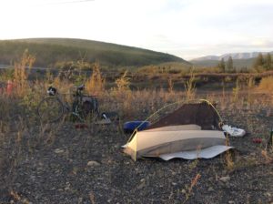
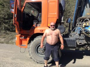
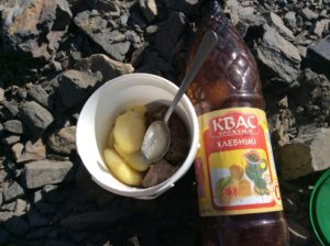 B
B