Bariloche to El Chaltén

December 31, 2016

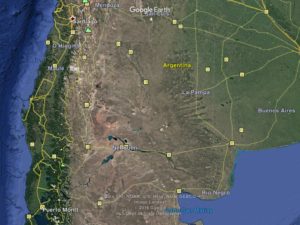
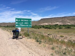
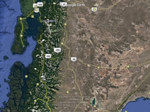
Bariloche is under the “40” at the top of the map.  The route goes through mountains to the south and then out onto steppes….
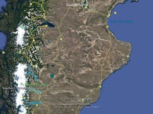
……..and continues to pea-green Lake Viedma.  El Chaltén is under the “O” in Monte.  The white areas are ice caps- Campos Hielo Norte and Sur, which are counterpart to Alaska’s and British Columbia’s coastal mountains.

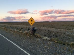
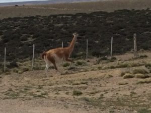
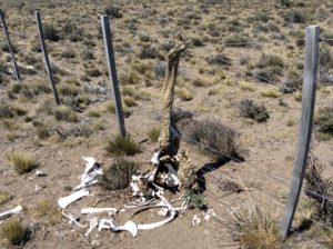
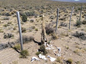
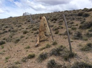
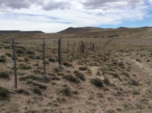
Before I get too far there are some heart-wrenching photos below that may be “viewer discretion”.  They’re of guanacos that are getting hung up on fences lining the highways.  The photos are not isolated cases- dozens of animals over a two hundred mile stretch.  I include them that folks might join in urging the Argentine Gov’t to do something about it.   It can’t be helping the economics of ecotourism, something they actively promote.

On another note of very sad news I would like to acknowledge the passing of our good friend and neighbor Jack Kidd.  Jack had a great life and a wonderful family.  His outlook was always positive and I believe he found a true happiness in a world fraught with difficulties.  He was 92.

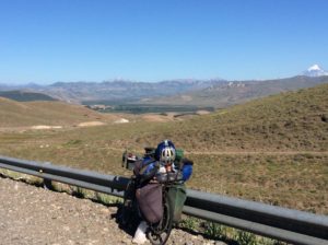
Rain with mild but unpredictable wind marked the first days south of Bariloche.  Highway 40 remains in mountain valleys for about 100 more miles after which you’re spit out onto steppes and once again into pitiless wind.  Distance-wise I’ve had the extrodinary good luck of having 70% tail wind but the flip side is that time-wise it’s been 70% head wind.  As with hills, you spend all your time on the slow sections. 70% headwind would be unbearable.
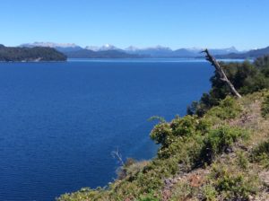
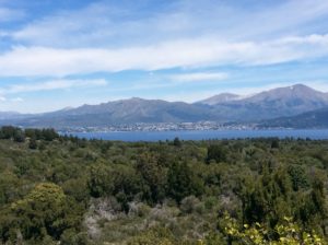
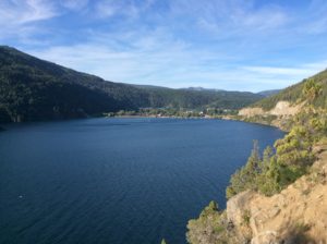
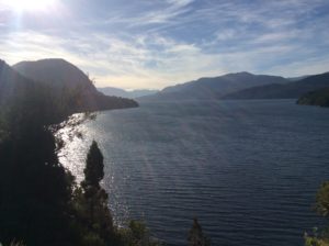
Lago Nahuel Huapi between Angostura and Bariloche.
Bariloche from across Nahuel Huapi.
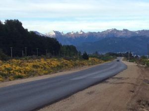
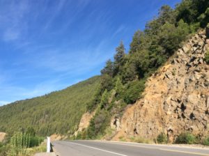
Near Bariloche
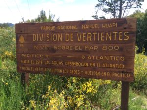
Continental Divide crossing to water flowing into Chile.
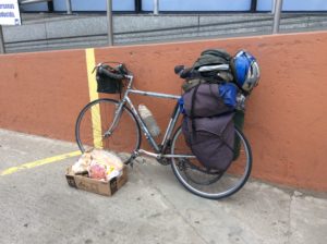
I try to leave any town on these vast stretches with four days worth of groceries. Getting it all on the bike is always a challenge.

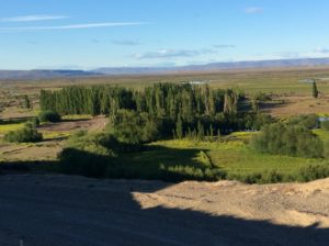
The lombardy poplar, planted as windbreaks in towns and estancias, should be Argentina’s national tree.

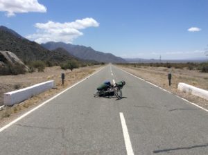
A memorable stretch between Bajo Caracoles and Gobernador Gregores, two small towns the size of Snowville, Utah, began on one day with light tail wind.  By midday it was a side wind and by early afternoon was much stronger with a component of head wind.  Side winds, even with a component of tail, are tough to ride in.  Side/tail wind needs to get around to about 45 degrees before it really does you any good.  Even then, though, it can be scary because although it propels you faster, with speed you have far less control over gusts.  Pure head wind greater than about 30 MPH isn’t rideable.   Enduring a day of either leaves your face, eyes and sinuses burning; ears ringing.  I use a neck gaiter-type face mask and ear plugs for the latter two.  This day I knew in the early afternoon that if I got about another 20 miles behind me a >90 degree bend in the highway was going to put me in very strong late-in-the-day tailwind.  It took about 5 hours of searing side wind to cover those 20 miles and several times I got blown off onto the shoulder, once over a guard rail (me only- bike stayed behind).  But then towards evening there was 40 miles traveled at over 30 MPH on dead flat.  I put the brakes on at 35.  Total for the day was 130 miles.  I got the drug infusion.
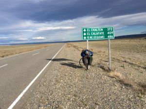
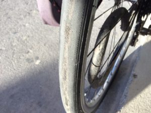
Tire that wore out after 600 miles.  May have to make the last 1000 miles to Ushuaia on what tires I have (down to one spare).
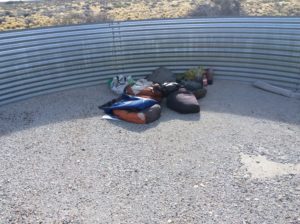
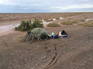
Water cistern in the middle of nowhere that has never impounded a drop of water.  Made a good camp though, and out of direct wind.
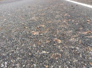
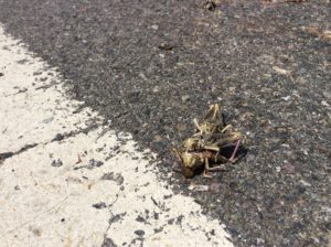
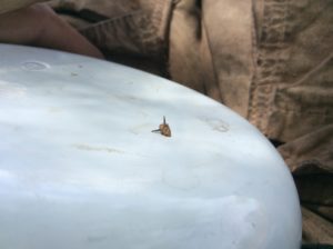
Smashed locusts covered the road in sections. Below, a bit of cannibalism.

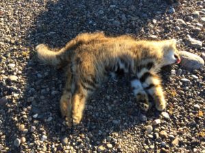
Geoffery’s cat. I’ve seen a couple that have been hit on the highway and one live one running up a road cut. They’re a little bigger than a domestic cat.  Lots of foxes as well.
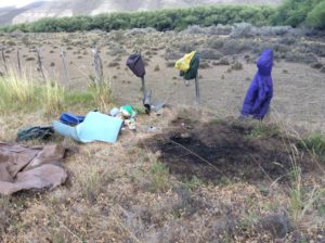
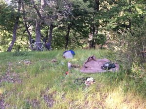
A near disaster here priming the stove in dry grass and wind. I keep the lid to the pot close by to tamp out what ever catches fire, but it got away from me here within seconds. I was able to beat it out with the ground tarp but for an uncertain instant was ready to grab what I could and run upwind, which was to the right in the photo.

Guanacos.

Over the course of trip I’ve had one “ride”, that was on an airplane getting from Panama City to Bogotá, Colombia. The rest has all been done on the bike….till now.  In the last miles getting to El Chaltén I’ve accepted 3 rides, all in circumstances of extreme wind. The first was just outside of Esquel, a ski town set at the foot of some beautiful mountains south of Bariloche.  Side winds were blowing me all over the road and a fishing guide, whose info I seemed to have misplaced, pulled over and without a word helped me load the bike into the back of his truck.   He took me the last few miles into town and I had tail wind after that.

The next was 40 miles before Tres Lagos. I had gotten a first-light start that morning and under reasonably calm conditions rode 40 miles before real wind began to kick in at about 10 O’clock. With nothing to even resemble a wind break from horizon to horizon I made a lee out of a highway sign that had blown down. I propped it up against the remainder of the post it had broken off of and settled in for the day. With some additional wind screen, I could light the stove and spent the afternoon with hot drinks, sudokus and math problems. Slept some. I intended to ride that night when the wind would abate and try to get the remaining miles to Tres Lagos, a small town before the final leg to El Chaltén, where I am now. There may have been a dozen cars that went by throughout the day and a good five stopped to make sure I was OK. Just at sunset Daniel Steuri, from Lake Constance, Switzerland, stopped and offered a ride. I had learned from the last folks (who left me with water and would have given me anything they had) that a 40 km dirt section was coming up in about a kilometer.  This was unexpected and would make getting to Tres Lagos by morning all the harder. I took Daniel up on the offer to at least ride to the end of the dirt. I was curious to try riding at night on the deserted highways, even with no moon, to see if it was a feasible way to get around wind if and when it calmed after sunset.
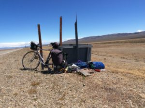
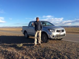
Escaping wind.
Daniel

With the sun setting we took off and I was altogether amazed at how fast dirt road miles went by when in a rental truck with a driver that treated it as such.  The problem was that we couldn’t get the tailgate of the truck up and though the the bike was locked in with a strap, a pannier came open.  This I discovered as he was dropping me off where the pavement resumed.  Things were missing.  The stove was the most obvious.  Daniel was more than game to go back and look for it and within a few miles we began seeing parts and debris strewn along the road.  I recovered everything that I know of but the stove needed some repairs to be functional again.  At that point I abandoned the idea of riding that night and went with Daniel the remaining miles into Tres Lagos where we got a room at a hostel.

The hostel didn’t take plastic and it took all the combined cash we had ($15 each!) to pay for the room.  We then found out there were no ATMs in town.  I had to have supplies for the next leg to El Chaltén and had no choice but to ride another 30 miles with Daniel to El Chaltén’s turnoff the following morning.

Daniel was just fun to be around and we seemed to hit it off.  He does about the same thing for a living that I do so we had a lot to talk about anyway,  but found also we well agreed on recent and disastrous presidential elections.  He instantly came up with one of the repairs for the stove suggesting a soup can for a lost heat shield protecting the fuel tank.  I made it out of a can of peas a couple of days later; works great.

El Chaltén is 50+ miles off of the main road, but I figured I could ride that far with what food I had.  Well, I pedaled two hours to get 10 miles in impossible head and side wind, when a van heading to Chaltén to pick up tourists took pity on me.  Third ride.

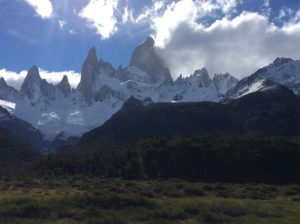
I was in El Chaltén in 2007.  In the 10 years that have passed since, the town has at least quadrupled in size and I could recognize very little- maybe the visitor center.  The town is at the foot of some of the world’s most dramatic mountains, Cerro Torre and Monte Fitzroy being the two most famous, and attracts tourists world wide.  Relatively easy, if crowded, hiking trails wind around to the foot of the peaks and massive glaciers.  Things are fairly expensive in town but there are no fees for the park and climbing is free.

El Chaltén was only declared a town in the 1980s.   A few climbers first came to the area in the 1950s making the first ascents of Fitzroy and Poincenot, but found only an estancia where the town now exists. The 60s saw a few more but people started coming in numbers in the late 70s and 80s.  The Argentine-Chilean border wasn’t well defined in many of the more remote frontier regions and here the land was up for grabs.  Argentina rushed to claim it as it became clear it was destined to become a world tourist destination.  Disputes over the border went on into the 1990s and it’s still a touchy subject between the two countries today.
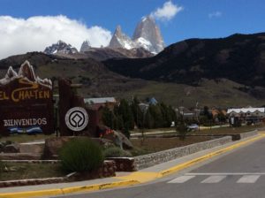
El Chaltén and Fitzroy.  The summit towers nearly 10,000 feet over the town.  The Grand Teton, by comparison, is about 7,500 feet above Jackson Hole.
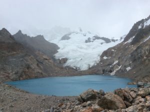
Lago de Los Tres at the foot of Fitzroy on a blustery day.
From the left, St-Exupery, Aguja Raphael, Poincenot, Fitzroy.

So, I’m in El Chaltén now and spent Christmas day in a bit of a vacuum camped outside of town avoiding campground fees.  It’s an incredible place and I needn’t be in too big of a hurry to leave as I’m well ahead of schedule.  The intent is to continue to Africa, starting in Cape Town and then heading north.  At the rate I’ve been traveling I could be in the Middle East in blistering summer heat which is an impetus to hang here for a while.  There’s climbing everywhere but I need to rent/buy gear and find partners.  To enable that, get Wi-Fi, and just for a little social life, I’ve moved for a few days to a campground in town which runs about $10 a night.  Expensive for S. America,  cheap for the US.
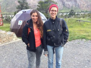
Federica & Francesca from Milan, Italy. While on a hike to the base of Fitzroy they were maybe 50 feet ahead of me where a forested trail emerged into a clearing. They suddenly turned and began walking fast towards me and passed saying “puma”.  I, of course, began walking fast towards the clearing to get a look.  The animal was long gone in the seconds it took me to get there. They described it and I believe they indeed saw a cougar- they’re here.  Of all the time I’ve spent in the outdoors the last 50 years, I’ve yet to see one.  Just isn’t fair.

These are hard to look at.  The fence wires are also too close together to allow adult Rheas to pass.  When trapped on the highway side they would run along ahead of me till they were exhausted enough that I could pass them.
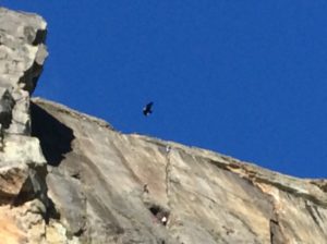
I’ll end on something a little more up-beat; an Andean Condor floating past some climbers at a crag near town.  With a ten foot wing span, it dwarfs the climbers who are at about the same distance away.

Thanks to everyone for the Christmas and birthday cheer-  I have two versions of The Raven to memorize now!  Happy new year.
Salta to Bariloche, Argentina


December 6th, 2016


Bzbz
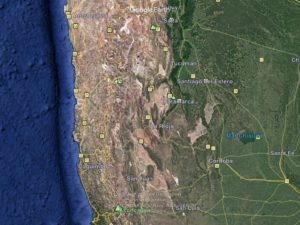
The route from Salta climbs back to drier terrain following the south-trending line of yellow squares (towns) to Mendoza which is due east of Aconcagua…….
......then
……then south to Bariloche which is on the lake just to the north and east of Puerto Montt.
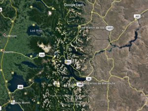
Closeup of Bariloche. The Seven Lakes route follows mountain valleys south of San Martin
Closeup of Bariloche. The Seven Lakes route follows mountain valleys south of San Martín.

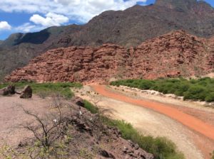
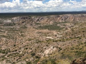
Since the last post from Salta I’ve covered 1800 miles to the town of Angostura, about 30 miles north of Bariloche.  It took just over three weeks. The cities of Jujuy and Salta are at the extent of a green, dry-tropics climate that is part of the Paraná River basin which drains into the Atlantic at Buenos Aires. To the south of Salta the route took me once again onto desert-dry terrain that climbs onto a lower version of the Altiplano, never exceeding about 8000 feet and averaging more like 4000 or 5000 feet. Over these vast deserts there are counterparts to all of our North American deserts from the Mexico and Arizona Sonora, to California Mojave, to Utah’s Colorado Plateau, to Nevada’s Great Basin, to Wyoming stepps. The distances between towns could be over a hundred miles and twice I was caught short on water over roads that maybe I saw a car per hour. I’ve ridden straight days since Salta, several were over 90 miles with one at 120 miles. A few that covered 30 or 40 miles sufficed for rest days. Winds have been variable with some very good tail wind, but also head winds and one day of horrendous side winds that blew the bike around on a shoulderless stretch with heavier than usual traffic. There was road construction in a couple of places and stretches of dirt road that, all told, added up to over a hundred miles. I was following Ruta 40, an Argentine highway with a sort of Route 66 or Lincoln Highway reputation that spans much of the country’s north-south expanse. There are certainly not the grades of Peru on Ruta 40 but it’s hilly just the same, although in a manner that keeps it more interesting than difficult. It was all very beautiful.

img_4746

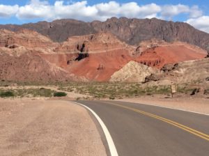
Utah landscapes!
Utah landscapes!
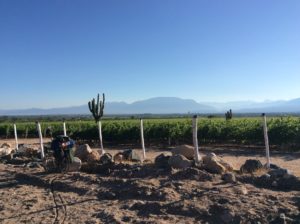
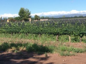
Vineyards near Cayafal
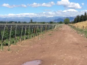
Vineyards near Cafayate.  Very much a desert environment but with irrigation it is good for growing grapes.
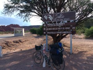
Wine country.
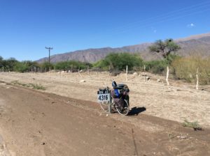
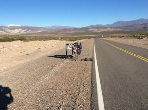
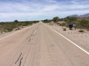
These mileage markers are for Ruta 40 and are counting down to somewhere in Tierra Del Fuego. I've followed them to about 2000 km.
These mileage markers are for Ruta 40 and are counting down to somewhere in Tierra del Fuego. I’ve followed them so far to about 2000 km.
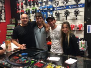
  • Enzo, Martin, Guevara, and Lali of Maxi Bici Bikes in Mendoza. These guys gave me a new chain and a bunch of accessories all free gratis. Stop in if you’re ever in Mendoza! http://Maxibici.com
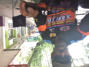
Jersey from the folks at Maxi Bici
Jersey from the folks at Maxi Bici- I finally look like a cyclist.
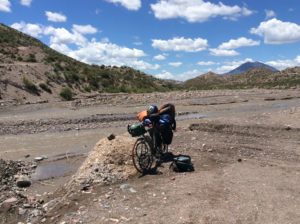
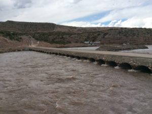
Ruta 40 essentially ends at this Rio but a mile down stream. I had to push the bike to a ford here where the road continues up the other side.
Ruta 40 essentially ends at this Rio but a mile down stream. I had to push the bike to the ford here, crossed, and found a road continuing up the other side.
Canyon with little or no road that had to be crossed.
Culvert bridge used by construction crews.
Culvert bridge used by construction crews on a much larger river in the next valley.
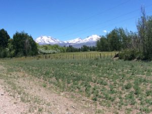
Could be a spring scene in the Rockies.
Could be a spring scene in the Rockies.  Nearing the small town of El Sosneado.

I had intended on a layover in Mendoza which is about the half-way point between Salta and Bariloche.  I wanted to climb Aconcagua, South America’s high point at 22,900 feet and Mendoza is about 100 miles away, the nearest big city and a take-off point to the mountain.  Plans were foiled when I discovered it would cost me around $1500.  The permit alone is $729.  Gear rental, buses and mules to transport everything to base camp add another $700 or $800.  I went to about 20,000 feet on the mountain in the 1990s but got weathered off and always wanted to get back to it.  Back then, a permit was about $80.   I had skipped the mule rental then, but started out with a pack weighing 105 lbs- something I don’t want to repeat at this point in my life- but a mule and driver would be over $300 now.  I was disappointed because it was the one mountain I could realistically do by myself.  There are no major glaciers to get to the summit by the easiest route which is essentially a hiking trail.  I had a good head start on acclimation with all the time spent on the Altiplano.  The effort to cover ground quickly from Salta was in part to enable extra time for Aconcagua.  I was disappointed but for that kind of money it just wasn’t worth it.  You’re not required to hire a guide, like in Ecuador, but Argentina is not blind to the fact that the highest point in the Western Hemisphere is a true commodity with plenty of demand in the 21st century.  Argentina has, of course, many other great summits but none that I had much familiarity with and none made as simple as Aconcagua.  Part of the price I guess.

Mendoza has an almost mythical reputation for fine wine, good climate and enjoyable atmosphere.  I arrived early the day I got there but ended up in a less than desirable hostel.  That afternoon I got all the bad news on Aconcagua, and decided to head out the next day.  I found the city fairly chaotic and after all the hype was actually glad to put it behind me.  Bit of sour grapes, perhaps.  They’ve got the wine part of it right though- in Argentina in general you can buy a Malbec or Cabernet for $3 a bottle that is better than anything out of California for $15 or $20.  They (the locals at least) say that Argentina is now making the world’s best Cabernets.  And wine is everywhere; a large grocery store will have thousands of bottles lining aisles.  Street corner markets will have hundreds.  Leaving Argentina could take some adjustment.

img_4864 img_4867

The goat's head, probably the worst thorn there is for bike tires. We have these in the western U.S.
The goat’s head!  Probably the worst thorn there is for bike tires and we have it also in the western U.S.  I managed to pick up 20 or so of them wheeling the bike to a camp.  I got all but two out before they punctured a tube.  Remarkably, those are the only flats since the brutal roads in Bolivia.
Wet, muddy, miserable camp.
Wet, muddy, miserable camp just before Mendoza.
Tamarisk. I haven’t seen it in the monocultures found on the Colorado Plateau, but it’s definitely here.
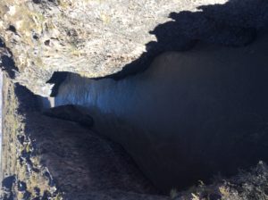
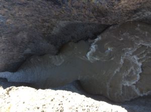
The Rio Grande of Argentina.  Here, it’s confined to this gorge and moving swiftly.  Up stream, where it’s in a wide valley, it’s a good hundred yards across in places.

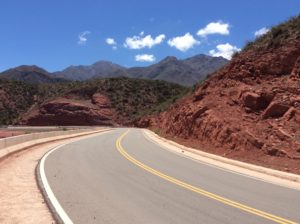
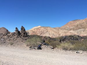
Many miles of dirt roads over lava beds lined with sandstone cliffs. Tough roads but incredible.
Ruta Cuarenta
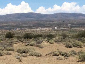
This is part of the Pierre Auger Observatory, a network of cosmic ray detectors the size of Rhode Island near Malarque, Argentina.  Cosmic rays are high energy protons believed to have originated from supernovae and possibly echos from the Big Bang.  Those that penetrate to the Earth’s surface are very high energy, some nearing 10²º eVs (electron volts).   By comparison, CERN’s new LHC (the thing that discovered the Higgs Boson) is achieving energies around 10¹² eVs, more than a million times less than these particles.  Nobody’s figured out how to do anything with them yet.  They’re popular with grant writers and at cocktail parties.

Some rainy days followed but soon I was again on high desert and somewhat able to plan days around wind cycles.  For the most part that meant getting going as early in the morning as possible, in relative calm, and then either going for a big mileage day in afternoon tailwind or shutting down for the day having at least gotten some mileage.  But tail winds are like a drug and when you get it, and then don’t, your life becomes miserable.  You can really do a number on yourself trying to force long mileages on days when it’s just not meant to be.  Basing what supplies you pack on hopes of tailwind is a dangerous gamble and I got burned with it on one occasion trying to get to San Juan, a major city just before Mendoza.  I pulled into the city out of food and water and pretty hammered.

The “glaciers” in these desert peaks are sand dunes.
Lots of friendly Argentines.

Vineyards closer to the Andes south of Mendoza.


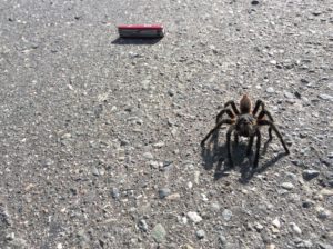
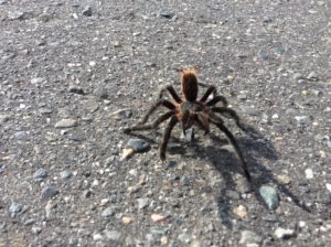
Tarantulas are commen, but this one was big enough I had to stop and get a photo.
Tarantulas are common, but this one was big enough that I had to get a photo.
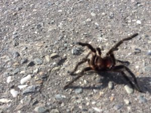
I skidded him (her) off the highway but this one wasn't used to being pushed around.
I skidded it to safety off the highway but found it ready to fight and not used to being pushed around.

I ran short on water again south of Chos Malal when a well meaning couple stopped and offered some.  I was getting down to my last as afternoon heat was settling in and though they only had a few swallows to give, it was good and cold.  We talked for a bit and exchanged contact information.  They said the next town, Las Lejas was only 15 kilometers away (less than 10 miles).  I asked about the mileage at least a couple of times to confirm it and then drank the rest of what I had confident I was close to a town.   It turned out, however, that La Lejas was more like 45 km (25+miles) and against a head wind that had picked up.  The real irony though was that I passed up a water source a couple of miles later at this roadside stand selling drinks out in the middle of nowhere.  I was mad at the misinformation but even madder at myself for not hedging my bets.  I ended up camping on a muddy stream 6 miles from Las Lejas that I was lucky to find.  I never could get the water clear enough for the UV purifier to work properly and had to drink it murky.  That’s been more than a week ago and no ill effects yet.

Muddy water camp- actually a very nice spot.
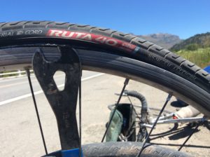
While changing out this tire I bought in Salta I noticed the eponymous model name.  Specialized needs to come up with a “Route 66” model.
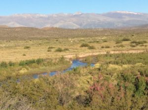
I was able to fill up on good, clear water once in a while.

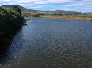
Zapala is the next good sized town encountered but then it’s another 100+ miles to Junín de los Andes over the last desert stretch before entering forested mountains.   I was much better prepared beginning that leg and was rolling at daybreak to get a head start on wind for the longest part.  I didn’t quite make Junín, but crossed the Rio Collon Cura, a beautiful, clear running river, reminiscent of Idaho’s Payette where it leaves the mountains prior to its confluence with the Snake.  I’ll do another plant segment, but mention now that as elevation, latitude and climate go through similar zones to that of the western U.S., many of the same familiar weeds are seen.  Here at the Payette’s counterpart I found good old star thistle, a nasty little Idaho knapweed to be avoided if you’re wearing anything but cowboy boots.

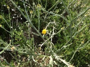
Star thistle! A North American invasive found in Idaho and now in an Argentine latitude and elevation counterpart.
Star thistle! Centaurea solstitialis, a North American invasive found in Idaho and now seen in an Argentine latitude and elevation counterpart.
Rio Collon Cura.  Fly fishing is popular here.
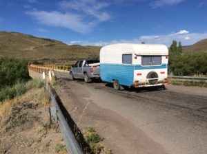
Argentinians recreate unlike any of the counties to the north but the RVs haven't quite evolved to the behemoths found on North American highways. You see a few ATVs, boats and mountain bikes as well, something very unusual in Peru or Bolivia.
Argentinians recreate unlike any of the counties to the north but the RVs haven’t quite evolved to the behemoths found on North American highways. Looks more like something from 1960s U.S.A.  You see a few ATVs, boats and mountain bikes as well, something virtually unheard of in Peru or Bolivia.
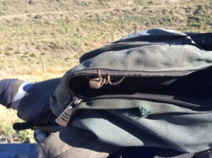
This guy jumped out of the iPad case when I pulled it out first thing in the morning.
View looking into Junín and where greenery is seen for the first time since Salta.
View looking into Junín’s valley where real greenery is seen for the first time since Salta.
San Martín de los Andes at the foot of Lago Lácar.
Pine, Cedar and Juniper were introduced here in great numbers and long enough ago that they look endemic.
Lago Lacár looking away from San Martín.
Good camp in South American beech trees, Nothofagus, the only endemic large trees here that I know of.

A desert akin to Wyoming stepps is left behind when Ruta 40 enters mountains near San Martín de los Andes, and follows a route called The Seven Lakes to Angostura and Bariloche.  San Martín is a ski town with commensurate prices and I didn’t stay long.  The Seven Lakes route travels Alp-like mountains and the area from there to Bariloche is National Park through glaciated valleys and lakes.  It rained for most of it and the iPad battery was dead so I took no pictures but there are plenty to be found on Google Earth.  The resemblance to the Alps attracted German settlers as early as the 1880s and there are tales that many Nazis fled to Bariloche and surrounding areas after WWII.  There is even a myth of Hitler living here with Eva Braun.  It’s true an SS Captain, Eric Priebke, was a director in the school system after the war but that may be the extent of it.

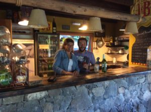
Ruso and Vale at the Hostel La Angostura put up with me for a couple of days while I did repairs and put the blog together.
I’ll end with a link to a song from a new album by Nathan Walker; scroll down a bit for a short article and video of his song Bobby.