Nogales

April 28th, 2016

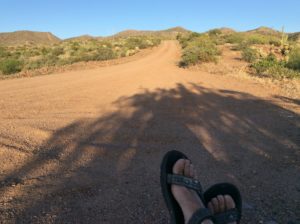
Left Tucson and rode against headwinds to a camp near pecan orchards.  Lots of fences and no trespassing signs but I got on an intersecting rail line and followed a rough, paralleling dirt road to the far edge of an orchard and a secluded camp.  Birds were everywhere, but this time I had binos, and got a vermillion flycatcher, a verdin, a cardinal and a few I need to look up.  Guess I’ll need to add a bird book to the pay load (somebody said there’s an app for it.)

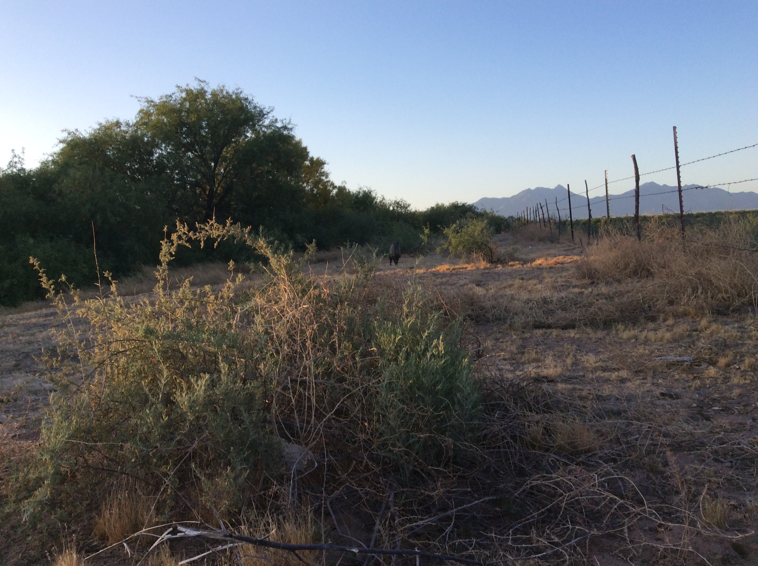
The next morning I had the usual breakfast-in-bed quiet time and was enjoying coffee and looking at birds.  From behind me a family of javelinas came up but didn’t notice me till they were about 30 feet away and off to my side.   Once they discovered the anomaly on their morning circuit, one let out a couple of woofy grunts- that scared the hell out of me- and then they all just stared.   Once I knew what they were I was trying to decide whether to go for a photo or just enjoy the moment.   I went for the photo and ended up not doing either very well.  As soon as I reached for the iPad panic erupted and they were going every which way trying to decide the best exit plan.  I’d  swear I saw two smack into eachother.   The babies (shoats?) were the size of Yorkshire terriers and about as frantic.   They finally collected themselves and retreated the way they came and I got one picture of the rear guard sentry.   He’s visible just above dead-center of the picture but you may need a touch-screen to zoom in.
Rr

If I had to describe these animals in a word it would be “stout”.   What twists and turns in evolutionary selection produced such an ungainly life form one can only wonder at.

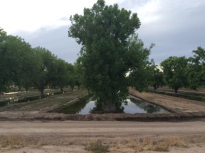
The pecan orchards extended for about a twenty mile stretch of highway.  I found a few remnant nuts from last years crop still hanging on the trees and cracked them open to find perfectly good pecans inside.  They were great to eat, but ordinarily one would expect anything as protein and fat  loaded as a pecan to have been long consumed by any number of big or small scavengers after languishing for five months.  You would rarely find an edible pine nut after that much time.  One wonders what chemicals your eating along with the nut.  The orchards are water intensive as well with irrigation troughs making a good 2/3 of a given acreage periodically into a shallow lake.
image

By the time I got rolling it was fairly late and headwinds had begun.  By the time I was 8 miles to the small community of Continental, the winds had shut me down.    I buried myself in a McDonalds and scammed Wi-Fi.  Towards the afternoon I chisled out a few more miles and found a relatively good camp site in secluded mesquite forest at the base of a wind sheltering hill.   Took a short hike before dark and saw several phainopeplas.  Twenty-two mile day.   Odometer turned over 1000.

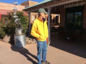
Rose early the next morning to beat the wind and rode easy miles to a coffee shop in Tubac where I was greeted by an interested South African named Franz (sp) who was traveling the US.  He bought me a coffee and cake.   He left a donation as well, along with some fatherly advice.
image

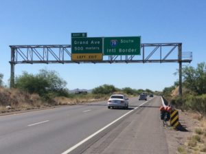
After coffee and conversation I rode the remaining miles into Nogales.  Since Tucson I had been following I-19 but along continuous frontage that avoids the actual freeway.   Somewhere after Tubac the frontage road ended and spit me out onto the freeway for a few miles.  This was actually OK since the frontage was fairly crowded and in places had no shoulder- with the freeway you get federally mandated emergency lane and, though smoothness isn’t guaranteed, you get enough room that the slipstream boost of passing semis isn’t totally unwelcome.  But you also get a sobering look at shredded tire debris (the bandag re-cap) and various configurations of twisted metal making you glad you were somewhere else when they flew off.   And the times sleeping close to the constant din of the highway you inevitably hear at some point in the night the familiar flap-flap of one of those bandags in the process of separating from an inside dual and the driver oblivious.  (And yes, I’ve been that driver.)  A cyclist is ever wary of the flap-flap coming up behind him or her.   Got to Nogales and checked into a motel and began regrouping and preparing to cross into Mexico.
image

Distances this close to the border are already in kilometers, signs often have Spanish first / English beneath and most people I’ve encountered here speak very little English.  American Nogales is very Mexican.   It’s also very friendly and the people seem genuinely happy;  rural Arizona to the north not so.


Flagstaff to Tucson

April 27th, 2016

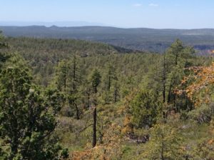
I took HWY 3 southeast out of Flagstaff, which is a secondary paved road that follows rolling, ponderosa covered plateau for 50 miles to where it tee’s into HWY 87, and another 25 miles to the edge of the Mogollon (moogy-on) Rim.   HWY 3 has great shoulder and sparse traffic, 87 just the opposite.   From the grand view at the Mogollon Rim you descend a few thousand feet through several towns (Payson the largest) and vegetation zones 50 miles to Roosevelt Lake.    Lots of head wind but enjoyable none-the-less through really beautiful country.   The Mogollon Plateau has the world’s largest stand of ponderosa pine (just read that in the Payson newspaper, actually).

image

Top of the Mogollon
Top of the Mogollon
.....and off of the edge.
…..and off of the edge.

Roosevelt Lake is one of several reservoirs on the Salt River, the largest, and is a water source for Phoenix, to the west.  It’s in the Tonto Basin, a beautiful valley with saguaro cactus covered hillsides, and grim history of cattle & sheep range wars (Google Tewksburys and the Grahams).   It’s also a crowded recreation destination for Phoenix folks and a bit of a relief to get away from.

Roosevelt Lake
Roosevelt Lake

image image


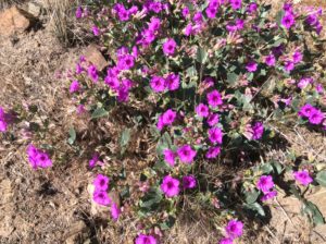
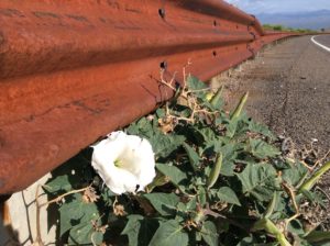
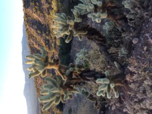
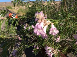
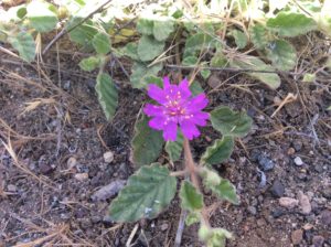
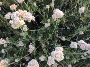
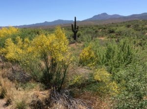
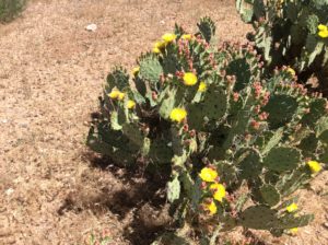
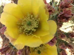
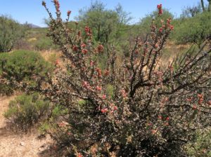
Lots of spring flowers and flowering shrubs, many I don’t recognize.   Below, a few photos (actually a bunch) for the botanist types.

Four o'clocks
Four o’clocks
Datura
Datura
Cholla near camp
Cholla near camp
Camp
Camp.  The road’s the only place safe from cholla debris.  Very deserted though- not a car the whole time.
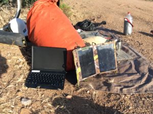
Charging the iPad
Charging the iPad
Magnoliphyta sp.
Magnoliaphyta sp.
Another Magnoliaphyta
...and another
…and another
Juniper. I know they have one down here called "alligator".
Juniper. I know they have one down here called “alligator”.
Paloverde in flower
Paloverde in flower

image

Opuntia
Opuntia
More Magnoliaphyta
More Magnoliaphyta
Very cute Astragulas
Phlox
Phlox
Revenge of the forgotten banana

There was a steep grade getting out of Tonto Basin that I did half of one evening and the other half the following morning after a night in a beautiful campsite over looking the valley.  Fought headwinds the rest of the way to Globe and then had a little misadventure getting to the town itself.  Globe sits at the top of a hill and as I approached town could see the highway curving off the wrong way to a junction and then backtracking up the hill to the town proper.  I couldn’t help but notice a little side road that appeared to lead straight to the town without the detour.   I’m a chronic shortcutter and resistance to this one was useless.  I pushed the bike up a rediculasly steep hill (something I actually don’t mind doing once in a while- it can be a sort of “moving rest”) passed some businesses and rounded some corners.  But then, at an unlikely place for a dentist’s office, everything ended.  When does one admit defeat and go back?  I potraged the bike and gear in three carries up a sandy cactus and yucca slope to a dirt road.   I would have still been money ahead to just turn back at that point but instead walked the bike over a rocky two track that wound up and down and eventually back to the highway.  Got me off of the bike for a while, I guess.

image

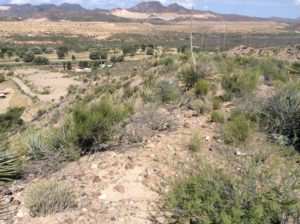
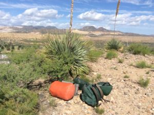
"The Portage". The yuccas I think are sotols, a plant I more associate with the Chijuajuan Desert.
“Portage Hill”. The yuccas I think are sotols, a plant I more associate with the Chijuajuan Desert.

Had a quiet time at the Globe library and a couple of restaurant meals in the morning and afternoon.   Then another misadventure getting out of Globe.    I won’t go into details (there were no more portages) but I squandered 10 precious miles on wrong turns and roads egressing a hillside city that’s laid out like a maze.   Had another beautiful high desert camp among pinions, mesquite and cactus.   Lots of birds to see and I wish I had binos.  May have to add a small pair to the payload.   Pretty sure on a green-tailed towhee.  Heard poorwills after dark.

A chilly morning and a long uphill to over 5000 feet began the day, followed by 20 miles downgrade to Winkleman,  an outpost that might be described as a “company town” where ore from the Globe copper mine is smelted.   A smokestack hundreds of feet high overlooks the town and there’s a fair amount of heavy truck traffic back and forth over the road I’d just traveled.   And true to the observed correlation of narrow shoulder / heavy traffic, it was scary in places.  I suspect a road approaching zero traffic would have a shoulder width tending to infinity.image

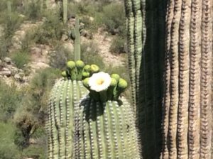
Saguaros in bloom. These things are really just big flowers.

I got caught by darkness in a Tucson satellite community called Oracle.  It’s at the top off a 10 mile upgrade that I was expecting to be much flatter and consequently took longer.  After getting water I pretty much plopped down in a vacant lot.  Sixty five mile day.

Easy downhills and tailwinds brought me 35 miles to Tucson this morning.  Bought some mini binoculars at REI.

Tucson and ten unpleasant miles ahead
Mt. Lemon
Mt. Lemon
5 Points Market & Restaurant. They had Wi-Fi and info on what's ahead.
5 Points Market & Restaurant. They had Wi-Fi, great food, and info on what’s ahead.

Animals


April 23rd, 2016

I’ve had a variety of animal and bird encounters that haven’t been included in the posts.  I’ll recount a couple here.  Those bored by that sort of thing can skip on.

The night in Goshen Canyon was amid some deer.  I kept hearing the hoof falls close by in the night but was surprised to see fresh droppings on the ground tarp I had laid the sleeping bag and pad on.  He/she practically stepped on me.  Slept through that part.

At the toadstool camp I woke fairly early and got the usual “breakfast in bed” which is facilitated by having the stove, coffee accouterments, water and so forth right near where I’m sleeping.  I wake up and pull myself into a Crazy Creek chair and light the stove.  Before I can get my favorite powdered coffee/hot chocolate concoction into the cup, the water’s boiling.  It’s really easier and more convenient than descending the steps from the bedroom to the kitchen at home.    So, I’m sitting there motionless, with the exception of raising the cup to my mouth every so often, and I notice “activity” about five feet away in a clump of cheat grass (or at least a weedy brome of some kind).  Out pops a pocket gopher!  I’ve never seen a pocket gopher.  They spend the vast majority of their lives in their tunnel systems and evolution has just about eliminated their eyes altogether.  Olaus Murie had a hard time finding one as well and finally got pissed off and shoveled out a burrow till he dug one up.  I’ve never been that curious (well, maybe once, but it was unsuccessful) but here was one to see, doing what ever it is they do at home.  And what was that?  He began nipping the cheat grass stalks, one at a time, at the base, and then dragging it trunk-first into the hole.  He’d pop back up, fell another stalk, then down the hole.  It was hilarious.  I didn’t move through the whole episode.  After a few minutes the “stand” was “felled” (in a radius about that of a lengthwise pocket gopher) and he disappeared into the hole, plugging it back up from the inside.  I should have taken a picture of the “clear cut” but didn’t.   It was better entertainment than a Republican debate.

At the camp at the end of the 75 mile day I had a restful night but did wake up once and noticed movement about 30 feet away.  In the light of a nearly full moon I could tell it was a badger.  And he was coming towards me!  I was maybe 8 feet up on a slickrock shelf and he was down on the sand,  but I really didn’t want him to get any closer.  At 20 feet I made enough of a rustle in the sleeping bag to get his attention.  He stared at me for about a 1/2 minute, surely sizing me up,  and ambled off in another direction.  The next morning I looked at his tracks and, below,  you can see them “on top” of the tracks I made the evening before pushing the bike to camp.  Look close and you can see the “offset” (one a little ahead of the other) characteristic of mustelids.

image image image

At the “windswept” camp, just between dusk and full dark,  and a lull in the wind, I had a smallish owl fly over me, maybe 20 feet up, and hover for a couple of seconds checking me out.  He was beating his wings frantically to hold a motionless position, but I could hear nothing!  If it would have been a crow doing that you would have heard whoosh, whoosh.  Owls are pure stealth.

About every night sleeping out owls and coyotes are heard.  A couple of nights, poorwills.   But all of this fun wildlife, I hate to admit, is the result of not having a dog along.  Nothing better than watching your best friend altogether thrilled to be alive in the great outdoors, but it really hampers any kind of animal encounters.   The dogs will always find themselves between you and anything sentiently alive.  And I’d hate to think of where an encounter with the badger might lead.

Kanab to Flagstaff

April 21st, 2016

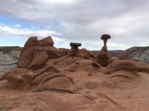
The Canyons Motel in Kanab had an all-you-can-eat breakfast with anything you can imagine from a fruit assortment to king sized sausage.   Spent the morning eating and started out a few minutes before 11 am checkout.  Winds were reasonable; couple of grades.  Did a 50 mile day to a roadside hiking trail within a corner of Escalante Grand Staircase NM.  Pulled the bike up the trail to get out of sight and camped- so easy to do on a bike.   Walked the trail a 1/2 mile in waning light to a series of “toadstools”- erosional features not uncommon on the Colorado Plateau.


imageimage

imageAnother roadside attraction

Cooked up some spaghetti and put the last of dried tomatoes and basil from last years garden in it.  Slept the sleep of the dead-tired, rose early and rode the last miles to Glen Canyon Dam and onto Page.

Another roadside attraction
Another roadside attraction……..

imageimage

......for a lot of people.
……for a lot of people.

Got to Glen Canyon and found that the Bureau of Rec still worships Carl Hayden and, judging from the Tiberian fountains out front, really hasn’t figured out water yet.

image

Let the desert bloom like the rose....Eh Carl.
Let the desert bloom like the rose….Eh Carl?

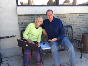
I pulled up the brutal hill into Page and wandered  punch-drunk into a grocery store to get food and drink, took it all outside to some tables, couldn’t decide which table to sit at (sun or shade) and managed to leave my wallet sitting on the first one.  A concerned woman noticed right off and saved me some potential heartache.  She was on a bench with her husband with a computer in her lap and curiously close to an electrical outlet.  Nothing like scamming a little free power.  And so close the Glen Canyon source!   I struck up a conversation and found they were Brits, Dean & Linda, traveling the US.  Soon I was charging my iPad the same way.

Dean & Linda
Dean & Linda

I reluctantly left the amenities of  Page and got on the Coppermine Road to the south.   This highway was just recently paved to enable a bypass route to Page when Hwy 89 had a major washout on the hill coming up from Lee’s Ferry.   The washout’s since been fixed, took a couple of years, and now the Coppermine Road, though not completely abandoned, is a nice alternative to the line of cars and trucks found on 89.   It begins with a bit of a climb, more than I remembered, but then takes an undulating and scenic route over cedar forested top land and gradually tilts into a 25 mile gratifying down hill stretch back to 89.   Those last easy miles lured me into making a 75 mile day, something I don’t intend to make a habit of, but nice to know I can still do if I have to.

Navajo Mountain and Kaiparowits Plateau. Glen Canyon runs between the two.
Navajo Mountain and Kaiparowits Plateau, way in the distance, from the Coppermine Road. Glen Canyon runs between the two.

I found  an incredible camp site on some slick rock outcrops and had an evening and morning of hiking around and taking pictures.

Camping as good as it gets. No wind, no bugs.

image image image

The first few miles the following day saw me back on Hwy 89 battling spurious shoulders and heavy traffic.  A 50 mile day brought me to a camp on a windswept flat entirely too close to the highway.

Camp Windswept. Humphrey's Peak and the San Francisco Mountains near Flagstaff.
Camp Windswept. Humphrey’s Peak and the San Francisco Mountains near Flagstaff.


This little roadside gemstone got me thinking about what characteristics the ultimate bicycle seat should have.

I’m in Flagstaff now for a couple of days “rest”.  Got bike parts  (spokes,  tires, rear view mirror); a long sleeved cotton shirt and truly geeky straw hat for the desert (just emulating my heroes Buddy and Graham);  an ultraviolet light water purifier (filters evidently gone the way of land line telephones and floppy discs).  The purifier has a rechargeable battery I can hook up to the solar panel.  I got spur-of-the-moment overseas immunizations (finally!) at a place that specializes in such, Passport Health, and had the good fortune to get an hour or so of brain picking from the manager, Brad Heck.

World traveler Brad Heck
,World traveler Brad Heck

Brad’s spent a good deal of time in Latin America including two years with the Peace Core in Paraguay.  I left feeling like I have after a physics lecture and had a wad of notes to take over to a next door breakfast shop to review and rewrite.  He clued me in on ultraviolet water purifiers.  But I’ll exit Flagstaff tomorrow and none too soon- spent over six hundred  bucks here.

What the hotel folks don’t know won’t hurt ’em


Panguitch

April 15th, 2016

Spent the night in tall sage and tetradymia near Circleville, Utah.   Pitched the tent to get out of the wind but it was a lucky thing as it began raining pretty hard at about midnight and was lightly snowing by morning.

1/2 – person tent. This model does for tents what the bikini did for swim suits; Flimsey and doesn’t cover much.  Can’t complain about the weight though.
Snow
Light snow and a low ceiling
Echinocereus?
Echinocereus?

image

Panguitch

But yesterday’s head wind had turned into an incredible tail wind and the few miles into Circleville went fast.  Got food at a small grocery store then took advantage of the tail wind to get me 30 miles to Panguitch in about an hour-and-a-half.   It was snowing lightly the whole way but the flakes just floated ethereally along side and the miles were easy.  I got breakfast in Panguitch during which time the snow flurries became a blizzard and began sticking to the highway. So, I retreated to the town library and descended into the dark hole of figuring out computer mysteries; more specifically iPads, which are new to me and wholly different from the prosaic, but seemingly more understandable world of Windows.    These computers are certainly a jigsaw puzzle, but one without border pieces-  just indefinite expansion.

Spent the afternoon in the library all the way to closing.  The blizzard was still howling at 5 pm and I had to make a choice whether to ride or get a motel and I decided to ride.  Fifteen miles of extreme tail wind got me to Hatch, but over wet highway, spraying semis and at times heavy snow. Camped in a thicket of cedars 5 miles beyond there as the storm was abating.  I found a patch of rocky ground in the lee of the wind and on a skiff of fresh snow.  Once in the cocoon I was warm and a clammy sort of dry.

The next morning it was still cloudy, same tail wind but no precip.   The irony was that the best way to get out of the wind was to ride.  After a cup of coffee I went 25 or so downhill, downwind miles to Mt Carmel and another 17 to Kanab.

I met Sylvia, my renter for the house in Logan, and her mother here.   They are traveling across the country east to west and fate had it that our paths crossed in this small southern Utah town.   We had a quick dinner and cut short a conversation that could of gone for days so they could find a place to camp while it was still light.

Today I start a two day trip to Page, AZ.  Hope the wind gods are kind.


Nephi to Marysvale

April 14th, 2016

Uneventful but nice ride over the hill to Moroni, Ephraim and Manti.   I wanted to just go to Levan and Gunnison (shorter/flatter) but I needed a bike tire and a guy at the hardware store in Nephi said a shop in Ephraim would have it.  Got to Ephraim at 8:00 the next morning but the shop didn’t open till noon.  I didn’t hang around and rode to Salina against head winds and checked into a motel.

Camp in Goshen Canyon

 Rode to Richfield the next day and found a tire in a bike shop that also specialized in motorcycles as well as selling guns and ammo.  But they did have a tire!

Astragalus sp. It's not utahensus but every bit as colorful. Help me out Buddy, or any of many on this distribution that might know.
Astragalus sp. It’s not utahensis but every bit as colorful. Help me out Buddy, or any of many on this distribution that might know.
In the canyon east of Nephi
Relict tunnel on a welcome 20 mile rails-to-trails stretch between Elsinore & BRCM

More headwind travel brought me to within a mile or two of Big Rock Candy Mountain.   And yes, it’s the BRCM that Harry McClintock wrote about while riding the rails in the 1930s (where the blue bird sings by the lemonade springs.)  Had a good camp in some cottonwoods along the Sevier River.

Big Rock Candy Mountain
Cheanactis near BRCM
Chaenactis near BRCM (Correction: Cymopterous- I don’t know what came over me!)

So, now I’m in Marysvale at a little outdoor hamburger stand called the Dawg House.  Cold, raw day and a headwind to look forward to.  Better get after it.  SW

The dawghouse- WiFi central in Marysvale
The Dawg House- WiFi central in Marysvale


Graham & Debbie

April 11th, 2016

image image

A welcome surprise seeing Graham and Debbie not far from Goshen, Utah.   They were returning from Capitol Reef and passed me heading south.  They loaded me up with food and a bottle of Graham’s home brew, neither of which I would have found in Goshen on a Sunday.   Had a wonderful camp in Goshen Canyon that night.   This little out-of-the-way loop parallels I-15 a little north of Nephi and can be a  respite from the inevitable freeway burnout one gets coming into SLC from the south.  It gets a bit of traffic now and up until a few years ago it was dirt for a couple of miles.   From a camp overlooking the road I could watch the few cars and noticed nobody really drove very fast.  30 mph max.  It’s like a time warp in there that people seem to want to savor.   Not surprisingly, G & D had just come that way.


Finally Leaving Logan

April 10th, 2016

Hi Folks,

Got away from Cache Valley 3 days ago.   I kind of wanted to stay around for one more going away party- a great social life was emerging just as I had to go.   Had a little drama pulling away for the first mile; Melanie’s boy Leif managed to step on a prickly pear I have in the front yard and we had to take out a few thousand microscopic, fuzzy spines from the bottom of his foot.  He cried (screamed!) through the whole process but with 2/3 of them out we discovered that he was perfectly capable, willing and happy, at five years old, to pull them out himself without all the uncertainties of a bunch of adults jacking him around.

Anyway, Sardine Canyon was the first milestone and, lo and behold, Paul Vaslet drove passed at the summit and pulled off to bid farewell.  And it was a good thing- he was able to give me directions to the liquor store in Brigham City.  Camped that night in the foothills above Willard.

Next Day saw me 55 miles to Gail’s in SLC.  Stopped at Loyals bike shop in Farmington looking for a replacement to my bike pump that appears not to exist anymore.  But thanks none-the-less to Jeff Hepworth, the owner, who loaded me up with spare tubes, patch kits, water bottles et al, all free gratis.  When I got to Gail’s she treated me to pizza, red wine and a place to stay.   Nearly 30 years into dealing with multiple sclerosis, she’s as active and involved politically as ever.  She still keeps an office at the U of U’s economics department, publishes papers, works with the the Utah Rivers Council and UCAN, and volunteers at the Galavin Center teaching English.

Left Gail yesterday after a late morning of coffee and conversation.  Took an unnostalgic and nerve wracking ride out State Street to about a millionth south shopping for everything from bike stuff to a solar charger for the computer (the latter I didn’t know existed till a few days ago and had to have one).   Managed to kill the balance of the day doing that and camped in a copse of trees near Camp Williams where the extent of  Salt Lake valley housing development is unbelievable.  I’m at a Betos wifi cafe now in Saratoga Springs and will ride the west side of Utah Lake today and camp, hopefully, in Goshen Canyon tonight.  Cheers, SW

Preparations

The preparations for this trip are something of a paradox in that most of them have nothing to do with the trip itself. There is so little that one can practically carry on a bicycle that it will take about ten minutes to actually load the panniers and ride off on the first mile. Easy. Finishing outstanding work at home for customers, preparing the house for renters (a heap of deferred maintenance to confront), choosing renters (from what is now a field of about a hundred applicants), taking care of bank accounts and investments, eliminating a ridiculous number of automatic withdrawls that pay fees and premiums I’ll no longer have; all of this must be accomplished before I can even think about passing go.

OLYMPUS DIGITAL CAMERA
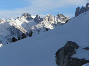
The High Point of Wyoming (that bright, white thing way in back)
But I’ve been picking away at it for over a month now and the end- or beginning- is in sight. I’ll miss many things and people that I’m leaving behind, but this one photo (above) taken deep in the Wind River Mountains on an especially sunny winter’s morn represents something I’ll particularly miss. I’m including it here as a sort of anchor and I’ll set it as a goal to one day get back here- the purpose of the trip perhaps simply to return. And it’s not just to the Wind Rivers- say more the Rockies in general. They are where I grew up and what I always dream of when in some far away place for a while.

So what am I preparing for? There’s an outlandishly lofty goal of leaving Logan, Utah, USA, heading south, and then return coming from the north. A small air hop from the tip of S. America to S. Africa and then another from Siberia to Alaska. I think of it as an exploration of the fragments of Pangea, or trying to treat five of the seven continents as though they were still, more or less, one. It’s a sort of Mobius strip that, with a couple of exceptions, the bike tires never leave the paper, and though the continents are split, they are really still as one given an appropriate transit. But that’s the outlandish part. The more realistic part is to say I’m heading south out of Logan, Utah and beyond that I need to see how I feel- both physically and mentally. I’m nearing sixty, but I’m young for my years; I have vast experience that the young and strong lack, but I’m cynical and afraid; I’ll be alone but I know I’ll find people; My knee hurts but the doctors say it’s my imagination (x-rays look normal); I’ll be heading into the jaws of some of the most dangerous parts of a world that is, from all appearance, at war. Can I find a safe way? Can I endure? Can it be something that at least at times could be regarded as fun? Quien sabe?